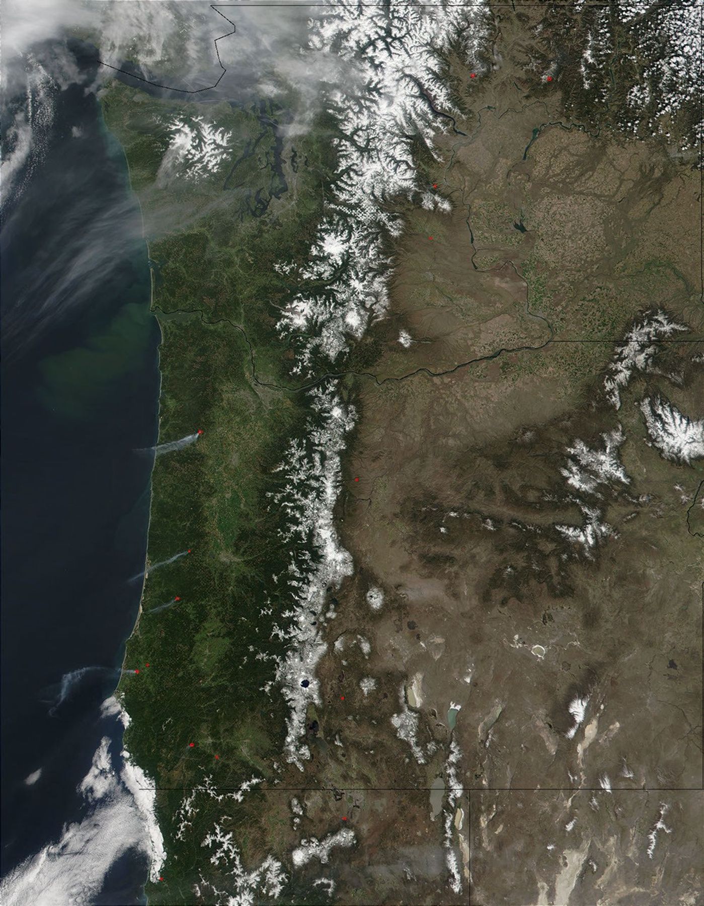
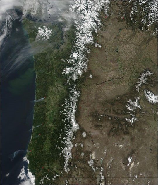
East and west of the snow-capped Cascade Mountain Range, scattered fires were burning in Washington (top) and Oregon (below) on April 24, 2002. Plumes of smoke drifted westward out over the Pacific. At the upper left, hazy skies over northwest Washington and the Puget Sound are likely a mixture of smoke and clouds. The Columbia River marks the boundary between Washington and Oregon, and provides irrigation water to the agricultural land of Washington’s interior.
The Moderate-resolution Imaging Spectroradiometer (MODIS) aboard NASA’s Terra satellite captured this image, along with active fire detections, a little after 12 p.m. local time. Please note that the high-resolution scene provided here is 500 meters per pixel. For a copy of this scene at the sensor’s fullest resolution, visit the MODIS Rapid Response Web site.
References & Resources
Image courtesy Jacques Descloitres, MODIS Land Rapid Response Team at NASA GSFC