Suggested Searches

1 min read

Fires in the Southeast Amazon

Instruments:
Topics:
2005-07-16 00:00:00
July 16, 2005

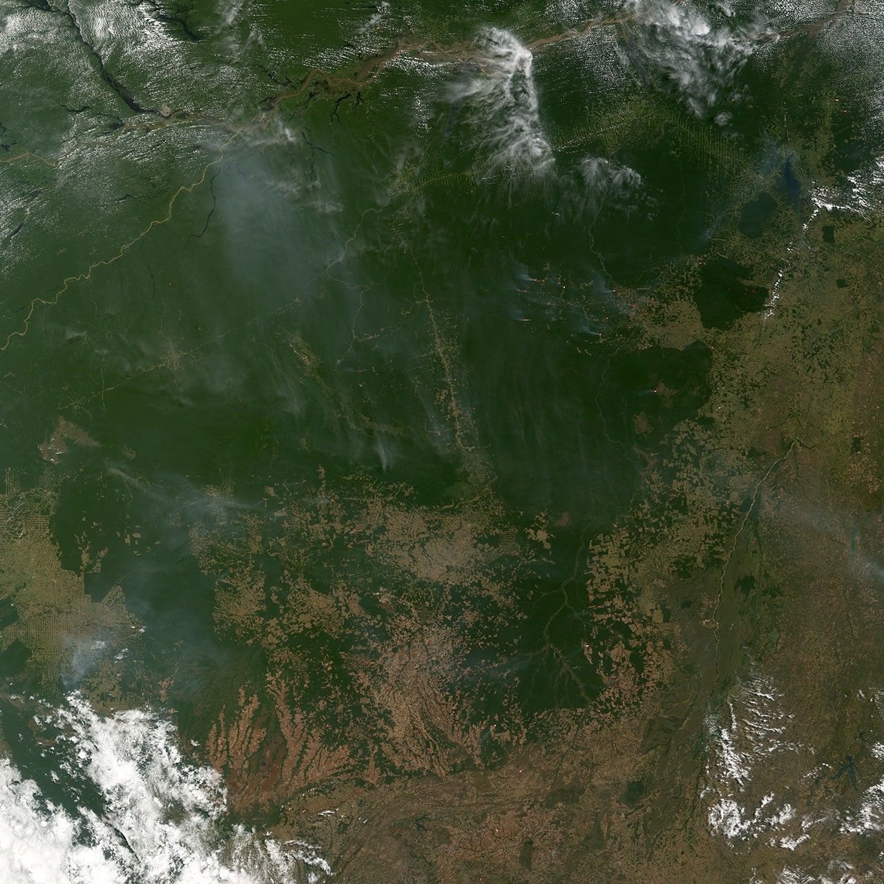
In the southeastern Amazon, biomass burning is transforming the landscape. Fire is commonly used to manage agricultural lands near to forests as well as to clear intact forests for ranching and farming. This image of the region was captured by the Moderate Resolution Imaging Spectroradiometer (MODIS) on NASA’s Terra satellite on July 16, 2005. Active fires are marked with red dots. The fires are burning along the forest margins and alongside several roads that run through the forest toward the Amazon River, which runs in a muddy path across the top of the image.

References & Resources

NASA image created by Jesse Allen, Earth Observatory, using data obtained from the Goddard Earth Sciences DAAC .

You may also be interested in:

Stay up-to-date with the latest content from NASA as we explore the universe and discover more about our home planet.

New Timing for Stubble Burning in India
5 min read

Scientists say the seasonal crop fires are burning later in the day than in previous years.

Article
Fires on the Rise in the Far North
3 min read

Satellite-based maps show northern wildland fires becoming more frequent and widespread as temperatures rise and lightning reaches higher latitudes.

Article
Reshaping the Forests Around Kisangani
5 min read

Satellite data show decades of gradual but persistent change to forests around one of the Democratic Republic of the Congo’s…

Article