


- Large images
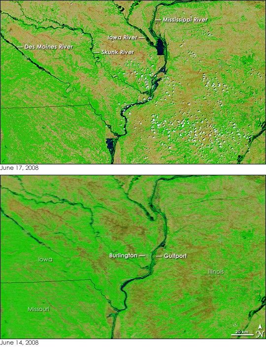
- June 17, 2008 (4.59 MB JPEG)
- June 14, 2008 (3.24 MB JPEG)
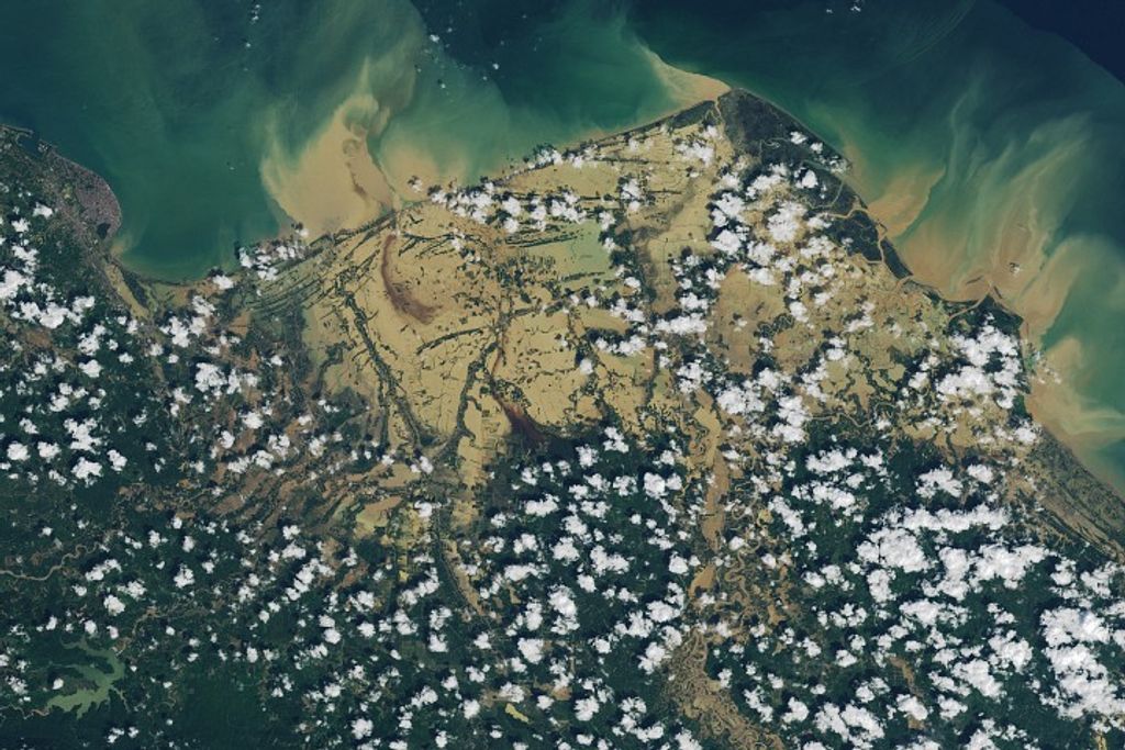
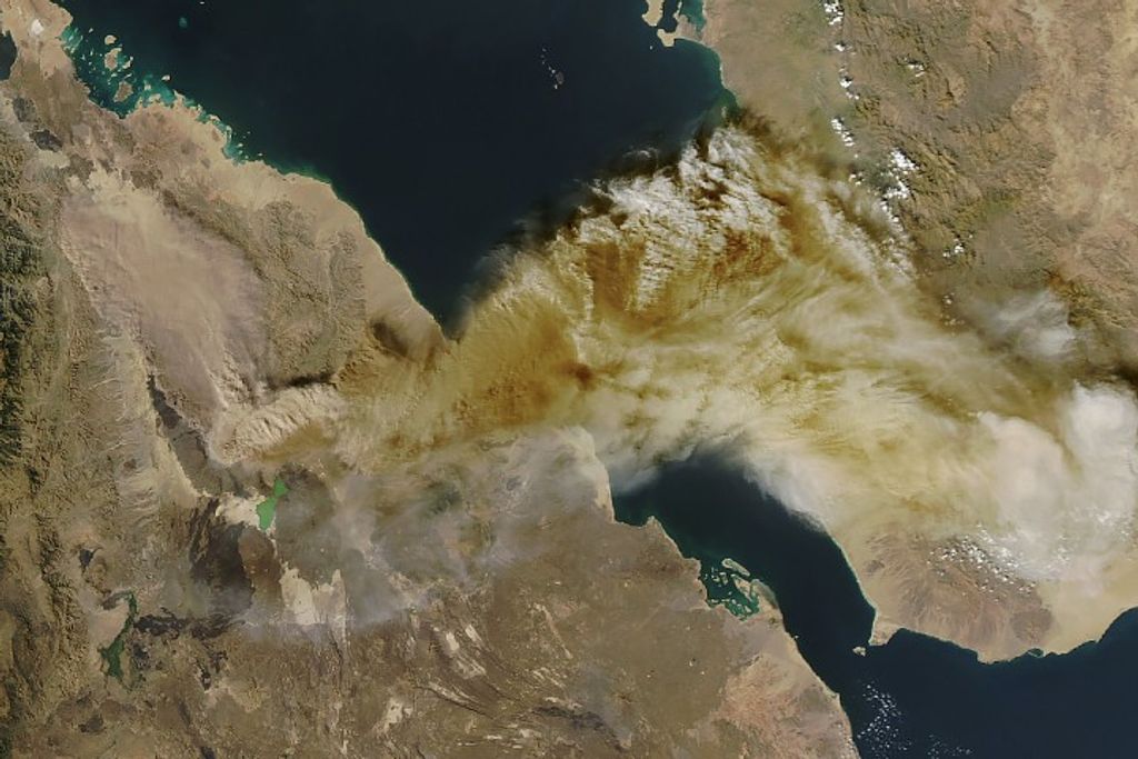
Taken just three days apart, these images illustrate the rapid rise of water levels on the Mississippi River. The glut of water that had swelled Iowa’s rivers drained in to the Mississippi, raising water levels to dangerous levels. The National Weather Service reported major flooding—record flooding in some cases—at gauges on the Mississippi from Iowa nearly to St. Louis, Missouri.
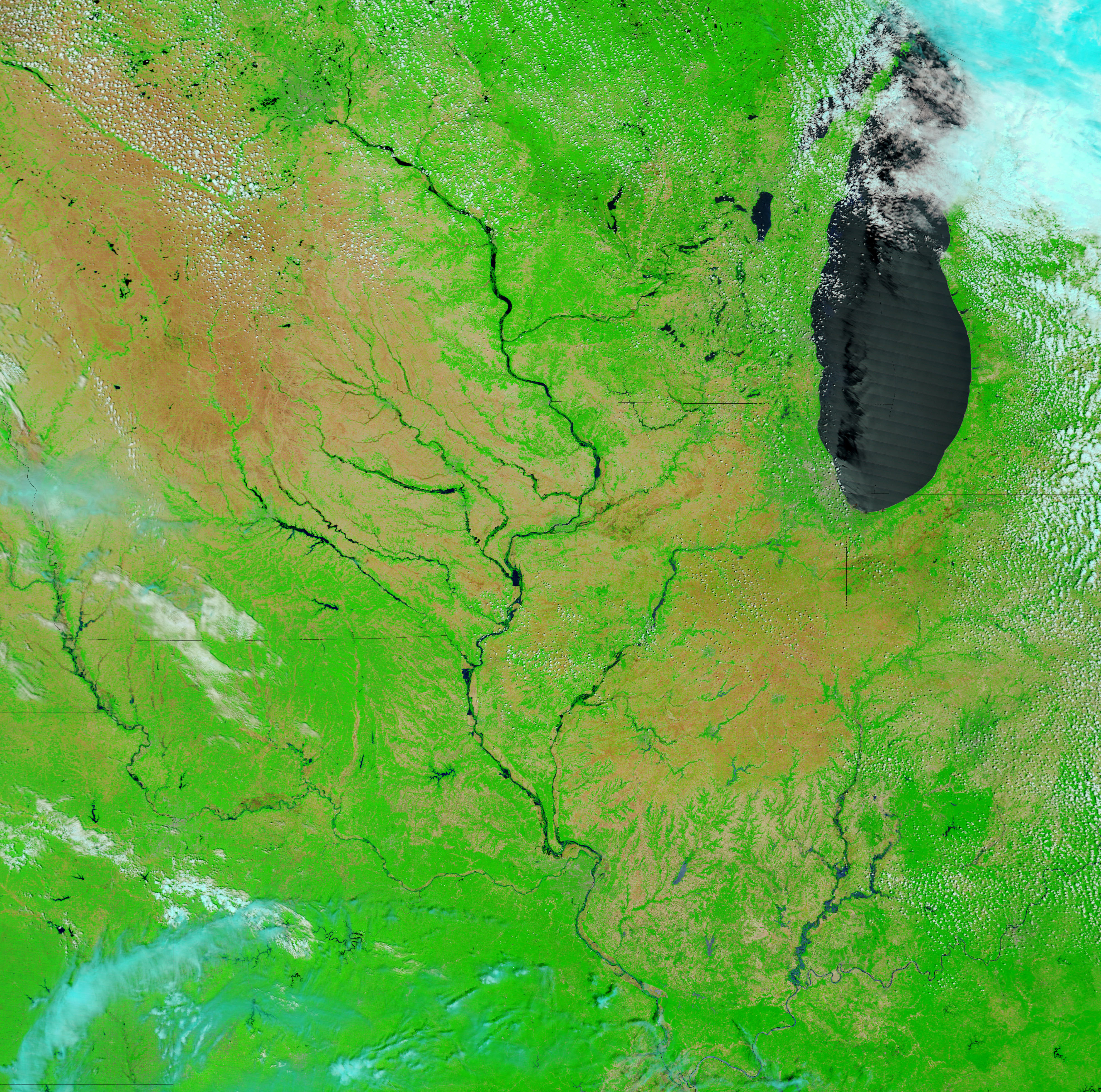
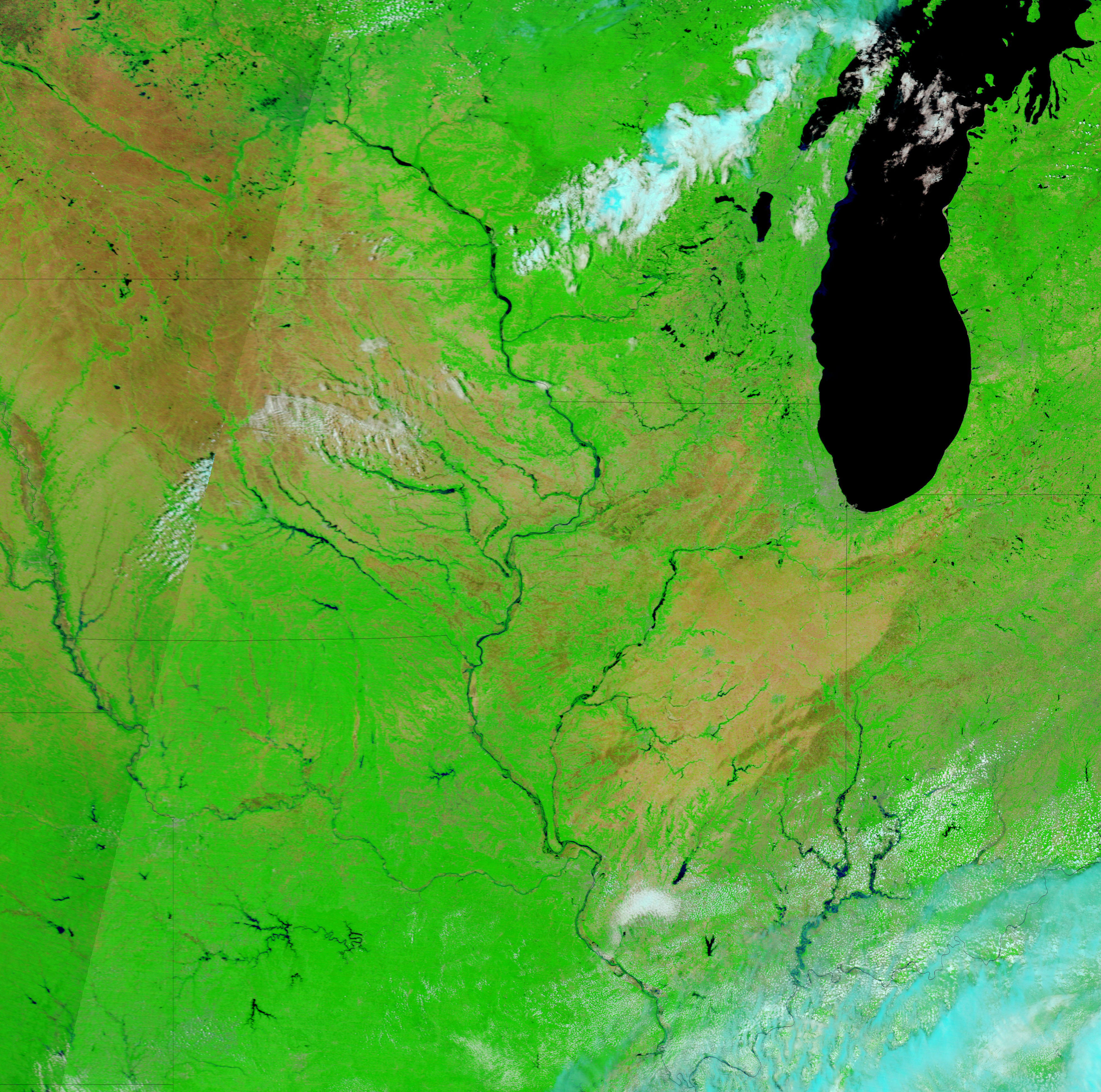
Captured by the Moderate Resolution Imaging Spectroradiometer (MODIS) on NASA’s Terra satellite, these images show the extent of the flooding across most of the flood region. The large images show additional flooding along the Mississippi River. Water in these false-color images is black, while plant-covered land is green, and bare ground is tan. Clouds are light blue and white. Large bulges punctuate the Mississippi River in the June 17 image (top) where the river flowed over its banks. One of the new bulges threatens the town of Gulfport, Illinois, where a levee burst early on June 17, reported CNN. The river is also wider on June 17 than it had been three days earlier.
References & Resources
- References
- CNN. (2008). Flood shuts down Mississippi River bridge. Accessed June 17, 2008.
- National Weather Service. (2008, June 17) Advanced Hydrologic Prediction Service. National Oceanic and Atmospheric Administration. Accessed June 17, 2008.
NASA images courtesy the MODIS Rapid Response Team at NASA GSFC. Caption by Holli Riebeek.


