Mars Global Surveyor
Science Instruments
Mars Global Surveyor carried a complement of six scientific investigations to perform atmospheric monitoring for sister orbiters during aerobraking, and it helped rovers and lander missions by identifying potential landing sites and relaying surface telemetry.
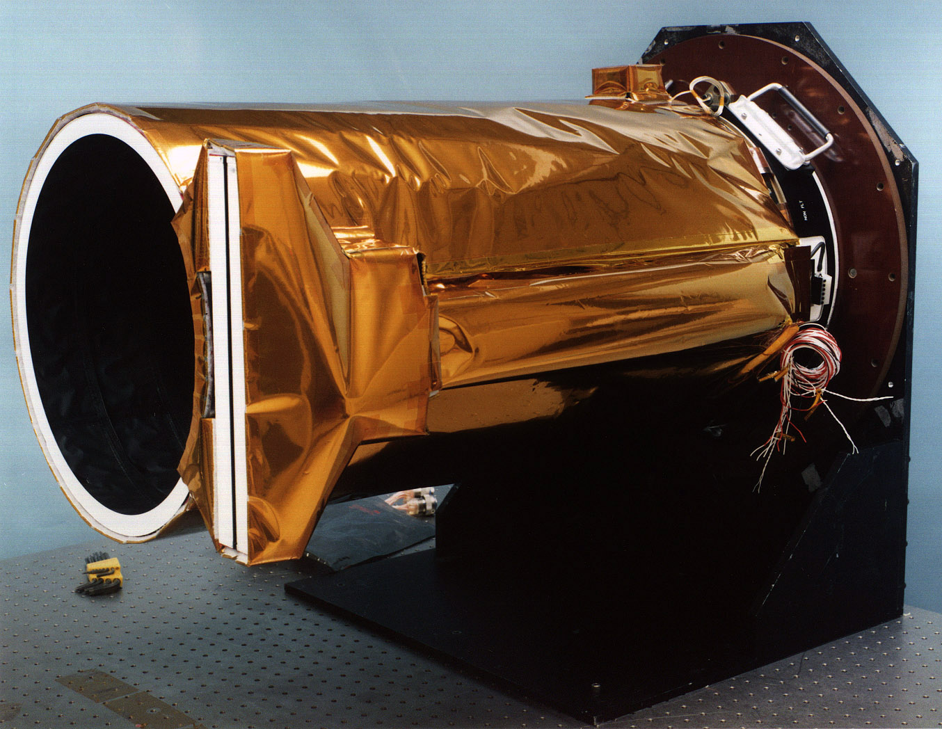
Mars Orbiter Camera
At the time of its operations, most data volume from Surveyor was generated by a dual-mode camera called the Mars Orbiter Camera (MOC). This device worked like a television camera, but took still images instead of motion video. In narrow-angle mode, MOC's black and white, high-resolution telephoto lens spotted Martian rocks and other objects as small as 4.6 feet (1.4 meters) across from orbit. The pictures were sharp enough to help scientists conduct detailed geological studies without setting foot on the planet.
In contrast to the detailed surface images, MOC's wide- angle, global monitoring mode used a "fish-eye" lens to generate spectacular color panoramic images spanning from horizon to horizon. These pictures resemble weather photos of Earth commonly shown on news broadcasts.
Using hundreds of these panoramic photographs, scientists all over the world were able to play them like a slow-motion "flip-book" or a film. This helps show the life history of Martian weather phenomena such as dust storms, cloud formations, and the polar ice cap growth and contraction. In addition, these time-lapse animations allowed scientists to track surface features that get blown by the wind, such as dust streaks and sand dunes.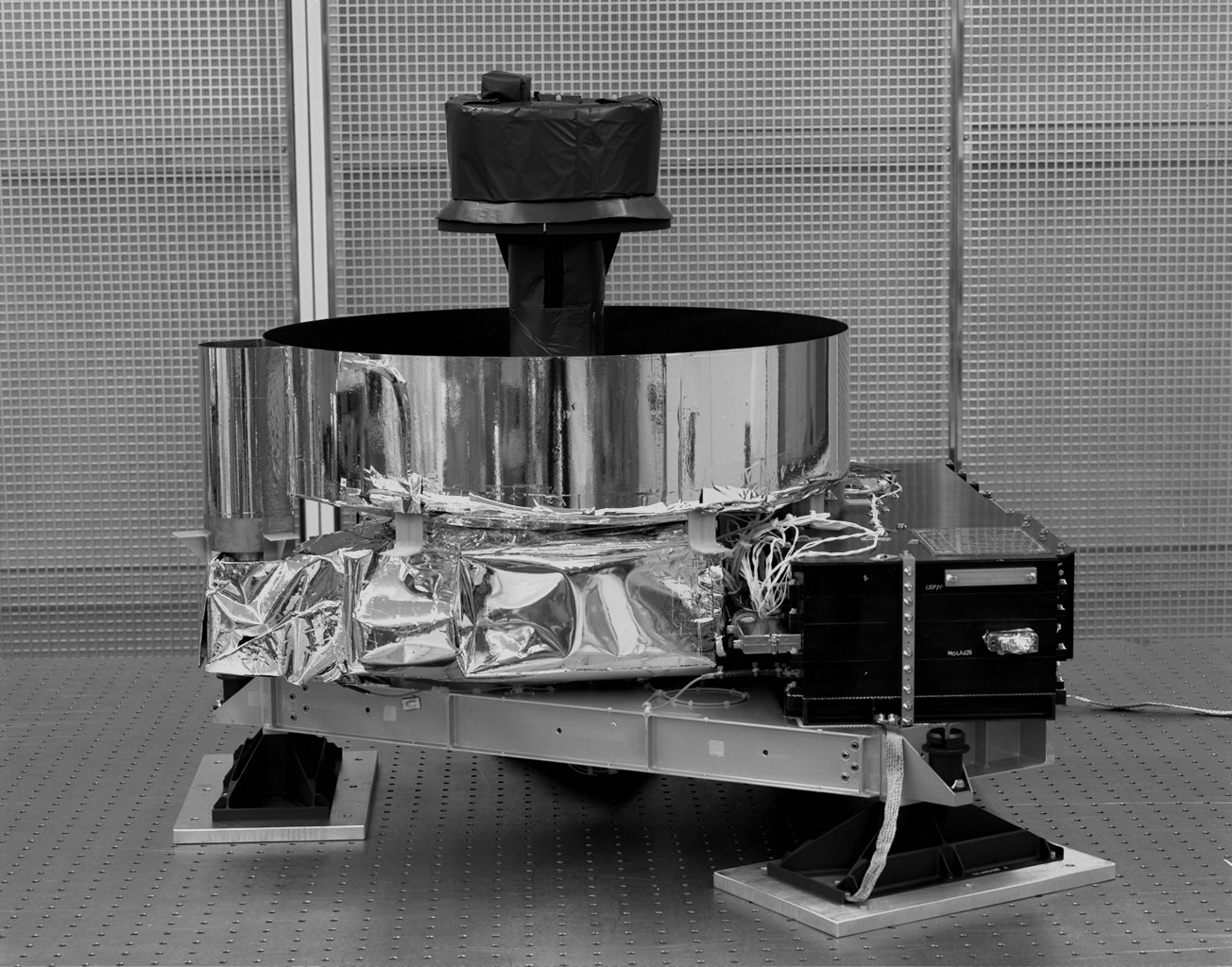
Mars Orbiter Laser Altimeter
The laser altimeter, known as the Mars Orbiter Laser Altimeter (MOLA), gathered data used to calculate the height of surface features.
This altitude determination process measures how long a pulse of light takes to leave the spacecraft, reflect off the ground, and return to MOLA's collecting mirror. By multiplying the reflection time by the speed of light, scientists were able to calculate Surveyor's altitude above the local terrain to within 98 feet (30 meters) or better.
As the spacecraft flew above hills, valleys, craters, and other surface features, its altitude constantly changed. A combination of MOLA data with images from the camera allowed scientists to construct a detailed topographical atlas of the planet. Such maps have helped in the understanding of the geological forces that shaped Mars.


Thermal Emission Spectrometer
The Thermal Emission Spectrometer (TES) instrument systematically measured and monitored the Martian surface and atmosphere throughout all phases of the mission. The TES spectrometer collected over 206 million infrared spectra, and the TES bolometer was in continual full-time use throughout the entire mission.
TES was both an instrument and a technique. TES first flew aboard the Mars Observer spacecraft. Following the loss of that spacecraft, TES was rebuilt and launched along with five of the original seven Mars Observer instruments aboard the Mars Global Surveyor spacecraft. The purpose of TES was to measure the thermal infrared energy (heat) emitted from Mars. This technique, called thermal emission spectroscopy, can tell us much about the geology and atmosphere of Mars. TES data provided the first detailed look at the composition of Mars.


Magnetometer (Electron Reflectometer)
The magnetometer studied the magnetic properties of Mars to gain insight into the interior of the planet. This instrument found small, localized magnetic fields and remnants of larger areas of ancient magnetic fields, providing clues to how Mars evolved.

Radio Science (Gravity Field Experiment)
The radio science investigations had two distinct objectives: to map the planet's gravitational field and to measure the atmospheric pressure and temperature in the polar regions.The gravity field results, combined with topographic data from the MOLA experiment, allowed estimates to be made of the structure of the Martian interior, from which studies could be done of the thermal and chemical evolution of the planet and the history of surface features and the atmosphere. The atmospheric experiment aided in studies of atmospheric dynamics and meteorology, and in detailed studies of transport of water, dust, and carbon dioxide in the atmosphere.

Mars Relay System
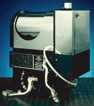
Of the six main instruments that flew to Mars on Surveyor, the Mars Relay was the only one not designed to take scientific measurements. Instead, this cylindrical-shaped antenna collected data transmitted to Surveyor from landers on the Martian surface. After collecting the data, Surveyor transmitted it back to Earth. By using Surveyor as a relay satellite for Mars landers, the lander spacecraft did not need to carry large antennas to talk with Earth. Instead, this reduction in the weight of the landers allowed the spacecraft to carry more scientific instruments.
The relay operated at a UHF frequency of 437.1 megahertz and could listen to stations on the Martian surface up to 3,125 miles (5,000 kilometers) away from Surveyor. The French space agency CNES (Centre National d'Etudes Spatiales) provided the relay antenna to NASA as part of an international cooperation toward the study of Mars.


