


Description

Map Projected Browse Image
Click on image for larger version
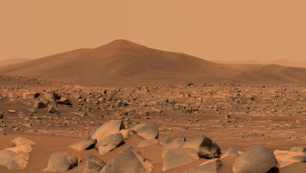
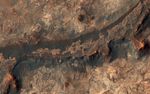
Billions of years ago, a river flowed across this scene in Mawrth Vallis. Like on Earth, these river beds can get filled up with rocks that are cemented together. After Mars became a colder, drier place and the river disappeared, the rocky river bed remained.
In this HiRISE image, we see a dark ridge snaking across the surface. The dark ridge is the old river bed. It is raised above its surroundings now because these softer surroundings have been eroded away, whereas the rocky river bed resists that. Scientists call these ridges inverted channels and many of them are visible in this area of Mars.
The map is projected here at a scale of 50 centimeters (19.7 inches) per pixel. (The original image scale is 59.1 centimeters [23.3 inches] per pixel [with 2 x 2 binning]; objects on the order of 177 centimeters [69.7 inches] across are resolved.) North is up.
This is a stereo pair with ESP_071041_2060.
The University of Arizona, in Tucson, operates HiRISE, which was built by Ball Aerospace & Technologies Corp., in Boulder, Colorado. NASA's Jet Propulsion Laboratory, a division of Caltech in Pasadena, California, manages the Mars Reconnaissance Orbiter Project for NASA's Science Mission Directorate, Washington.


