


Description
Map Projected Browse Image
Click on image for larger version
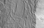
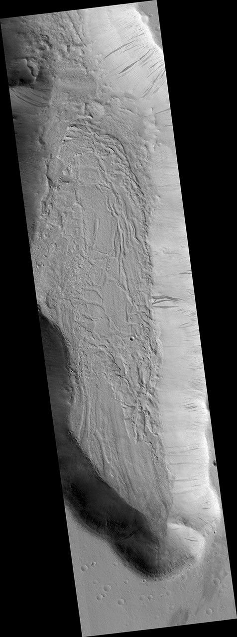
The geologic setting and latitude here suggest this is a glacial (ice-rich) flow, but the surface is broken into plates like many lava flows on Mars. An image was targeted here to get a better look.
At the meter-scale resolution of HiRISE, we see a hummocky surface with boulders and craters plus some wind-blown landforms that seems consistent with either the glacial or lava hypothesis. This is a common result: getting a higher-resolution image doesn't necessarily provide more information about large-scale processes, instead providing information about how the surface has been modified.
The map is projected here at a scale of 50 centimeters (19.7 inches) per pixel. (The original image scale is 50.2 centimeters [19.8 inches] per pixel [with 2 x 2 binning]; objects on the order of 151 centimeters [59.4 inches] across are resolved.) North is up.
This is a stereo pair with ESP_077333_2100.
The University of Arizona, in Tucson, operates HiRISE, which was built by Ball Aerospace & Technologies Corp., in Boulder, Colorado. NASA's Jet Propulsion Laboratory, a division of Caltech in Pasadena, California, manages the Mars Reconnaissance Orbiter Project for NASA's Science Mission Directorate, Washington.


