Due to the lapse in federal government funding, NASA is not updating this website.

Suggested Searches

Technical information poster about the Landsat 7 system from General Electric and Hughes. The top shows a satellite image of Los Angeles from Landsat 5 TM dated April 1, 1992, alongside a 3D rendering of the golden Landsat 7 satellite. Key features are listed including Titan II launch, 96% space segment availability, upgraded spacecraft capabilities, Enhanced Thematic Mapper Plus (ETM+), and high-resolution multispectral stereo imaging. The bottom section displays four comparison images showing ETM+ data continuity versus HRMSI enhancements at different resolutions (30m, 15m, 10m, and 5m), demonstrating improved image quality and detail from simulated data based on a January 11, 1992 high-resolution color aerial photograph.

Landsat 7 System: Data Continuity and Enhancements Information Sheet

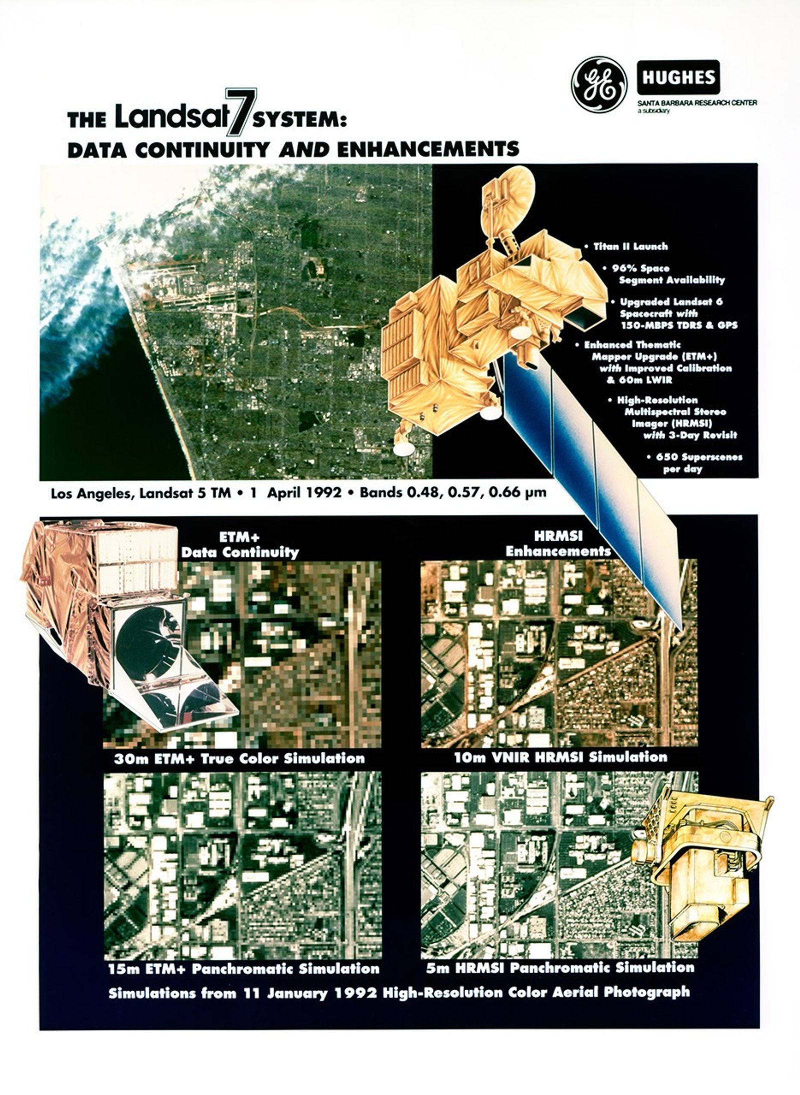
Hughes/General Electric promotional poster showcasing Landsat 7's enhanced capabilities and data continuity improvements over previous Landsat missions. The document compares ETM+ and HRMSI imaging capabilities through simulated data examples at various resolutions.

Image Credit: Hughes/General Electric
Download