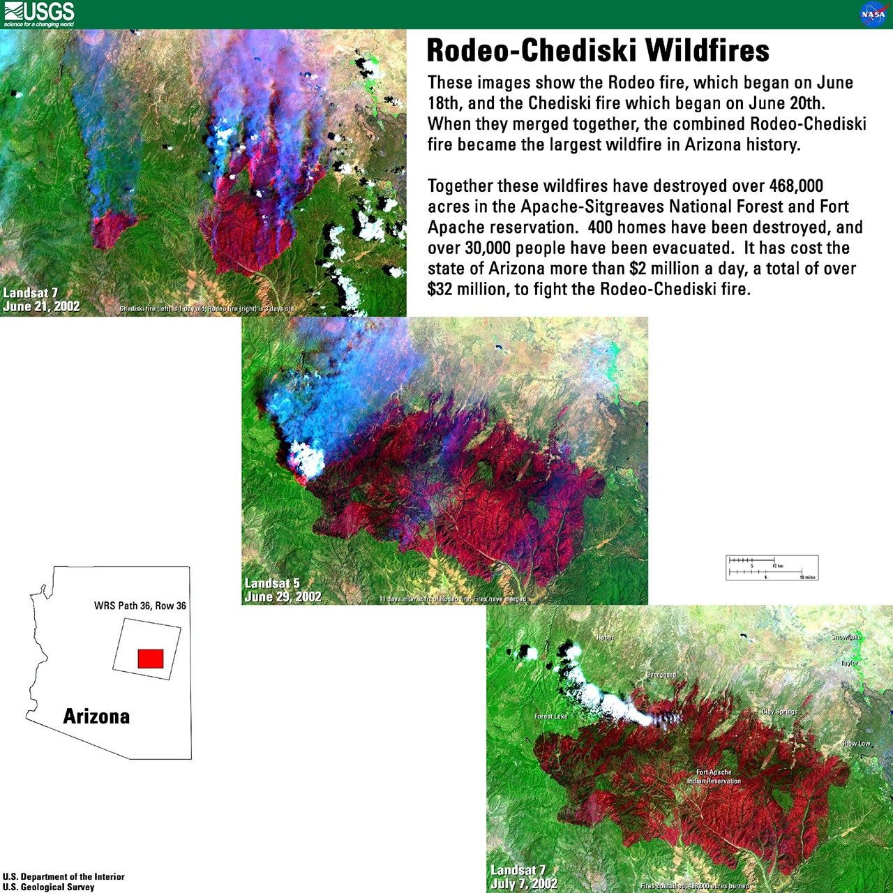
Landsat 7 Imagery of Rodeo-Chediski Wildfires in Arizona
Time series of Landsat 7 satellite images documenting the progression of the historic Rodeo-Chediski wildfires in Arizona during June-July 2002. These false-color images demonstrate how satellite monitoring can track wildfire development and assess damage, showing the fires' growth into Arizona's largest wildfire at that time, affecting over 468,000 acres.
Image Credit: USGS
- X
https://science.nasa.gov/image-detail/amf-7e2954f1-5c94-4e71-becd-f98e62aab9e2/
Image CreditUSGS
Size2560x2560px