Due to the lapse in federal government funding, NASA is not updating this website.

Suggested Searches

PRISM

Portable Remote Imaging Spectrometer

Active Mission

Current satellite monitoring is insufficient for tracking coastal events like oil spills and toxic blooms due to its low resolution. To solve this problem, PRISM, a compact and lightweight airborne imaging spectrometer, was developed. PRISM can be mounted on various aircraft, including drones, to fly below clouds and capture high-resolution data (as small as 30 cm), offering a state-of-the-art solution for observing the dynamic coastal environment.

Mission Type

Instrument, Ground-based

LAUNCH

2012

TARGET

Earth

STATUS

Active
A collage of three images related to the PRISM airborne spectrometer. The top left image shows the instrument with a silver, dome-shaped housing. The top right image reveals the complex internal components and wiring of the spectrometer. The bottom image shows the white and blue twin-engine propeller plane that carries the instrument, flying low over a rugged coastline.

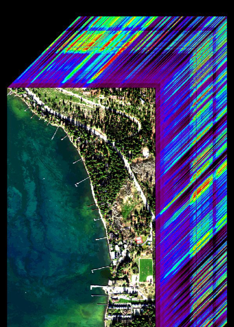
The coastal zone is home to a high fraction of humanity and is increasingly affected by natural and human-induced events from tsunamis to toxic blooms and oil spills. Current satellite data provide a broad overview of these events but do not have the necessary spectral, spatial and temporal, resolution to characterize and understand them.

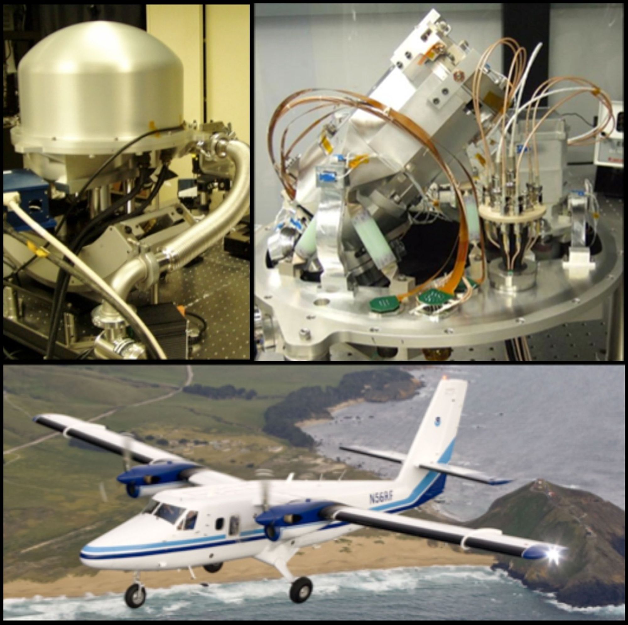
To address this gap, a compact, lightweight, airborne Portable Remote Imaging SpectroMeter (PRISM) compatible with a wide range of piloted and Uninhabited Aerial Vehicle (UAV) platforms was developed at the Jet Propulsion Laboratory. Optimized for the spectral range between 350 nm and 1050 nm, PRISM offers high temporal resolution and below cloud flight altitudes to resolve spatial features as small as 30 cm. The sensor performance defines the state of the art in light throughput, spectral and spatial uniformity, and polarization insensitivity.

PRISM also has a two-channel spot radiometer at short-wave infrared (SWIR) band (1240 nm and 1640 nm) in order to provide accurate atmospheric correction of the ocean color measurements.

The development of the PRISM instrument was supported by NASA Earth Science Technology Office, Airborne Sciences Program, and the Ocean Biology and Biogeochemistry Division.

A visualization of a hyperspectral data cube from an imaging spectrometer. The image shows a top-down aerial view of a forested coastline with clear, blue-green water and several piers. Extending from the top and right edges of this photo is a three-dimensional data block, which uses a color scale from blue and green to red and orange to represent the spectrum of light intensity measured at different wavelengths for each point on the ground.
Keep Exploring

Discover More Topics From NASA