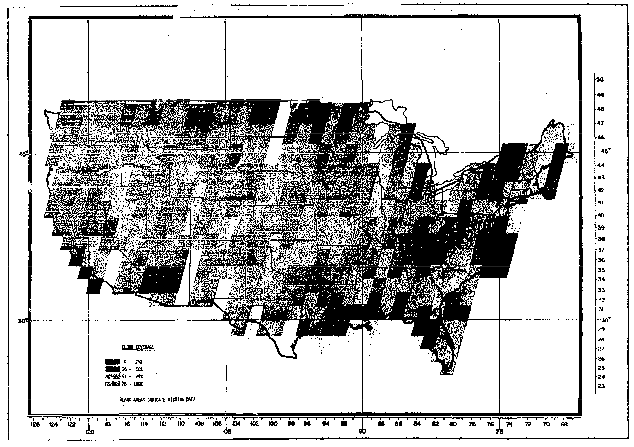
ERTS – Data Users Handbook – Figure 4-4.Sample Continental U.S. Outline Map.Image Credit: NASA Facebook Pinterest X LinkedIn Email https://science.nasa.gov/image-detail/amf-37b8490a-0c66-49e0-ac25-1c14914c1ead/Copy URL to clipboard> DownloadShareImage CreditNASASize2139x1507px