Orbit Path Technical Diagram
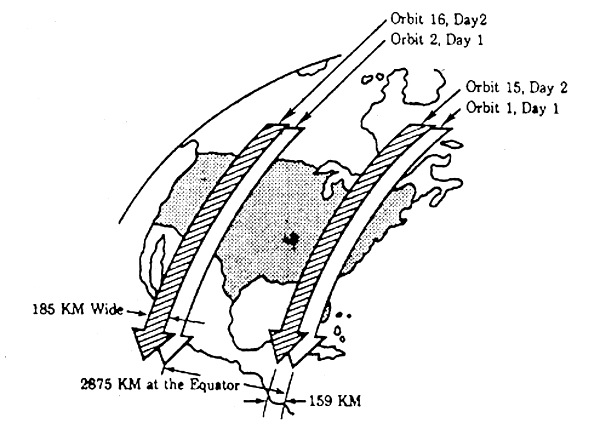
This illustration demonstrates the systematic Earth observation coverage pattern of a polar-orbiting satellite. The diagram shows how consecutive orbital passes (Orbits 1, 2, 15, and 16) create imaging swaths across the Earth's surface over a two-day period.
Image Credit: NASA
- X
https://science.nasa.gov/image-detail/amf-041af3cf-6d87-44b6-8c10-124433c84146/
Image CreditNASA
Size600x446px