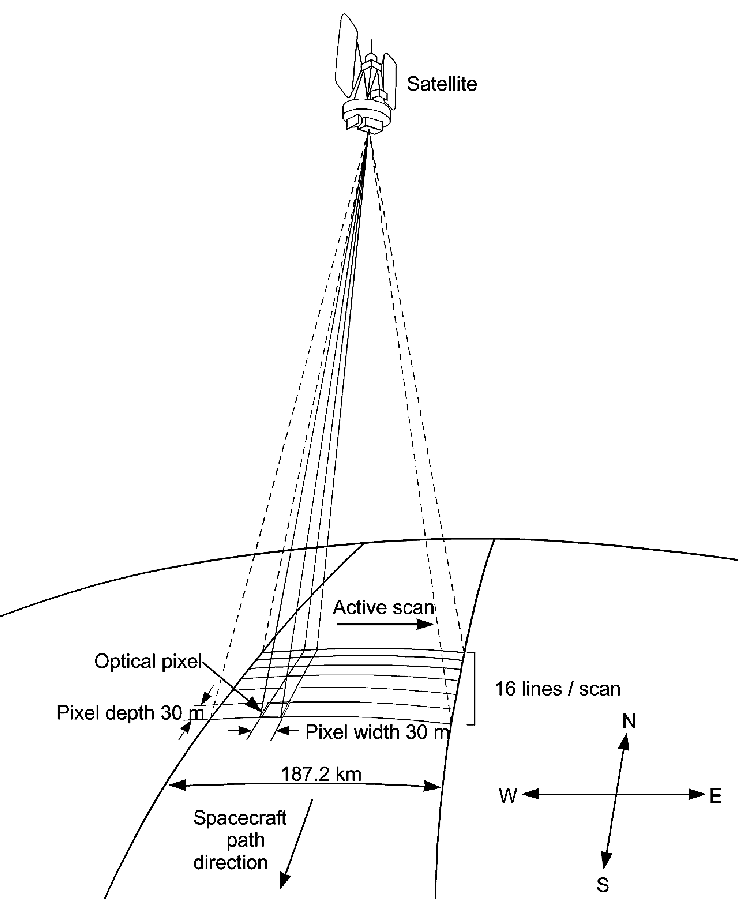
Landsat 1-3 Schematic
Satellite imaging geometry showing the relationship between orbital path and data collection. The illustration depicts a scanning sensor capturing 16 lines per scan across a 187.2 km swath width, with 30-meter pixel resolution in both dimensions. The active scan occurs perpendicular to the spacecraft's direction of travel, demonstrating how Earth observation satellites systematically image the surface below.
Image Credit: NASA
- X
https://science.nasa.gov/image-detail/amf-aedb7e60-0491-4c9a-bcf6-7dc13a08c847/
Image CreditNASA
Size738x899px


