Suggested Searches

OSIRIS-APEX (Origins, Spectral Interpretation, Resource Identification, and Security - Apophis Explorer)

Categories

NASA’s OSIRIS-APEX Spacecraft Slingshots Past Earth

At 1:00 p.m. EDT on Tuesday, Sept. 23, NASA’s OSIRIS-APEX (Origins, Spectral Interpretation, Resource Identification, and Security – Apophis Explorer) spacecraft flew within 2,136 miles (3,438 kilometers) of Earth.

During approach and as OSIRIS-APEX passed Earth, it looked home, capturing images and data of our home planet to help calibrate its science instruments.

The full disk of Earth against the black of space. Australia is near the center of the image, a dark brown landmass surrounded by ocean and white clouds. The far eastern edge of Asia peeks over the horizon on the left side.
This view of Earth was collected about nine hours after OSIRIS-APEX’s closest approach to Earth, when it was about 142,000 miles (228,000 km) away from Earth and getting farther. The continent of Australia can be seen in Earth’s Southern Hemisphere. This color composite combines six images from the MapCam imager, using its red, green and blue filters. MapCam is part of the OSIRIS-REx Camera Suite (OCAMS) operated by the University of Arizona. 
NASA/Goddard/University of Arizona

NASA's OSIRIS-APEX imaged Earth as it passed about 2,100 miles above the planet’s surface. In comparison, satellites in low Earth orbit are typically at altitudes up to about 1,200 miles (2,000 kilometers). This video, captured as about 424 individual images by the spacecraft’s StowCam imager, shows the OSIRIS-APEX instrument deck in the foreground while providing a view of Earth as the spacecraft flies over the Atlantic Ocean. South America can be seen on the left side of the frame.
NASA/Goddard/University of Arizona/Lockheed Martin

Earth fills most of the image, a moody blue globe mostly covered with tiny blueish white clouds like carpet pile or sheep’s wool. In the foreground, the instrument panel is dark enough to be nearly in silhouette, like a city skyline. A tall thin rectangle juts up from the left side of the panel, like a tall building, which is part of the SamCam. In the center, a shorter, squatter polygon shape is the OLA instrument. A slightly lighter colored Y shape lays on its side in front of the OLA.
To verify safe storage of asteroid sample during OSIRIS-APEX’s primary mission, StowCam captures both still and video imagery.
NASA/Goddard/University of Arizona/Lockheed Martin

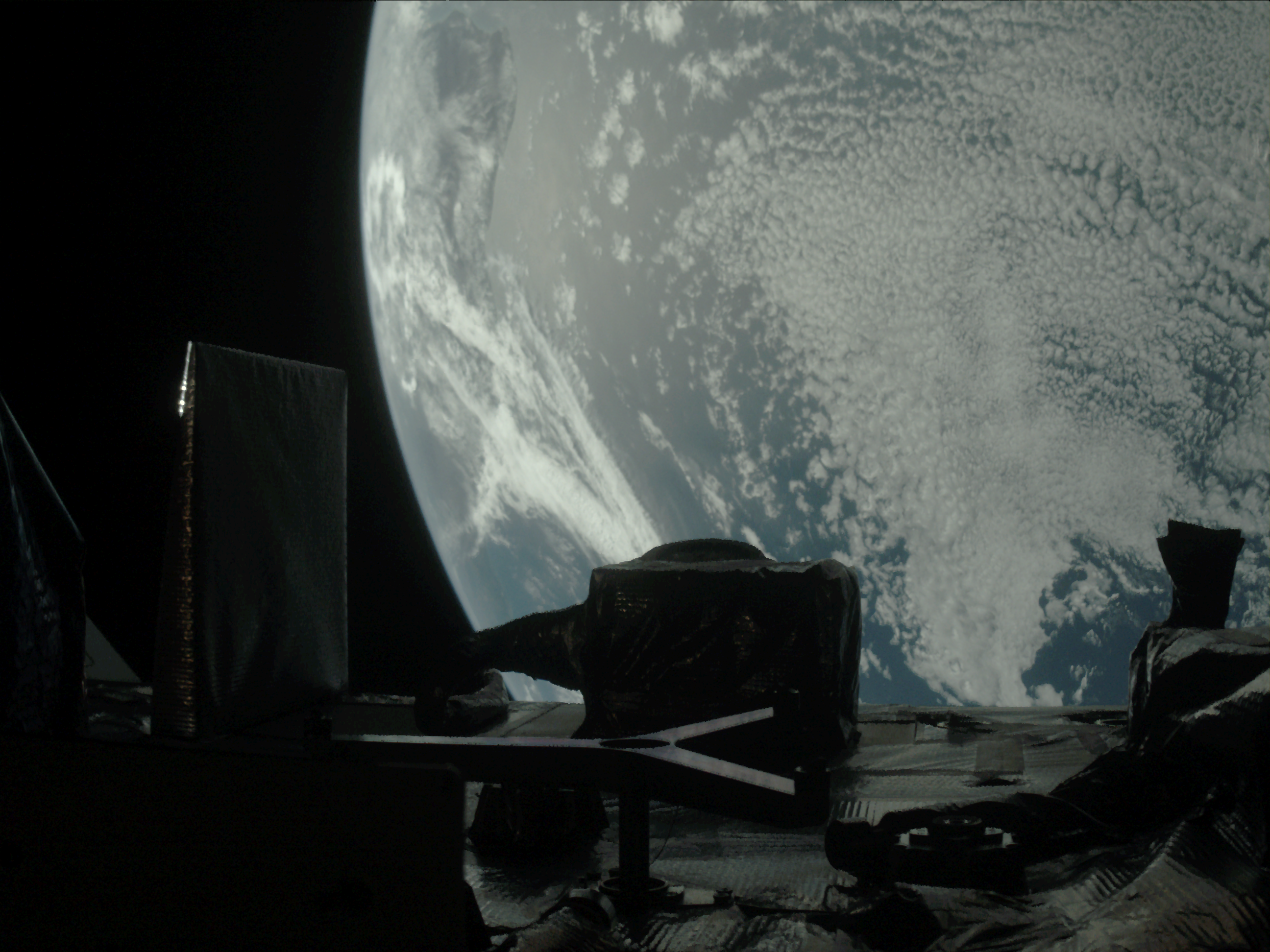
During the spacecraft’s primary mission, the StowCam instrument was used to verify the capsule full of sample from asteroid Bennu was safely stowed and prepared to journey back to Earth. Now, StowCam provides a view of the instrument panel, including the OSIRIS-REx Laser Altimeter, provided by the CSA (Canadian Space Agency) to create detailed 3D topographical maps of Bennu.

The Moon and Earth are two tiny dots on opposite sides of the black void of space. The Moon is a tiny white dot on the far left side of the image. Earth is a slightly larger dot made of shades of swirling blue on the right. In the foreground, bright polygons of light reflect back at the imager in white.
The StowCam also collected imagery as OSIRIS-APEX approached and departed from Earth. Two exposures from the instrument were used in this image of the Moon, on the far left, and Earth, on the far right. Light reflects off the spacecraft’s instruments in the foreground. OSIRIS-APEX was about 370,000 miles (59,600 km) away from Earth when it captured this view of the Moon and Earth on Sept. 24, 2025.
NASA/Goddard/University of Arizona/Lockheed Martin

NASA’s Goddard Space Flight Center in Greenbelt, Maryland, provides overall mission management, systems engineering, and the safety and mission assurance for OSIRIS-APEX. Dani Mendoza DellaGiustina of the University of Arizona, Tucson, is the principal investigator. The university leads the science team and the mission’s science observation planning and data processing. Lockheed Martin Space in Littleton, Colorado, built the spacecraft and provides flight operations. NASA Goddard and KinetX Aerospace are responsible for navigating the OSIRIS-APEX spacecraft. International partnerships on this mission include the spacecraft’s laser altimeter instrument from CSA. OSIRIS-APEX (previously named OSIRIS-REx) is the third mission in NASA’s New Frontiers Program, managed by NASA’s Marshall Space Flight Center in Huntsville, Alabama, for the agency’s Science Mission Directorate in Washington.