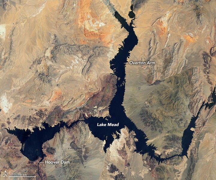
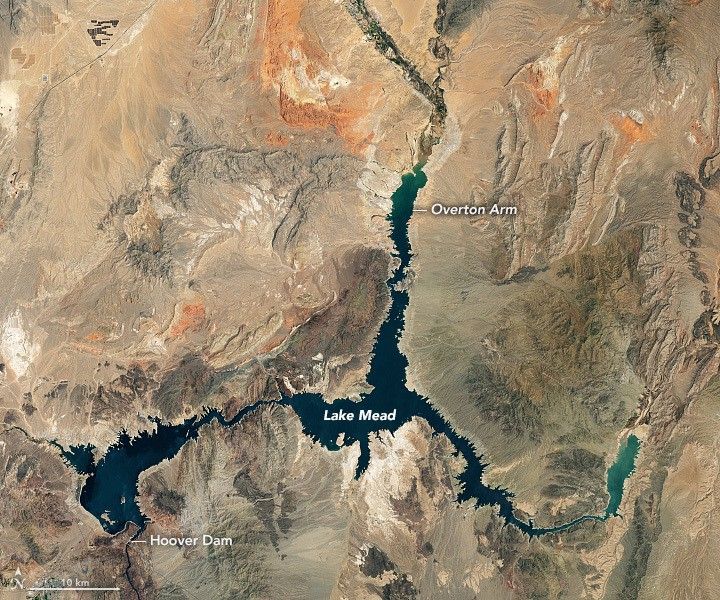


Before and After
Water levels of Lake Mead
July 6, 2000 - July 3, 2022
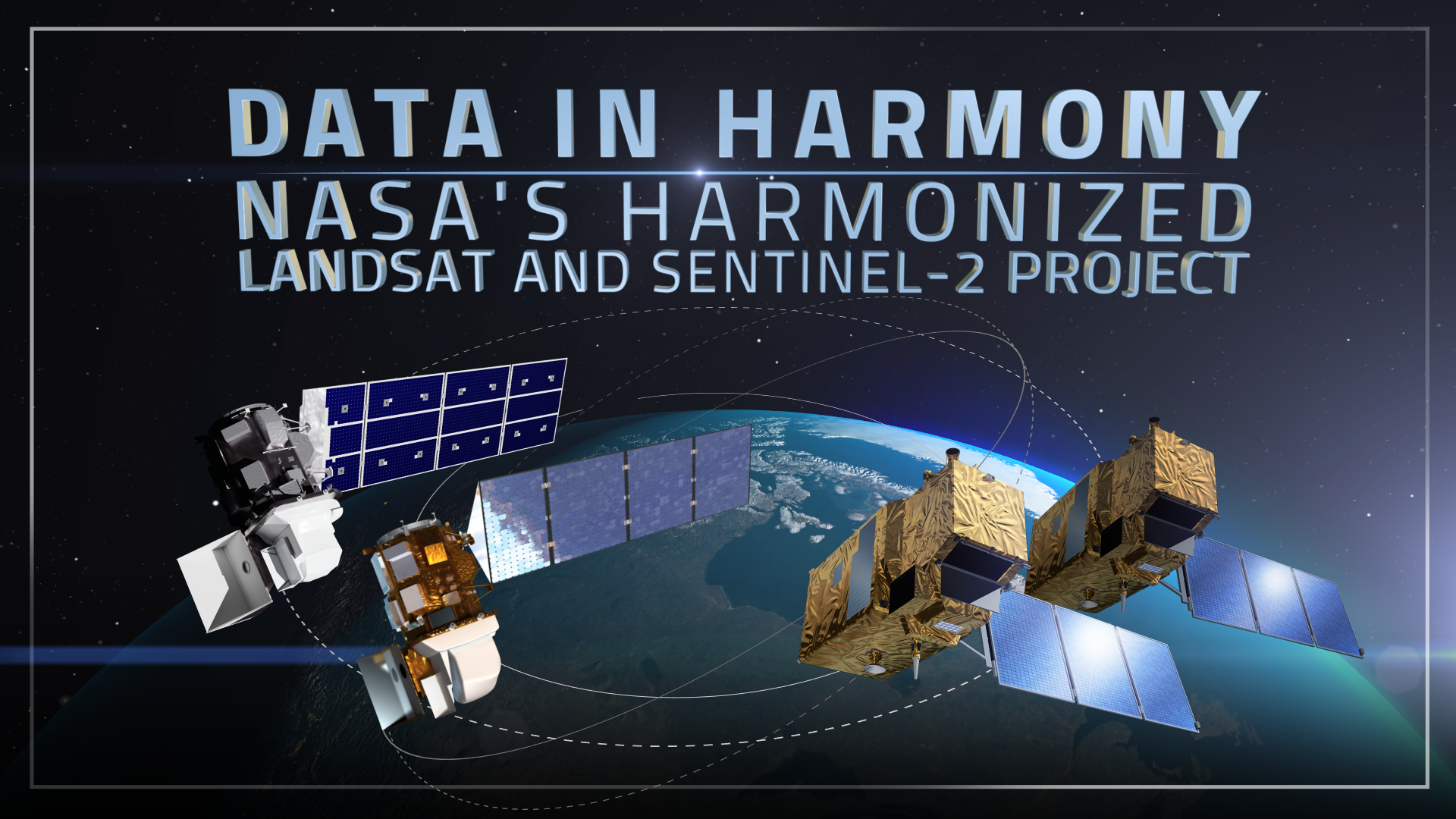
Monitoring reservoir water storage is critical for water resource management, flood control, and hydropower generation. Using data from Harmonized Landsat and Sentinel-2 (HLS), researchers led by scientists at Texas A&M University developed a new algorithm to monitor reservoir water levels in the contiguous U.S. every few days instead of every month. This peer-reviewed research was published in the American Geophysical Union journal Geophysical Research Letters in June and was co-authored by Justin Huntington, a former Landsat Science Team Member.
The paper introduced Sub-weekly Area of Reservoirs from Analysis of HLS for the Continental U.S. (SARAH-CONUS), which uses a machine-learning random forest classification model to classify pixels as water, non-water, cloud, and ice in over 1,900 reservoirs. After classification, the researchers created a time series of reservoir surface water extent. They checked their reservoir area results against in situ data from 240 reservoirs across the U.S., finding that their estimates closely matched on-the-ground measurements, with an R2 of 0.98.
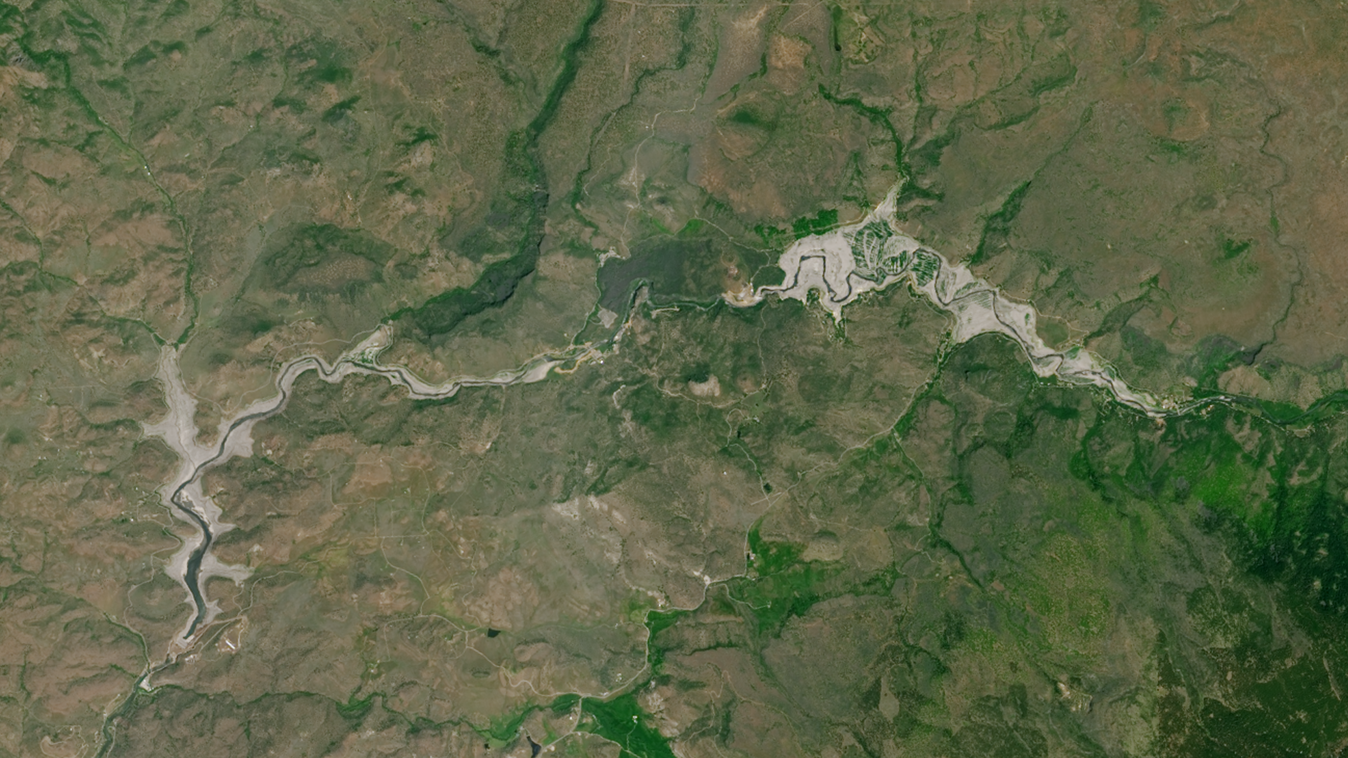
SARAH-CONUS can capture changes in reservoir surface area in greater detail than existing systems. Large-scale in situ monitoring of reservoir extent is rare. Existing satellite datasets lack the required temporal revisit or spatial coverage to accurately track seasonal and short-term variations in reservoir storage, especially in areas with frequent cloud cover. The strength of HLS data—the backbone of the new research—is that it supplies frequent observations from a constellation of satellites with similar land-observing capabilities. With an average global repeat of 1.6 days, HLS represents a major improvement on either Landsat 8 and 9 (combined 8 days) or Sentinel-2A, B, and C (combined <5 days) data alone.
SARAH-CONUS will allow water resource managers to make more informed decisions about water allocation throughout the US when in situ data is limited or not available. It provides early warning capabilities for drought conditions, helping farmers and the entire US agricultural sector better plan irrigation schedules.