


Seasat Stories

How US-Indian NISAR Satellite Will Offer Unique Window on Earth
5 min read
A Q&A with the lead U.S. scientist of the mission, which will track changes in everything from wetlands to ice sheets to infrastructure damaged by natural disasters. The upcoming U.S.-India NISAR (NASA-ISRO Synthetic Aperture Radar) mission will observe Earth like…
Article
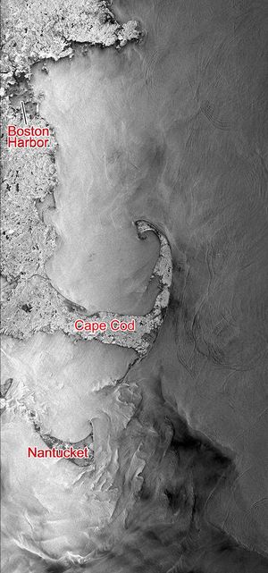
NASA’s Seasat Satellite Shows Massachusetts Coast
1 min read
This Seasat synthetic aperture radar image from Aug. 27, 1978, shows the Massachusetts coast from Nantucket Island in the south past Cape Cod and Boston to Cape Ann in the north.
Article

Seasat Celebrates Landmark in Remote-Sensing History
2 min read
Seasat, built and managed by NASA's Jet Propulsion Laboratory, was launched thirty-five years ago, on June 27, 1978. It was the first satellite designed for remote sensing of the Earth's oceans using many ground-breaking technologies.
Article