


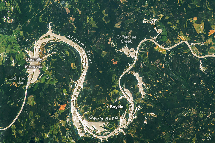
Bends of the Alabama River
Reflected sunlight highlights the water’s surface and flooded zones near Gee’s Bend. View the full story
Image Credit: NASA/Expedition 69 crew
- X
https://science.nasa.gov/image-detail/iss069-e-25553/
TakenJune 26, 2023
Image CreditNASA/Expedition 69 crew
Size720x480px