


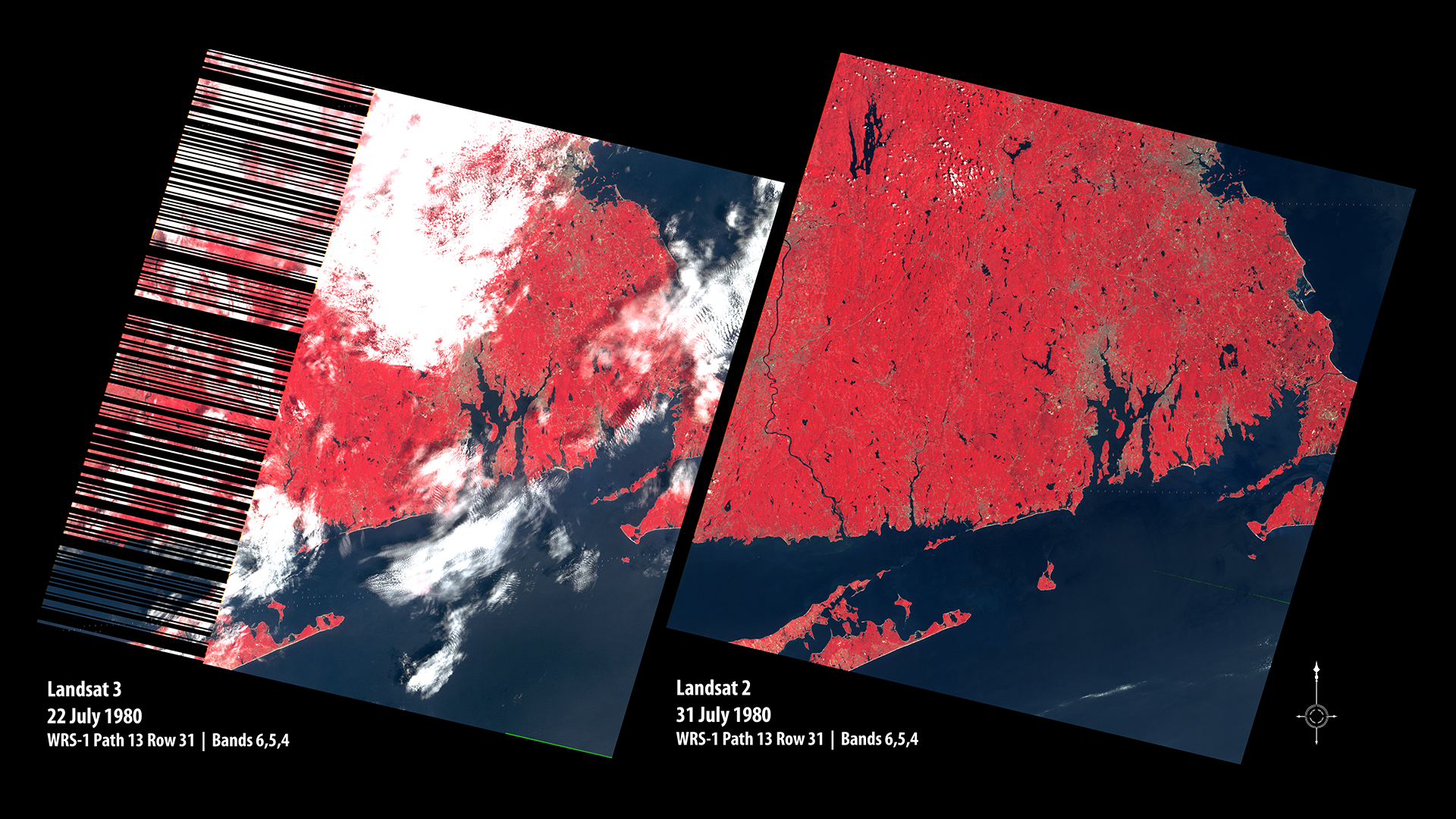
Line Start Problem – Landsat 2 & 3
Left image shows the onset of the Landsat 3 MSS line start problems. On the right is a Landsat 2 MSS image for comparison, acquired nine days later. Both images are displayed in false color. Location is WRS-1 Path 13 Row 31. Providence, Rhode Island is in image center at the head of the Providence River and Narragansett Bay; Boston, Massachusetts is at the top; eastern Long Island at bottom; and Martha’s Vineyard and Cape Cod’s edge at right.
- X
https://science.nasa.gov/image-detail/amf-d51902f5-565e-4726-82c0-e8123f5dd76c/
Size1920x1080px
