


RBV Icefield
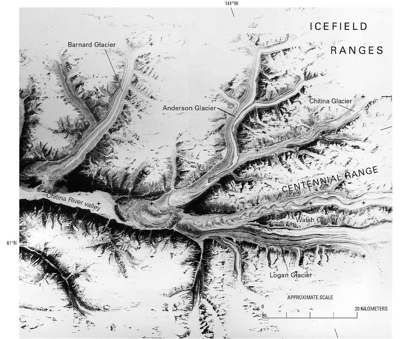
Part of a 40-meter panchromatic return beam vidicon (RBV) image (annotated) from Landsat 3, acquired on 5 July 1980 (WRS-1 Path 68 Row 17, subscene C), showing glaciers in Alaska’s Chitina River Valley near the Canadian border. Note the RBV réseau marks (small crosses) imbedded in the image.
- X
https://science.nasa.gov/image-detail/amf-c1c508c5-811f-49e3-beda-ec1105829af7/
Size1316x1080px
