


![Request for Information – Potential [Placeholder for Prize]](https://assets.science.nasa.gov/dynamicimage/assets/science/psd/solar/2023/09/s/solarsystem_0.jpg?w=1024)


before
after
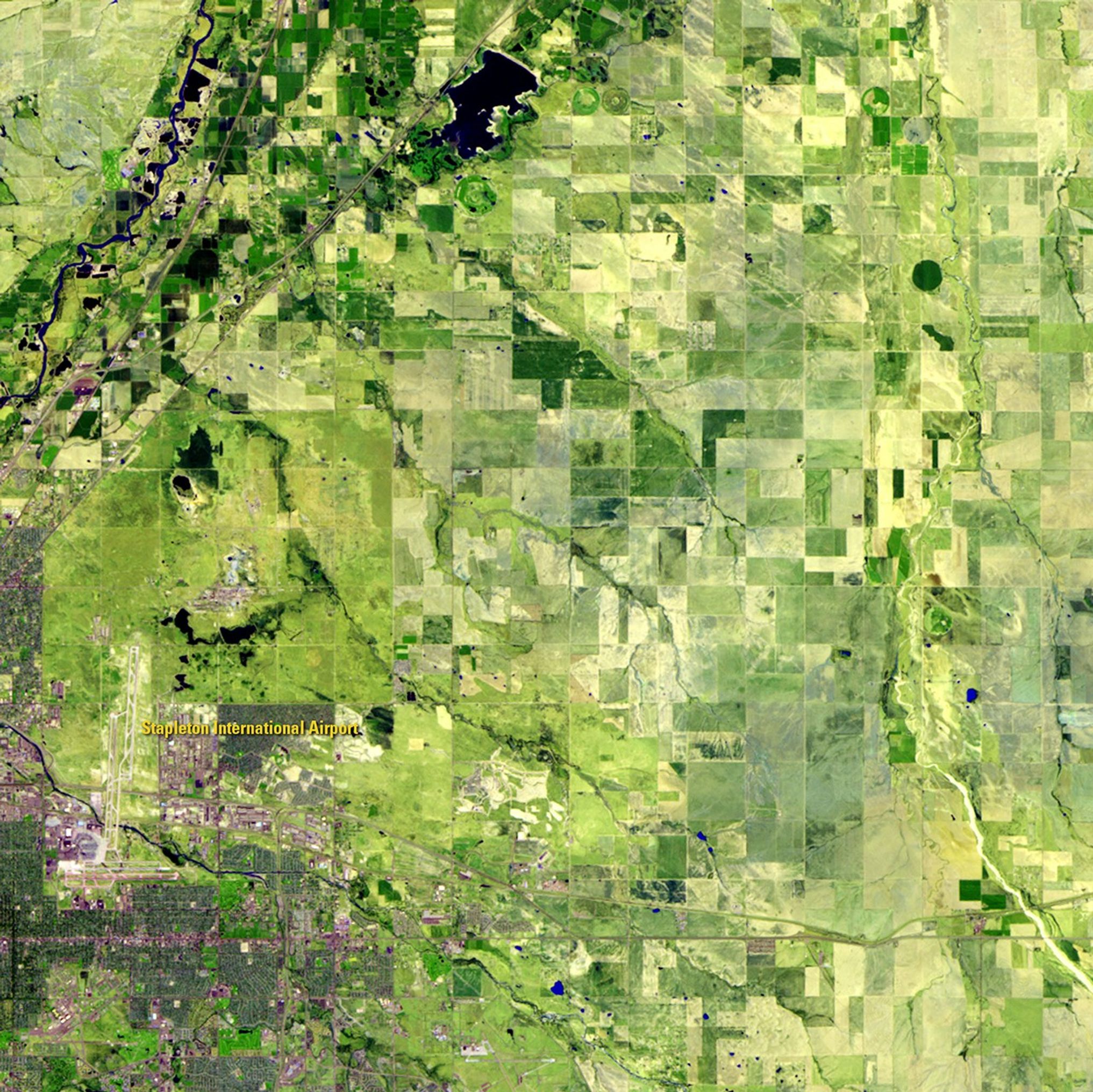
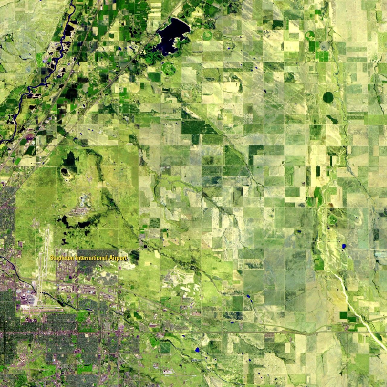
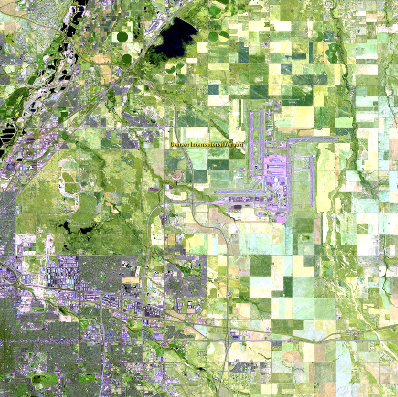
Denver International Airport covers 53 square miles (nearly 140 square kilometers), making it the largest airport in the United States and the third largest in the world. The 1984 image shows the landscape before airport construction began, and the 2011 image shows the same area with the airport in operation. In addition to the aviation hub itself, hotels, manufacturing and residential development have expanded, covering what had previously been farmland. Data from the Landsat satellite are used by regional and local officials to monitor the rate and direction of the expanded development. Images taken by the Thematic Mapper sensor onboard Landsat 5. Source: U.S. Geological Survey (USGS) Landsat Missions Gallery, "Denver International Airport," U.S. Department of the Interior / USGS.
NASA/USGS
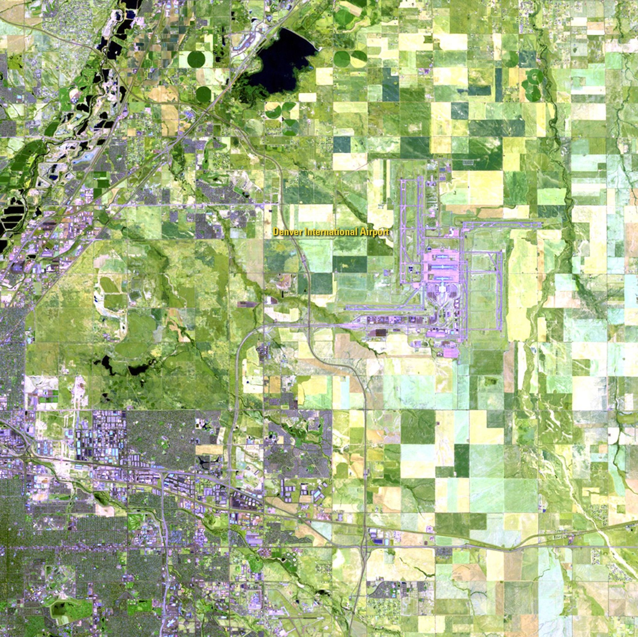
Before and After
Denver Airport growth, Colorado
August 25, 1984 - August 20, 2011
Denver International Airport covers 53 square miles (nearly 140 square kilometers), making it the largest airport in the United States and the third largest in the world. The 1984 image shows the landscape before airport construction began, and the 2011 image shows the same area with the airport in operation. In addition to the aviation hub itself, hotels, manufacturing and residential development have expanded, covering what had previously been farmland. Data from the Landsat satellite are used by regional and local officials to monitor the rate and direction of the expanded development. Images taken by the Thematic Mapper sensor onboard Landsat 5. Source: U.S. Geological Survey (USGS) Landsat Missions Gallery, "Denver International Airport," U.S. Department of the Interior / USGS.


