


before
after

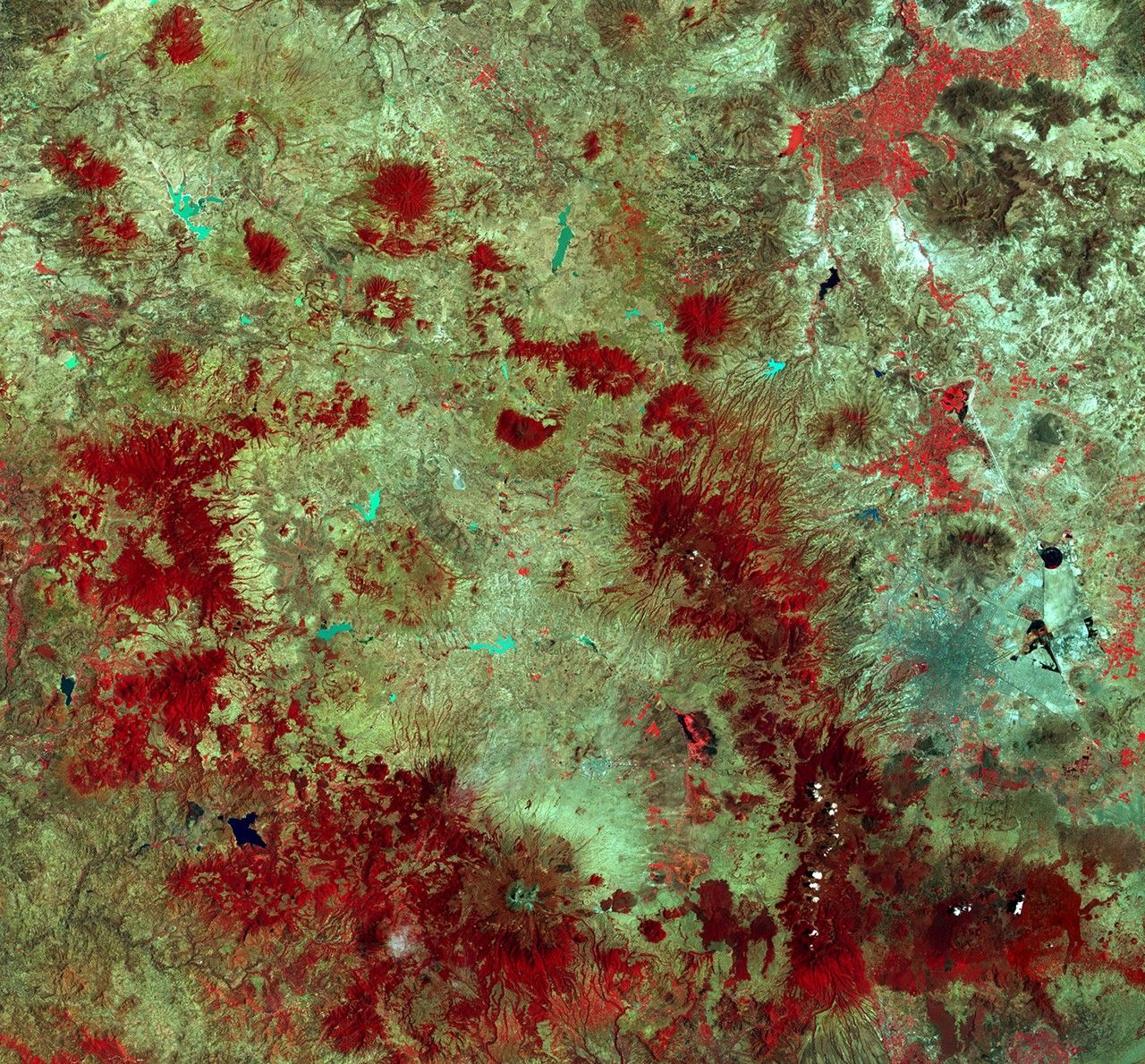
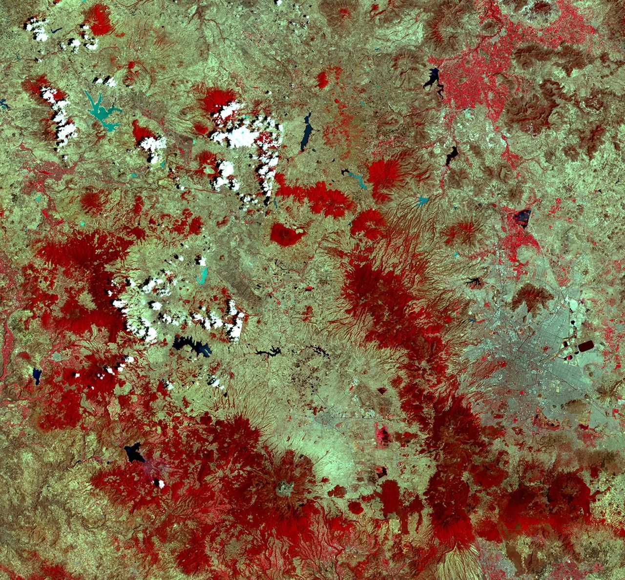
These images show a mountainous region of central Mexico near the town of Angangueo. Mexico City lies in the eastern part of each picture. Red areas show fir trees found on only about 40 to 50 thousand acres in Mexico. Monarch butterflies need thick forests of these trees for protection from the elements and predators after the long migration from the eastern U.S. and southern Canada. But many people who live along this area depend on the land for subsistence through farming, grazing and woodcutting, and the forest is being thinned despite the Mexican government having declared a number of reserves here for the Monarchs. 1973 image taken by the Multispectral Scanner onboard Landsat 1. 2000 image taken by the Enhanced Thematic Mapper Plus sensor onboard Landsat 7. Source: Earthshots: Satellite Images of Environmental Change, U.S. Geological Survey.
NASA/USGS
before
after
Before and After
Deforestation near Angangueo, Mexico
April 20 and 21, 1973 - March 21 and April 13, 2000
These images show a mountainous region of central Mexico near the town of Angangueo. Mexico City lies in the eastern part of each picture. Red areas show fir trees found on only about 40 to 50 thousand acres in Mexico. Monarch butterflies need thick forests of these trees for protection from the elements and predators after the long migration from the eastern U.S. and southern Canada. But many people who live along this area depend on the land for subsistence through farming, grazing and woodcutting, and the forest is being thinned despite the Mexican government having declared a number of reserves here for the Monarchs. 1973 image taken by the Multispectral Scanner onboard Landsat 1. 2000 image taken by the Enhanced Thematic Mapper Plus sensor onboard Landsat 7. Source: Earthshots: Satellite Images of Environmental Change, U.S. Geological Survey.


