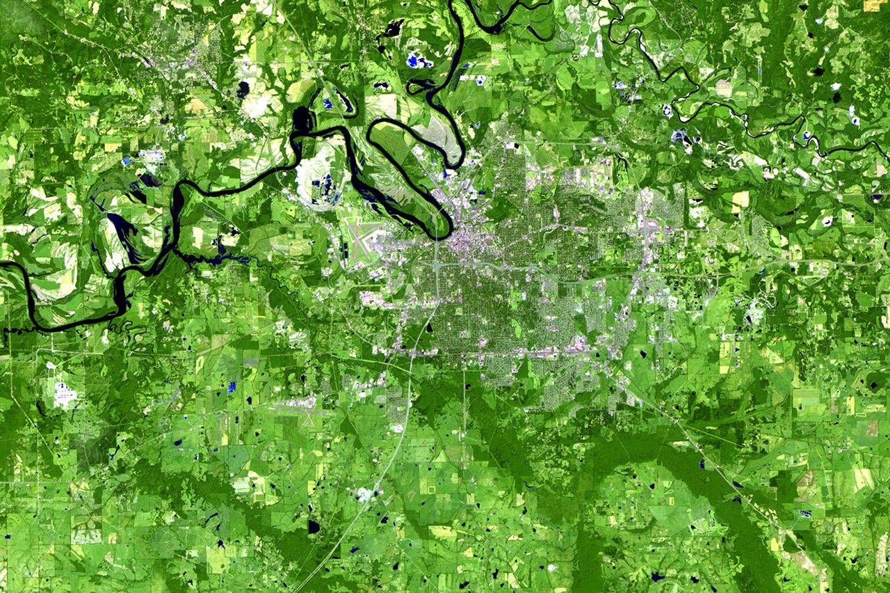
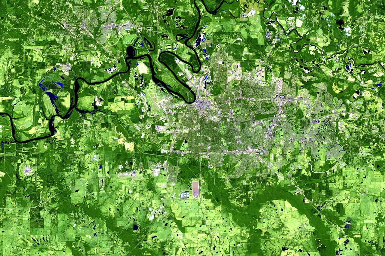
Due to the lapse in federal government funding, NASA is not updating this website.

Suggested Searches

1 min read

Urban growth in Montgomery, Alabama

before
after
Montgomery, the capital of Alabama, sits by the Alabama River in the south central portion of the state. Its population has nearly doubled during the past 30 years, from just under 125,000 to more than 200,000, thanks to increased tourism and commercial and industrial development. These images show changes from forest and croplands to urban and industrial areas around Montgomery and Prattville, located across the river on the northern side. The changes have been a major factor in altering regional air quality and the production of crops and lumber.   Images taken by the Thematic Mapper sensor onboard Landsat 5. Source: U.S. Geological Survey (USGS) Landsat Missions Gallery, "Urban Growth of the Montgomery, Alabama, area," U.S. Department of the Interior / USGS and NASA.
Montgomery, the capital of Alabama, sits by the Alabama River in the south central portion of the state. Its population has nearly doubled during the past 30 years, from just under 125,000 to more than 200,000, thanks to increased tourism and commercial and industrial development. These images show changes from forest and croplands to urban and industrial areas around Montgomery and Prattville, located across the river on the northern side. The changes have been a major factor in altering regional air quality and the production of crops and lumber. Images taken by the Thematic Mapper sensor onboard Landsat 5. Source: U.S. Geological Survey (USGS) Landsat Missions Gallery, "Urban Growth of the Montgomery, Alabama, area," U.S. Department of the Interior / USGS and NASA.

Before and After

Urban growth in Montgomery, Alabama

September 21, 1986 - September 10, 2011

Montgomery, the capital of Alabama, sits by the Alabama River in the south central portion of the state. Its population has nearly doubled during the past 30 years, from just under 125,000 to more than 200,000, thanks to increased tourism and commercial and industrial development. These images show changes from forest and croplands to urban and industrial areas around Montgomery and Prattville, located across the river on the northern side. The changes have been a major factor in altering regional air quality and the production of crops and lumber. Images taken by the Thematic Mapper sensor onboard Landsat 5. Source: U.S. Geological Survey (USGS) Landsat Missions Gallery, "Urban Growth of the Montgomery, Alabama, area," U.S. Department of the Interior / USGS and NASA.

Downloads

Image 1

JPEG

(4 MB)

Image 2

JPEG

(4 MB)