


before
after

Before and After
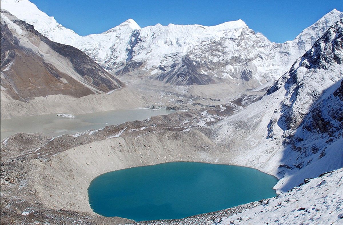
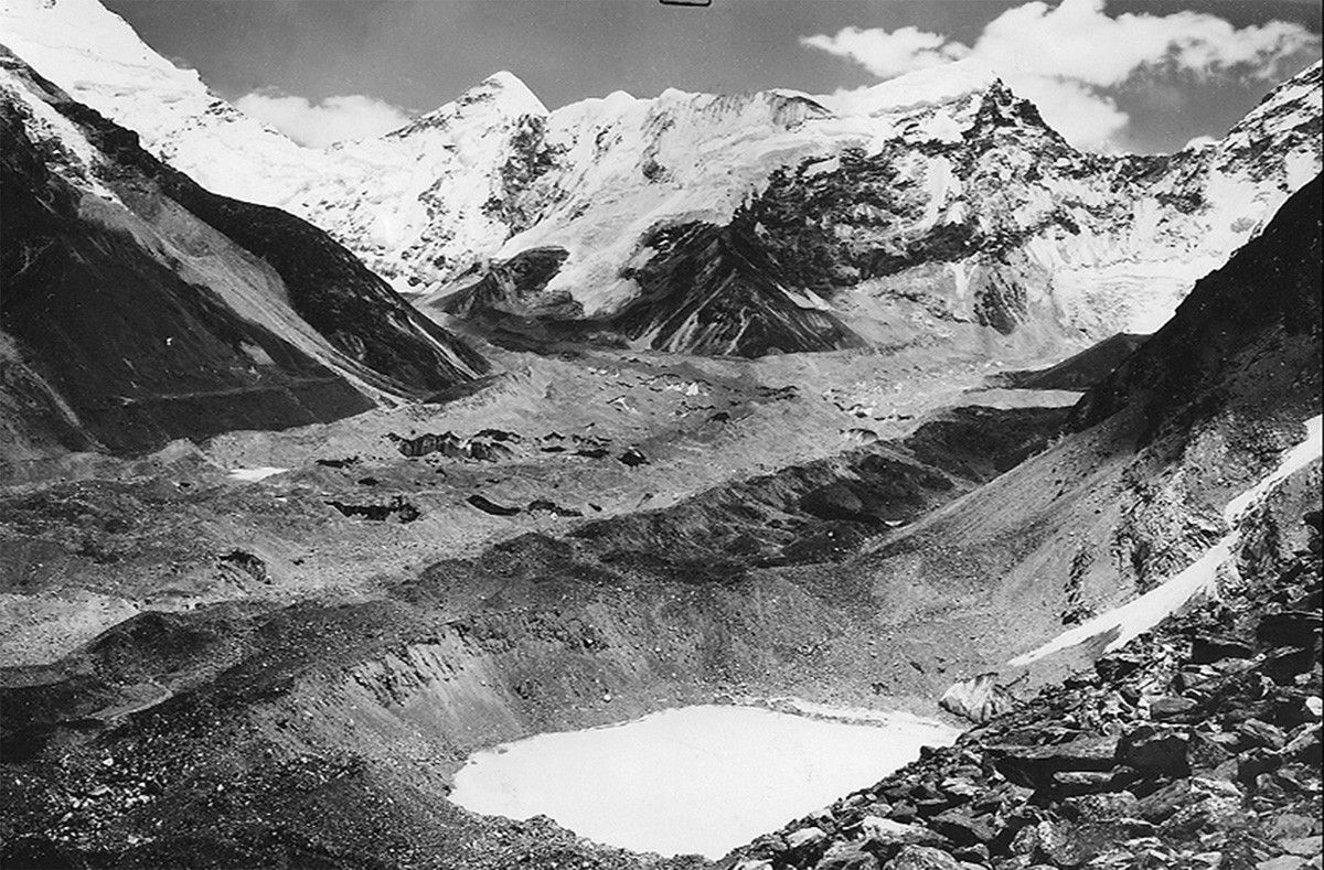
Imja Glacier melt, Himalayas
Autumn, circa 1956 - October 18, 2007
Imja Lake, the grayish glacial lake seen above Amphu Lake in the 2007 image, threatens to flood downstream communities if its unstable natural dam—consisting of dirt and rocks cemented by ice—gives way. It survived the Nepal earthquake of 2015 but remains hazardous. Imja Lake coalesced from a series of melt ponds that began forming on Imja Glacier, near Mt. Everest in the Himalayas, around 1960. By the mid-1970s, the ponds had merged into a single body of water, which has grown as the glaciers feeding it have retreated and thinned. The United Nations Development Programme has embarked on a project to lower the lake level and reduce the flood potential. Images: 1956 picture courtesy of the Association for Comparative Alpine Research, Munich; photo taken by Erwin Schneider. 2007 picture courtesy of the Archives of Alton Byers and the Mountain Institute; photo taken by Alton Byers. Sources for text: “Nepal's Imja Lake, Khumbu Region, Appears Resilient Against Gorkha Quake” and United Nations Development Programme.


