


![Request for Information – Potential [Placeholder for Prize]](https://assets.science.nasa.gov/dynamicimage/assets/science/psd/solar/2023/09/s/solarsystem_0.jpg?w=1024)


before
after
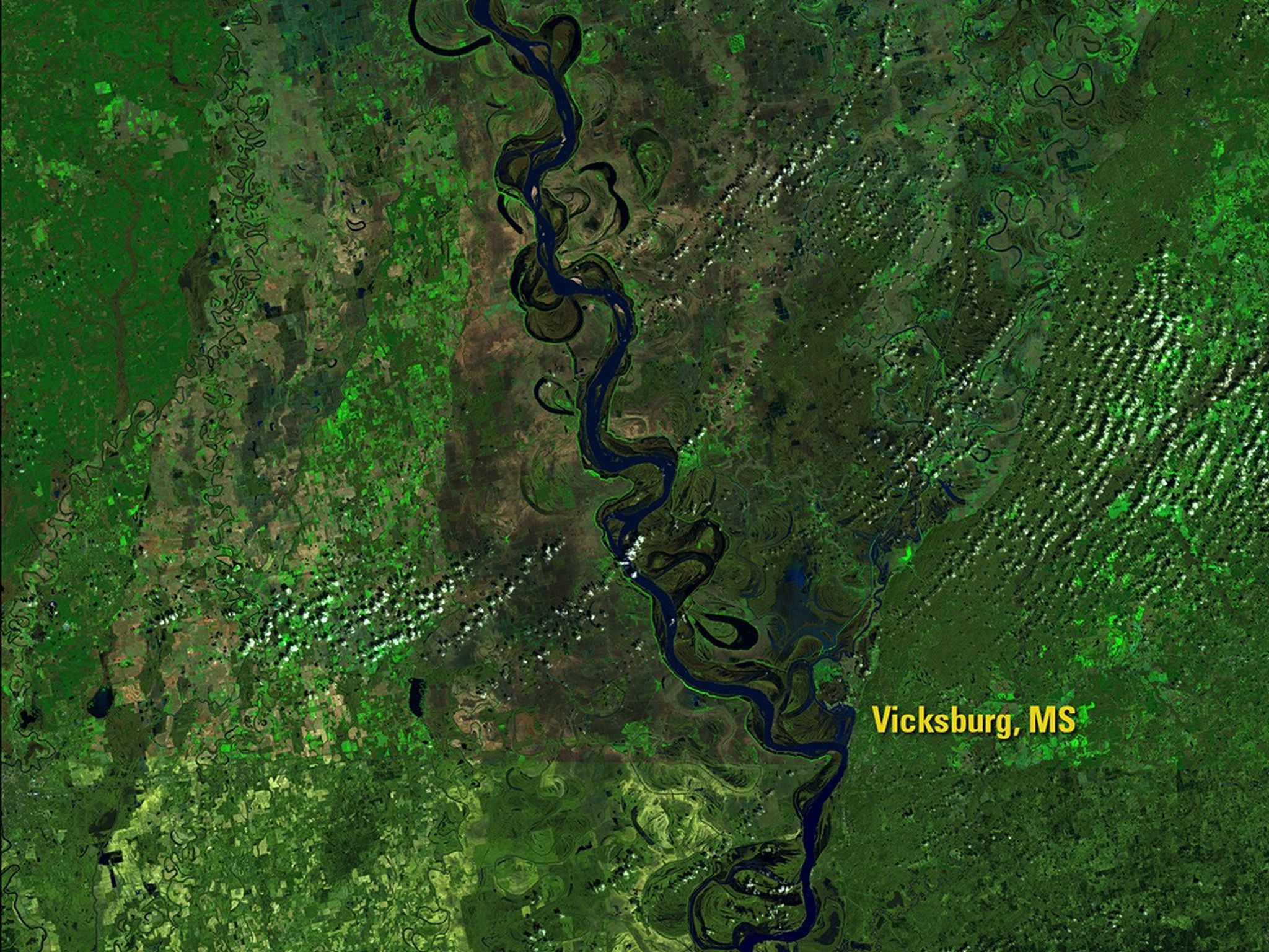
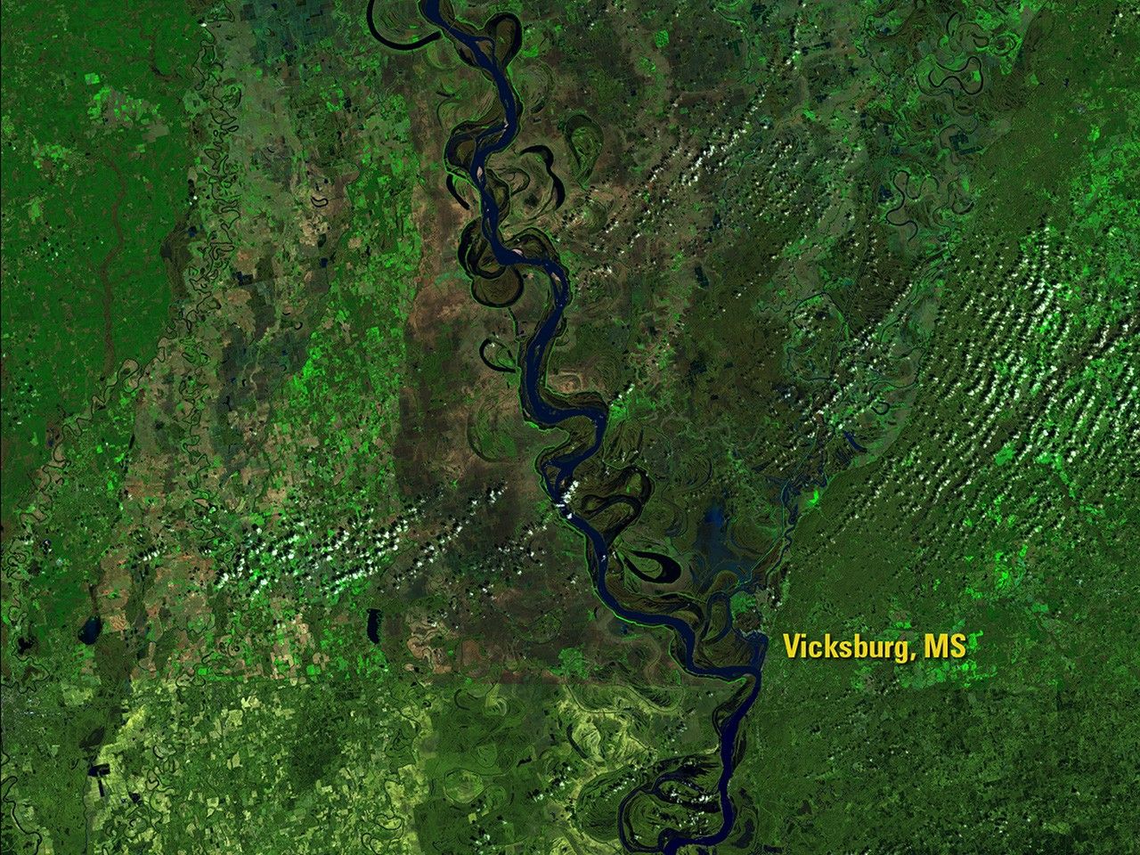
Following January storms that raised the lower Mississippi River to the top of its banks, storms in March 2016 drenched areas of Louisiana, eastern Texas, Mississippi and Arkansas with up to 20 inches of rain. Louisiana officials say the resulting flooding there was among the most widespread for any non-hurricane event, causing evacuations and significant damage. Images taken by the Operational Land Imager onboard Landsat 8. Source: U.S. Geological Survey (USGS) Landsat Missions Gallery; Mississippi River Floods Deep South; U.S. Department of the Interior / USGS and NASA.
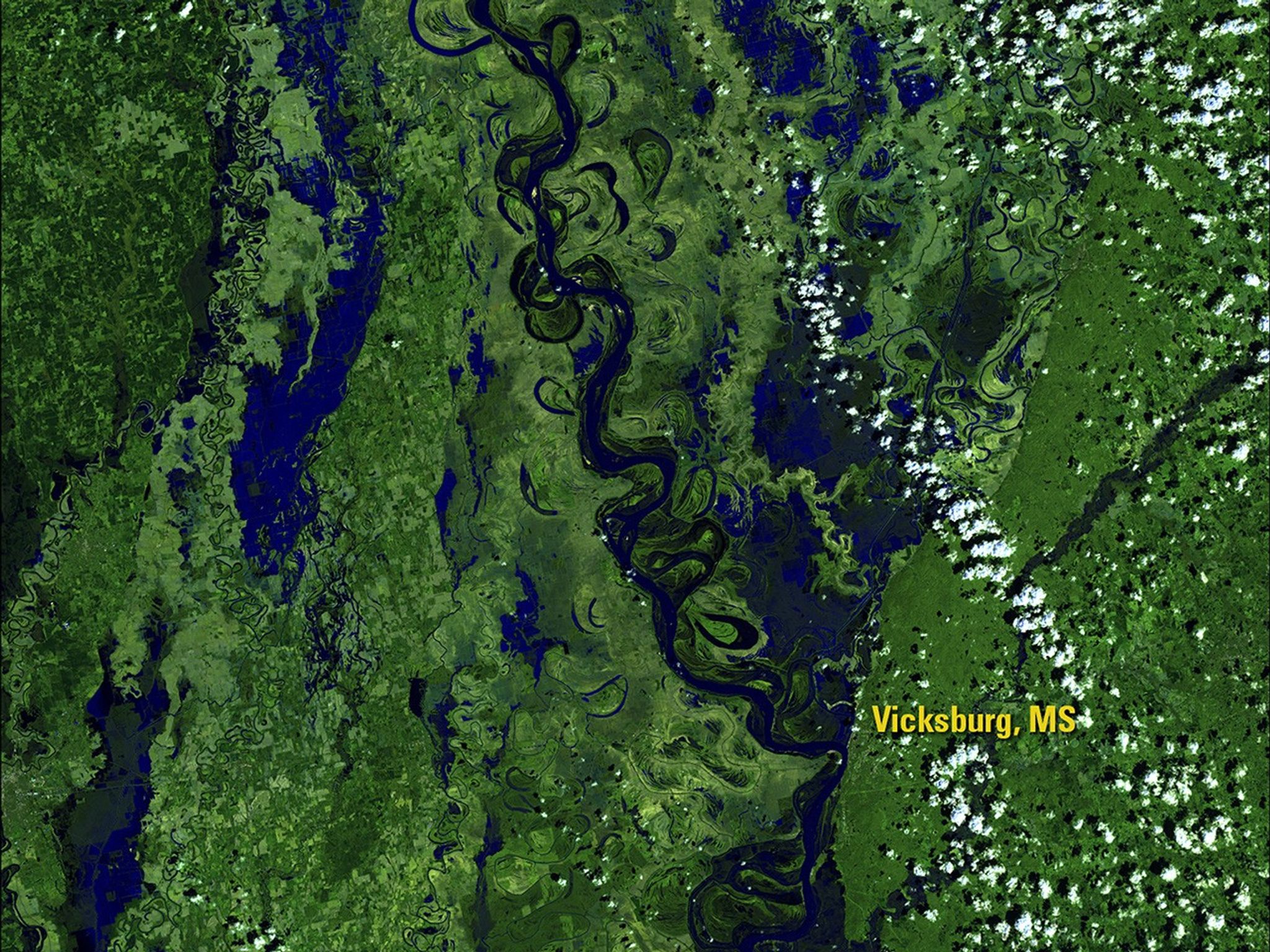
Following January storms that raised the lower Mississippi River to the top of its banks, storms in March 2016 drenched areas of Louisiana, eastern Texas, Mississippi and Arkansas with up to 20 inches of rain. Louisiana officials say the resulting flooding there was among the most widespread for any non-hurricane event, causing evacuations and significant damage. Images taken by the Operational Land Imager onboard Landsat 8. Source: U.S. Geological Survey (USGS) Landsat Missions Gallery; Mississippi River Floods Deep South; U.S. Department of the Interior / USGS and NASA.
Following January storms that raised the lower Mississippi River to the top of its banks, storms in March 2016 drenched areas of Louisiana, eastern Texas, Mississippi and Arkansas with up to 20 inches of rain. Louisiana officials say the resulting flooding there was among the most widespread for any non-hurricane event, causing evacuations and significant damage. Images taken by the Operational Land Imager onboard Landsat 8. Source: U.S. Geological Survey (USGS) Landsat Missions Gallery; Mississippi River Floods Deep South; U.S. Department of the Interior / USGS and NASA.
Following January storms that raised the lower Mississippi River to the top of its banks, storms in March 2016 drenched areas of Louisiana, eastern Texas, Mississippi and Arkansas with up to 20 inches of rain. Louisiana officials say the resulting flooding there was among the most widespread for any non-hurricane event, causing evacuations and significant damage. Images taken by the Operational Land Imager onboard Landsat 8. Source: U.S. Geological Survey (USGS) Landsat Missions Gallery; Mississippi River Floods Deep South; U.S. Department of the Interior / USGS and NASA.
before
after
Before and After
Flooding Mississippi River, Southern U.S.
March 4, 2016 - March 20, 2016
Following January storms that raised the lower Mississippi River to the top of its banks, storms in March 2016 drenched areas of Louisiana, eastern Texas, Mississippi and Arkansas with up to 20 inches of rain. Louisiana officials say the resulting flooding there was among the most widespread for any non-hurricane event, causing evacuations and significant damage. Images taken by the Operational Land Imager onboard Landsat 8. Source: U.S. Geological Survey (USGS) Landsat Missions Gallery; Mississippi River Floods Deep South; U.S. Department of the Interior / USGS and NASA.


