


![Request for Information – Potential [Placeholder for Prize]](https://assets.science.nasa.gov/dynamicimage/assets/science/missions/a-step/FFR_Earth_Background_20251120%20.png?w=1024)


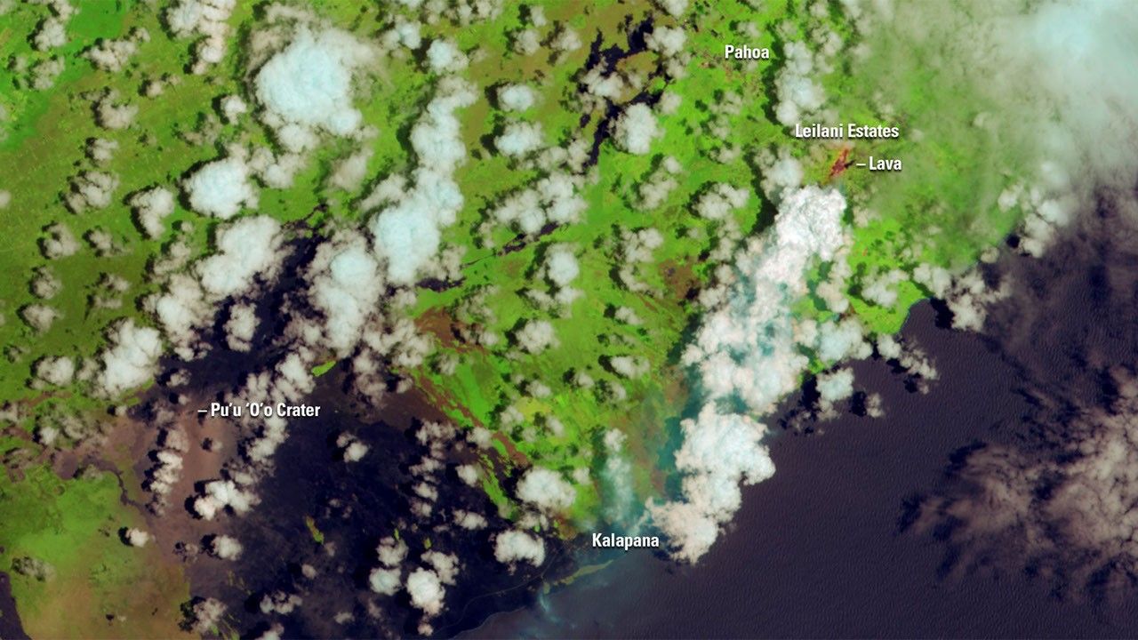
before
after
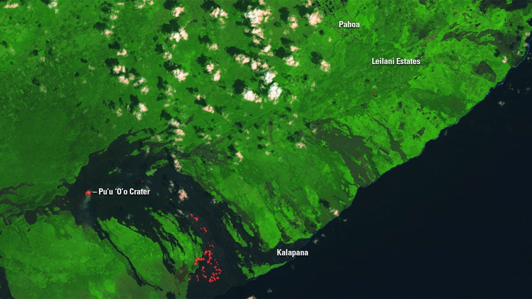
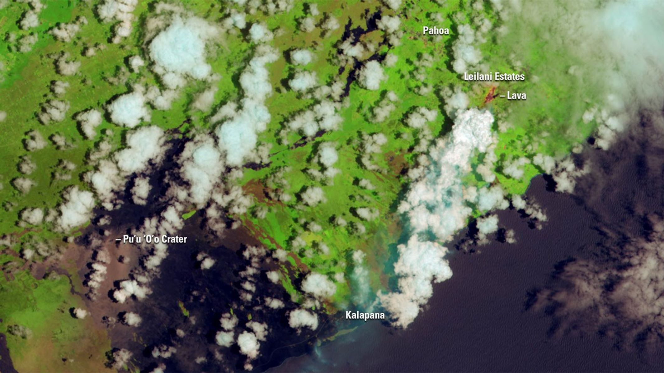
Before and After
Kilauea Volcano eruptions in Hawaii
Oct. 11, 1991 - May 6, 2018
New fissures opened up in the Pu’u ‘O’o Crater of the Kilauea volcano on the island of Hawaii in May 2018, spouting lava that destroyed homes in the Leilani Estates neighborhood. But eruptions from this crater have a history of burying towns. The 1991 image shows a lava flow, extending toward the east along the coastline, which buried the entire community of Kalapana in about 50–80 feet (15–25 meters) of lava the previous year. The 2018 image shows the remnants of a narrower flow between 2014 and 2016 that approached the community of Pahoa. 1991 image taken by Landsat 5. 2018 image taken by the Indian Space Research Organisation’s Resourcesat 2. Source: U.S. Geological Survey’s Land Remote Sensing Image Collections


