


![Request for Information – Potential [Placeholder for Prize]](https://assets.science.nasa.gov/dynamicimage/assets/science/missions/a-step/FFR_Earth_Background_20251120%20.png?w=1024)


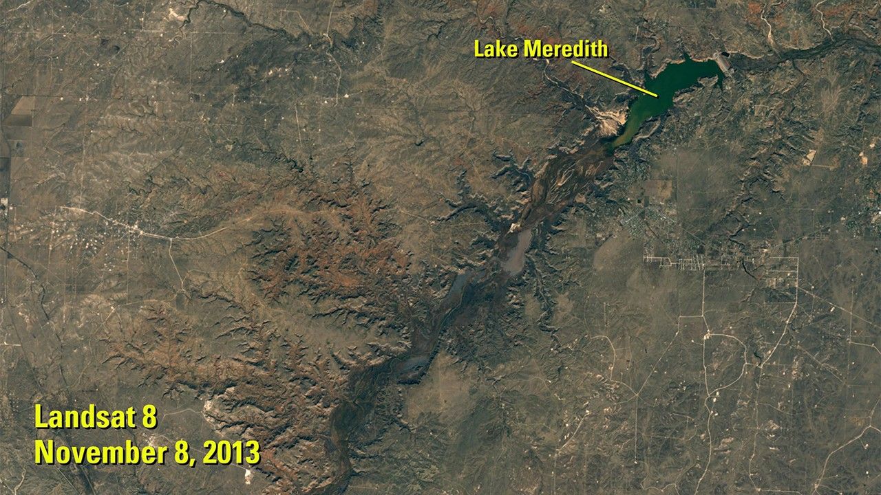
before
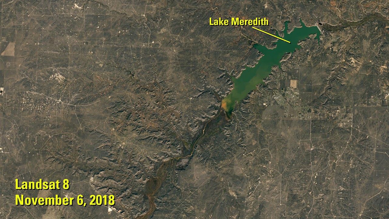
after


Before and After
Return of Lake Meredith, Texas
Nov. 8, 2013 - Nov. 6, 2018
Lake Meredith is a reservoir on the Canadian River in the Texas Panhandle. More than a decade of drought brought its depth to a record low in 2013. (See Lake Meredith shrinkage, Texas.) Recovery began with heavy rain in 2017, and its surface area more than doubled by the time of the 2018 image. A dam separates the lake’s northeastern tip from the Canadian River. Images taken by the Operational Land Imager on Landsat 8. Sources: U.S. Geological Survey’s National Land Imaging Image Collections, Canadian River Municipal Water Authority and National Weather Service.


