


![Request for Information – Potential [Placeholder for Prize]](https://assets.science.nasa.gov/dynamicimage/assets/science/missions/a-step/FFR_Earth_Background_20251120%20.png?w=1024)


before
after

Before and After
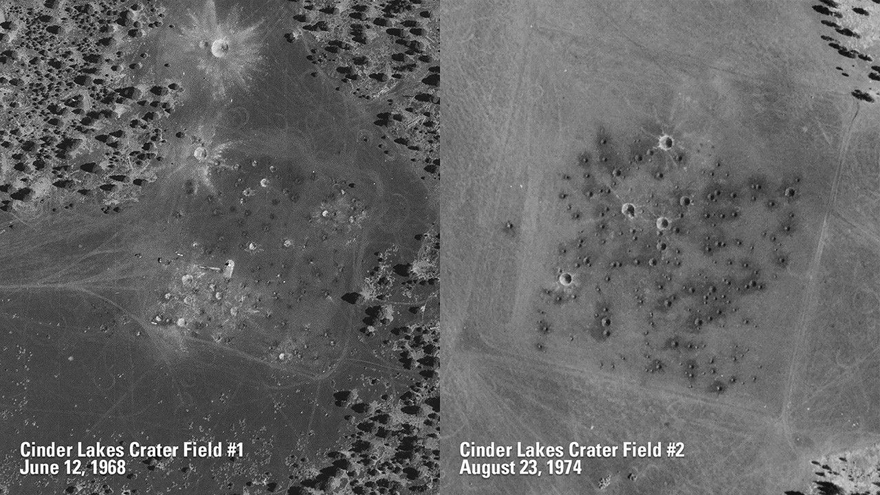
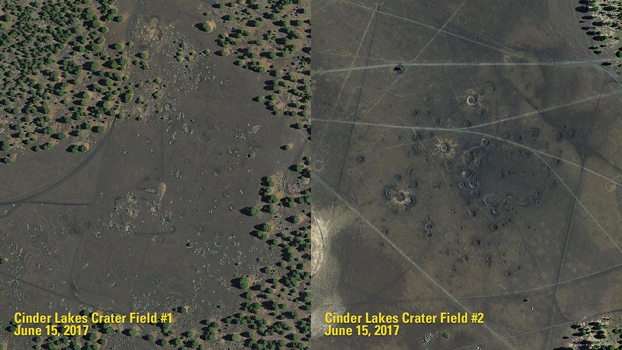
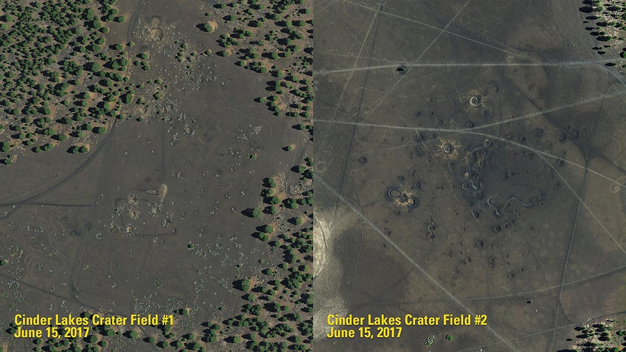
Arizona’s “Lunar” Craters
1968 and 1974 - 2017
The U.S. Geological Survey created the two Cinder Lake crater fields, near Flagstaff, Arizona, to help train Apollo astronauts bound for the lunar surface. The first of these fields (1968 image) was designed to simulate the Sea of Tranquility, where Neil Armstrong and Buzz Aldrin would land in 1969. The impact craters in these ancient lava flows were made with dynamite instead of meteorites. Unlike the airless Moon, which can preserve craters for eons, the Arizona craters have eroded, as seen in this comparison of 1968 and 1974 images with those of 2017. Aerial photography from the National Agricultural Imagery Program. Source: U.S. Geological Survey’s National Land Imaging Image Collections


