


![Request for Information – Potential [Placeholder for Prize]](https://assets.science.nasa.gov/dynamicimage/assets/science/missions/a-step/FFR_Earth_Background_20251120%20.png?w=1024)


Description
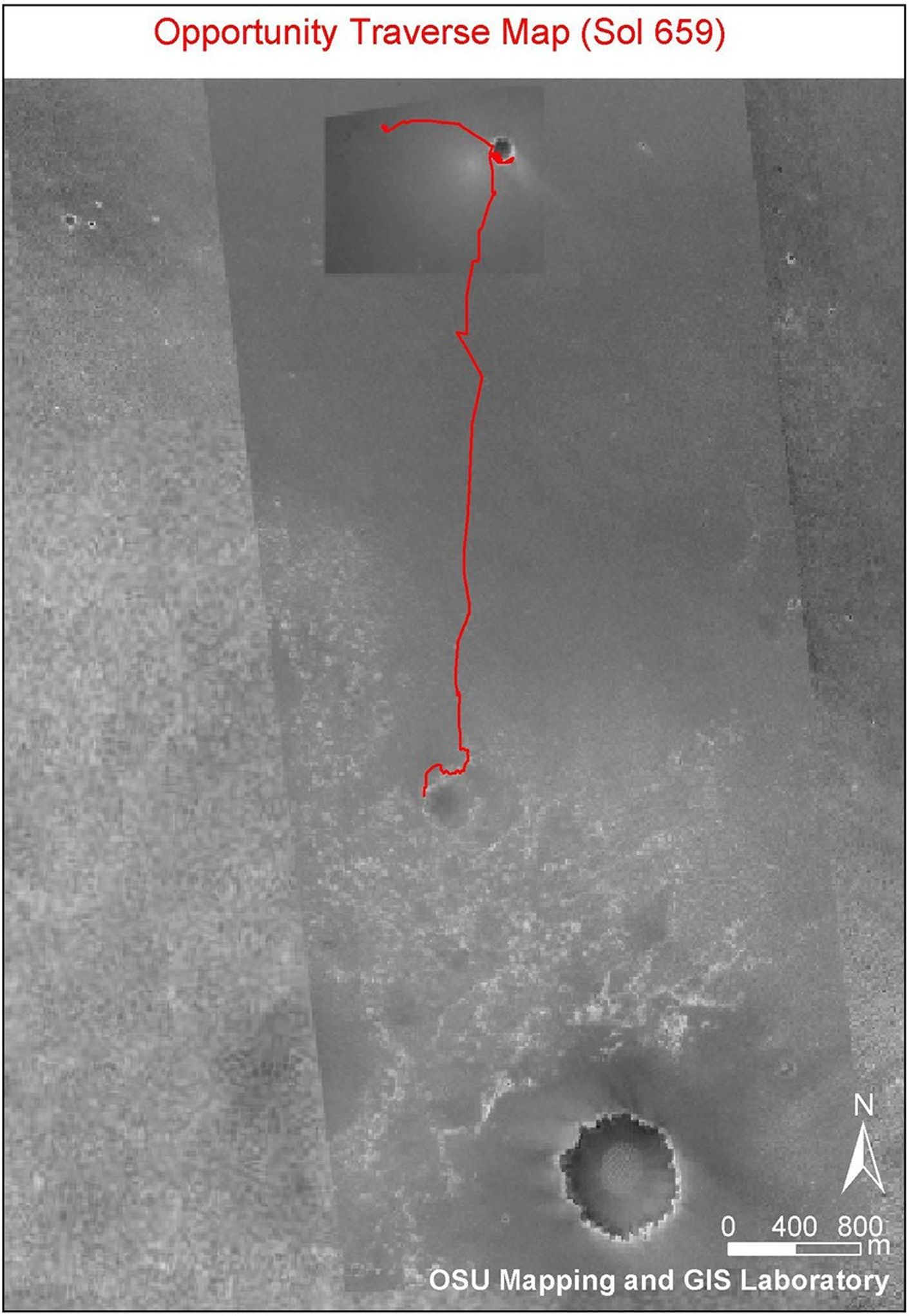
This image shows the route that NASA's Mars Exploration Rover Opportunity had driven through its 659th Martian day, or sol, (Dec. 1, 2005) relative to the potential destination of "Victoria Crater" farther south. The base image is a portion of a mosaic (previously released as PIA07506) combining images from the Mars Observer Camera on NASA's Mars Global Surveyor orbiter, the Thermal Emission Imaging System on NASA's Mars Odyssey orbiter, and Opportunity's own Descent Image Motion Estimation System. The scale bar at lower right is 800 meters (one-half mile).


