


![Request for Information – Potential [Placeholder for Prize]](https://assets.science.nasa.gov/dynamicimage/assets/science/psd/solar/2023/09/s/solarsystem_0.jpg?w=1024)


Description
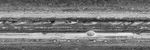
Huge cyclonic storms, the Great Red Spot and the Little Red Spot, and wispy cloud patterns are seen in fascinating detail in this map of Jupiter's atmosphere obtained January 14-15, 2007, by the New Horizons Long Range Reconnaissance Imager (LORRI).
The map combines information from 11 different LORRI images that were taken every hour over a 10-hour period -- a full Jovian day -- from 17:42 UTC on January 14 to 03:42 UTC on January 15. The New Horizons spacecraft was approximately 72 million kilometers (45 million miles) from Jupiter at the time.
The LORRI pixels on the "globe" of Jupiter were projected onto a rectilinear grid, similar to the way flat maps of Earth are created. The LORRI pixel intensities were corrected so that every point on the map appears as if the sun were directly overhead; some image sharpening was also applied to enhance detail. The polar regions of Jupiter are not shown on the map because the LORRI images do not sample those latitudes very well and artifacts are produced during the map-projection process.


