


Description
Annotated Version
Click on the image for full view
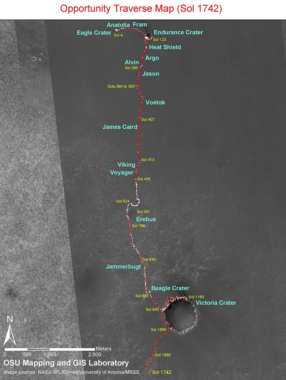
The red-and-white line on this image traces the route that NASA's Mars Exploration Rover Opportunity drove from its landing inside Eagle Crater on Jan. 4, 2004 (Universal Time; Jan. 3 Pacific Standard Time) through the 1,742nd Martian day, or sol, of the mission (Dec. 17, 2008). During that period, Opportunity drove 13.62 kilometers (8.5 miles).
Opportunity climbed out of the 800-meter-wide (half-mile-wide) Victoria Crater on Sol 1634 (Aug. 28, 2008). The rover's next major destination is a much larger crater further south, Endeavour Crater, with a diameter of about 22 kilometers (14 miles).
The route and labels on this map are overlain on an image from the Thermal Emission Imaging System camera on NASA's Mars Odyssey orbiter.


