


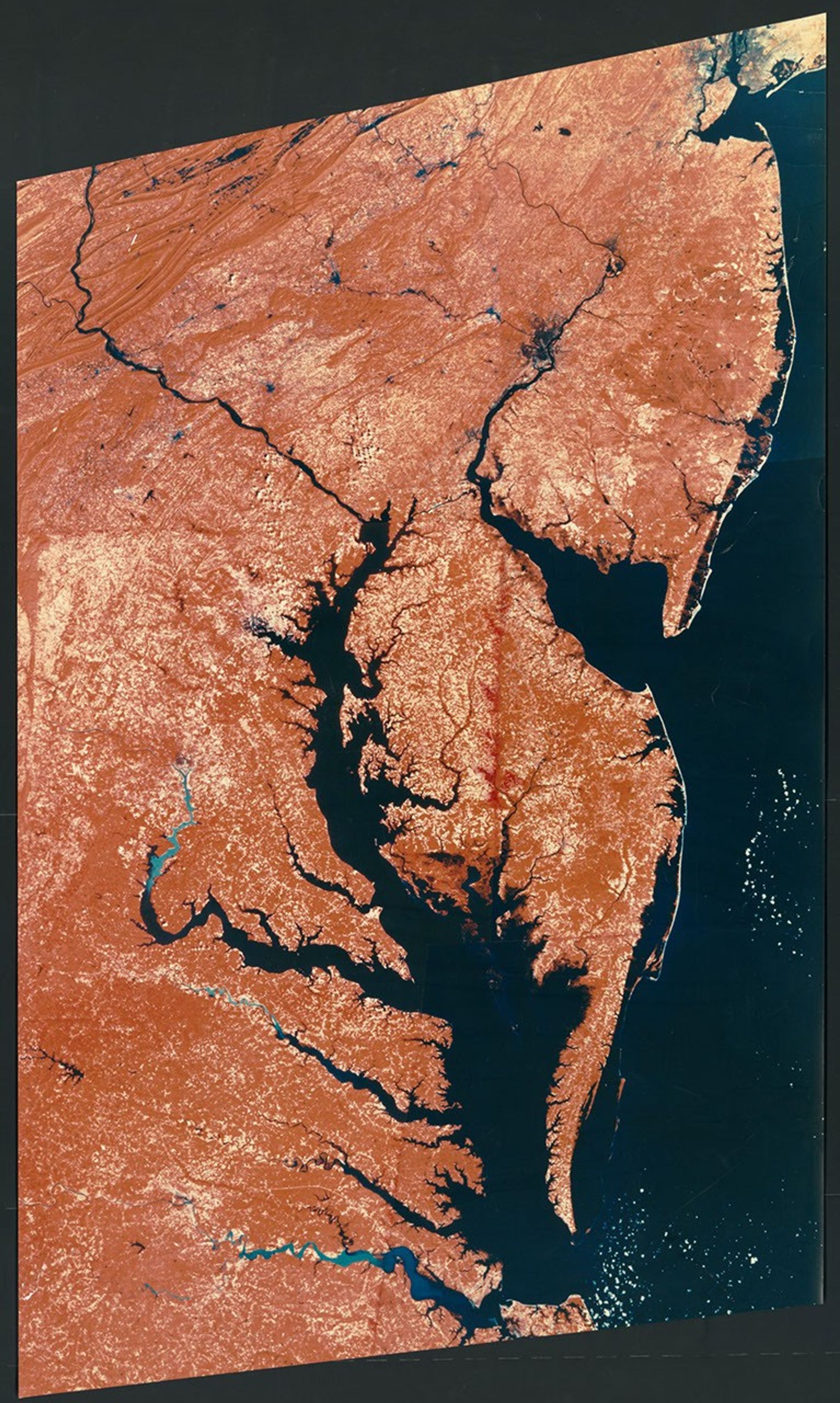
Landsat satellite image of the Middle Atlantic States, eastern part
This false-color Landsat satellite image from 1977 captures the eastern Middle Atlantic States, spanning from New York City to Hampton Roads, Virginia. The visualization was created as a prototype for an International Cartographic Association/National Geographic Society poster map. Using infrared and visible light data, the image highlights the region's distinctive geography with vegetation appearing in red, urban areas in lighter tones, and the Atlantic Ocean, Chesapeake Bay, and other water bodies in dark blue.
Image Credit: Library of Congress
- X
https://science.nasa.gov/image-detail/amf-63a0b7ef-2e31-4d59-901c-cb5a5753712e/
Image CreditLibrary of Congress
Size1891x3155px
