


State of Georgia – Landsat
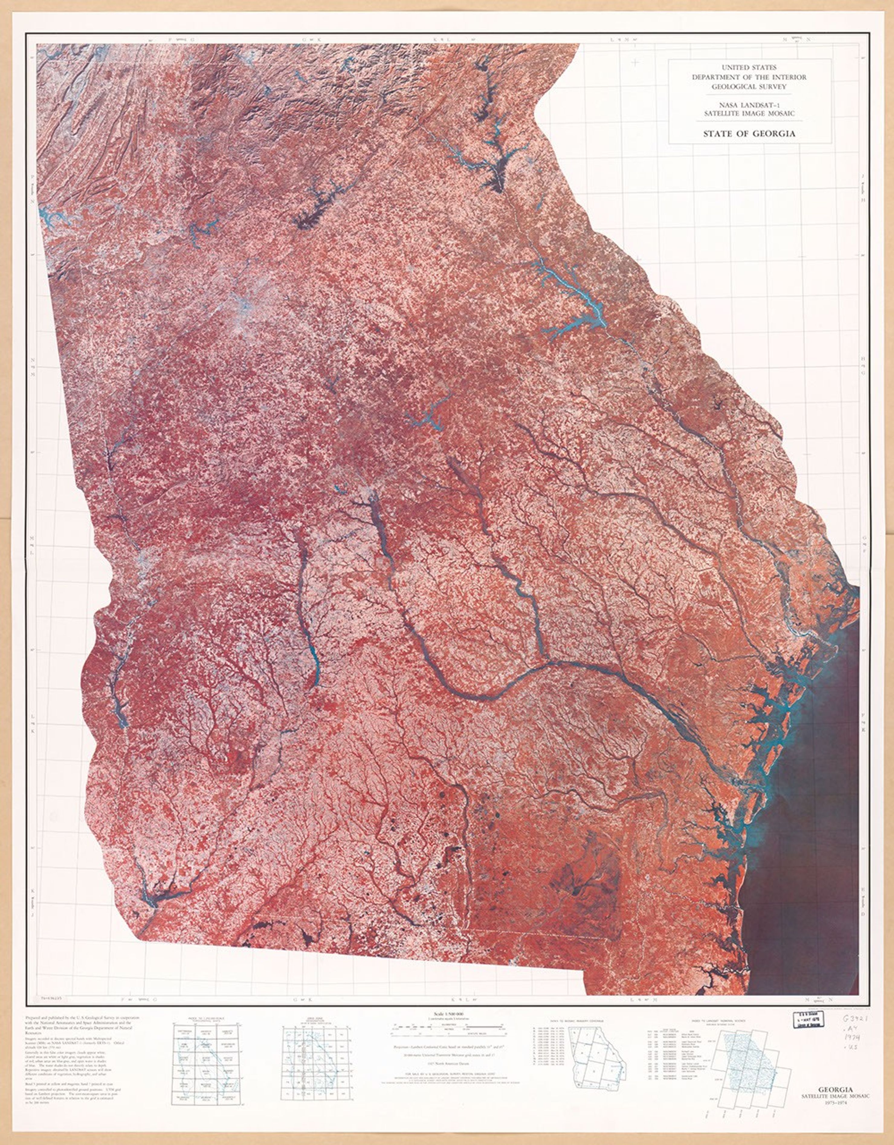
This comprehensive satellite image mosaic was produced by the U.S. Geological Survey in cooperation with NASA and Georgia's Earth and Water Division in 1976. Created at a 1:500,000 scale using LANDSAT-1 Multispectral Scanner data from 1973-74, this false-color visualization displays vegetation in reddish tones and water bodies in blue. The image reveals Georgia's diverse landscape, from the mountainous terrain in the northwest to the intricate coastal waterways along the Atlantic seaboard in the southeast.
Image Credit: USGS
- X
https://science.nasa.gov/image-detail/amf-d54cb8b1-ceb8-42c1-9d52-bae72b7203bb/
Image CreditUSGS
Size2960x3788px
