


Lake George, Florida, satellite image map
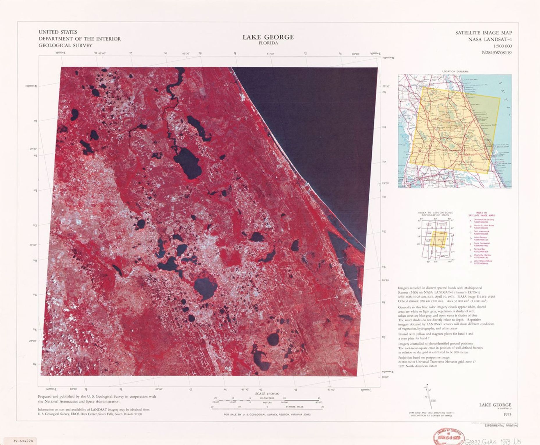
This satellite image map was created by the U.S. Geological Survey in cooperation with NASA using LANDSAT-1 data recorded on April 10, 1973. Published in 1977 at a scale of 1:500,000, this experimental printing uses false-color processing where vegetation appears in reddish-pink tones and water bodies in dark blue. The visualization clearly shows Lake George, located in Putnam and Volusia Counties, as well as the surrounding lake-dotted landscape and nearby Atlantic coastline of northeastern Florida.
Image Credit: USGS
- X
https://science.nasa.gov/image-detail/amf-981da493-93e6-454f-83ef-181cfef1c6d7/
Image CreditUSGS
Size1857x1531px
