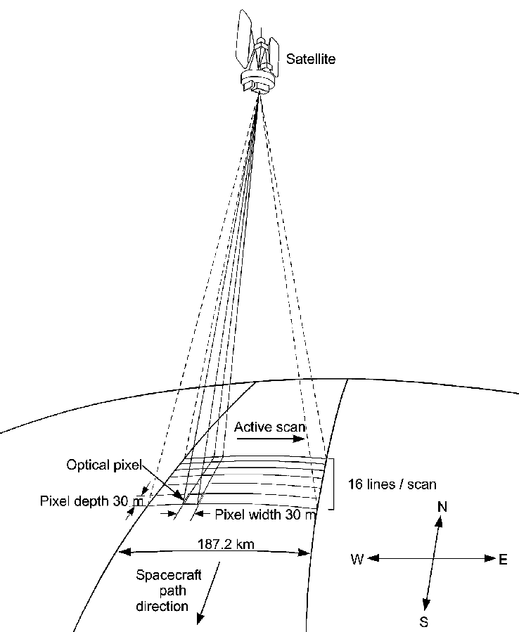
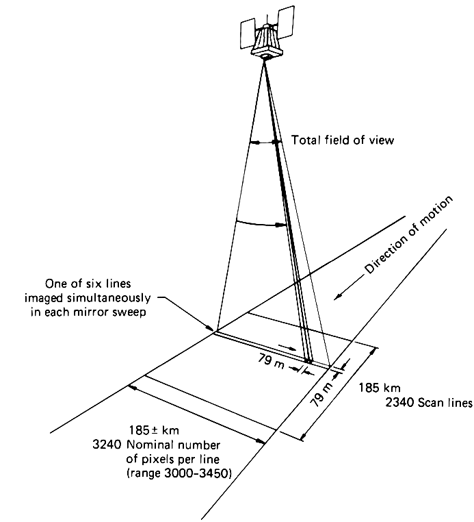
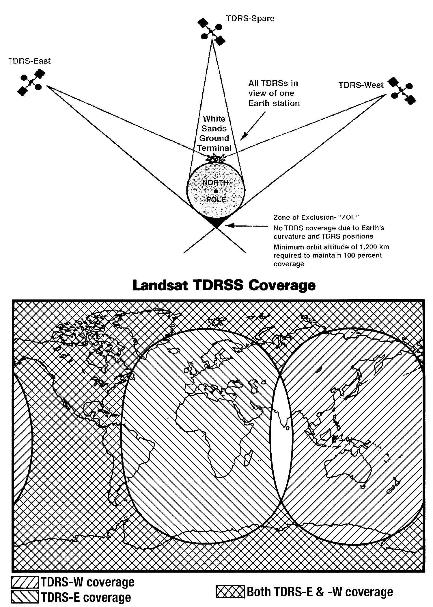
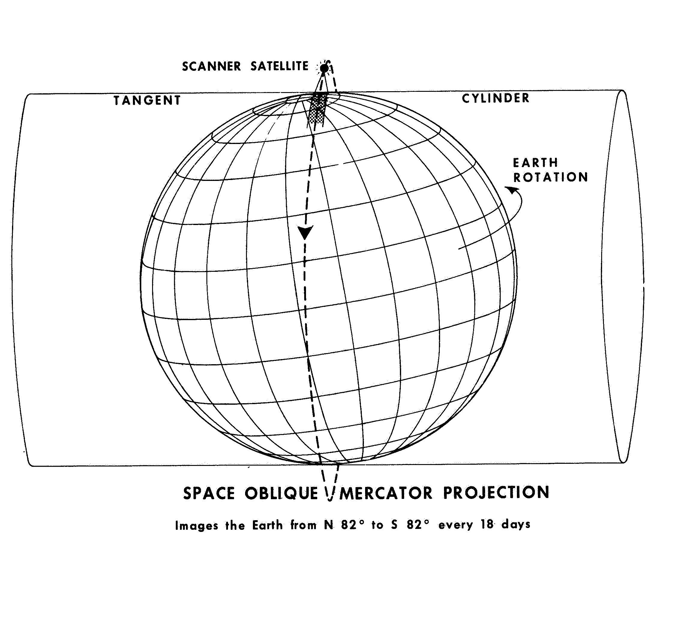
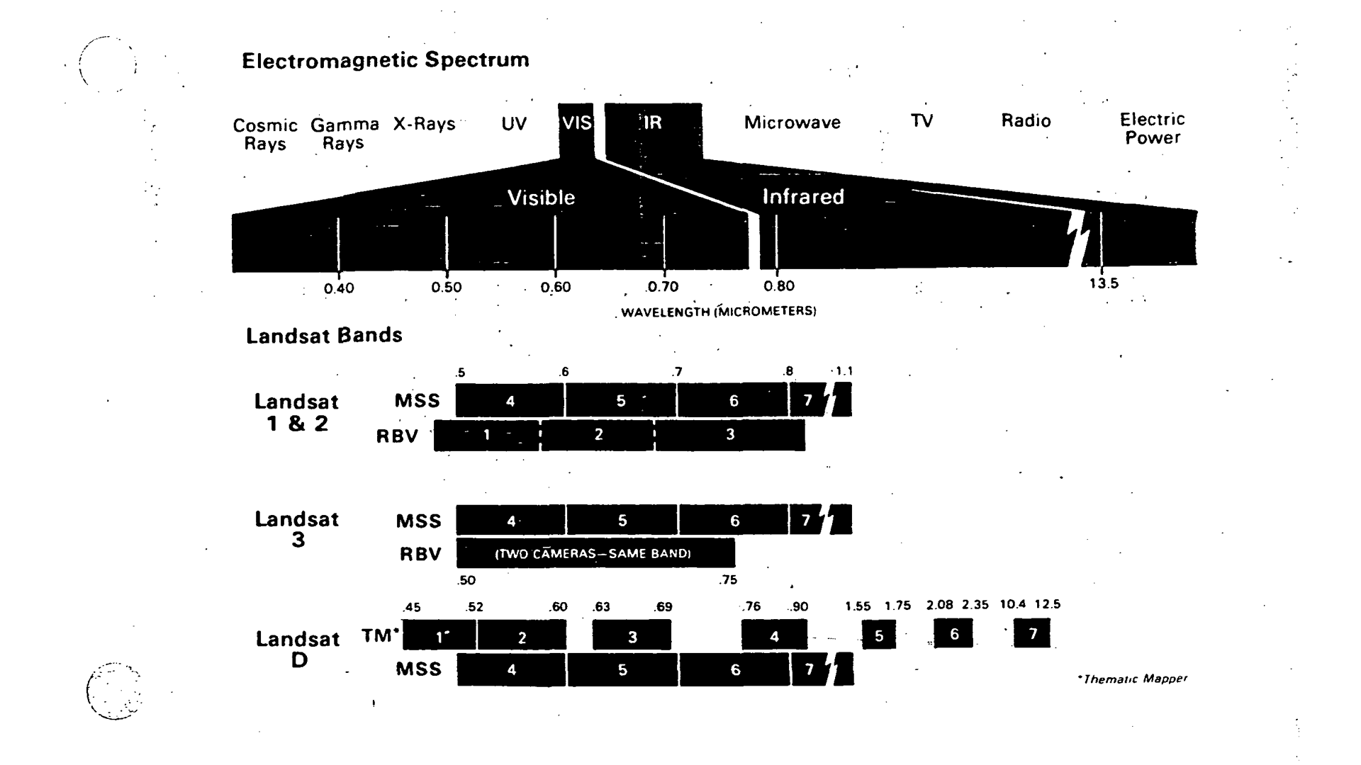
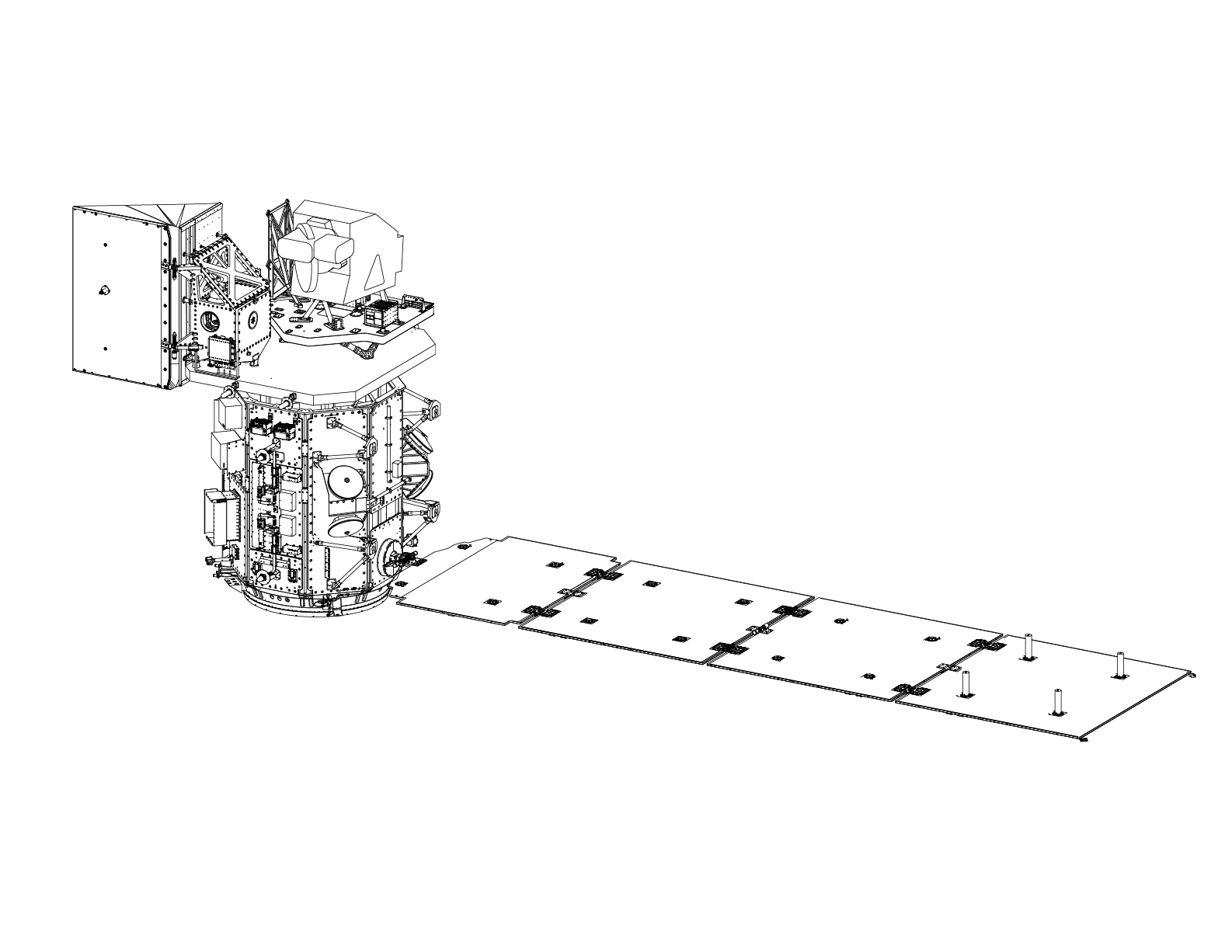
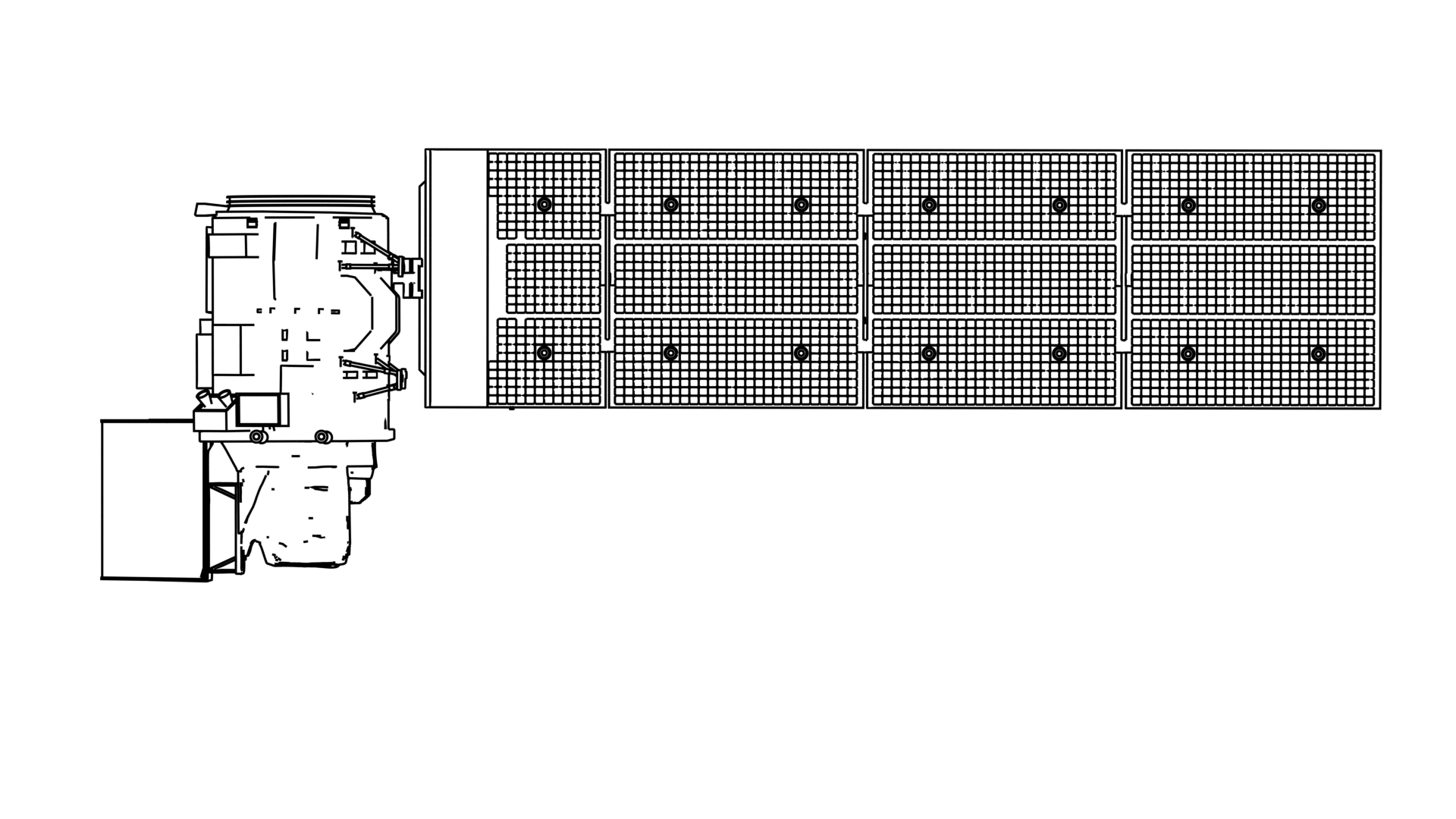
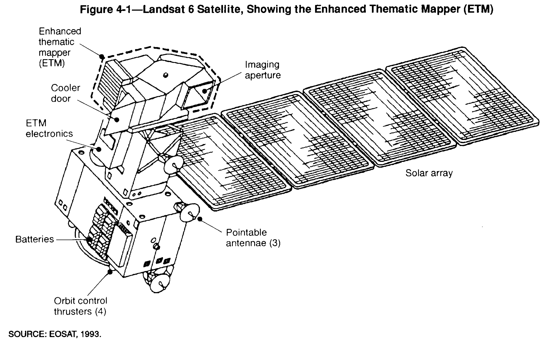
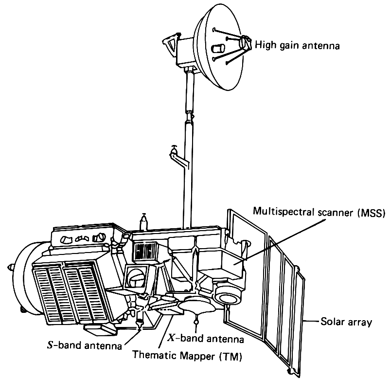
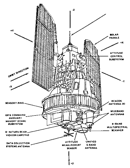
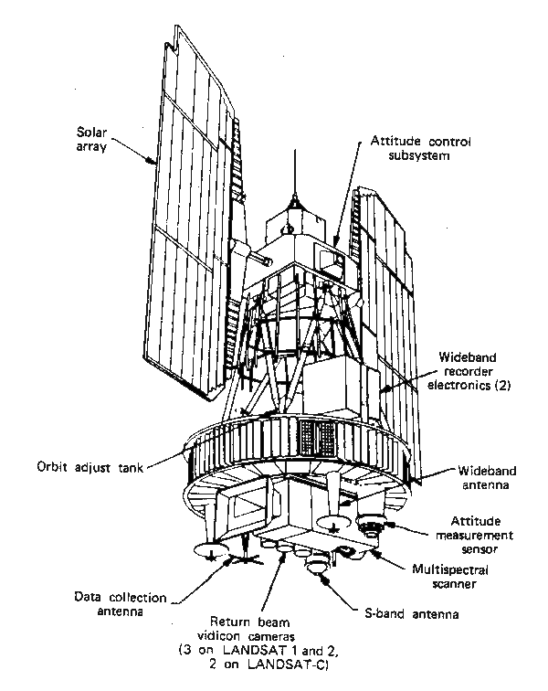
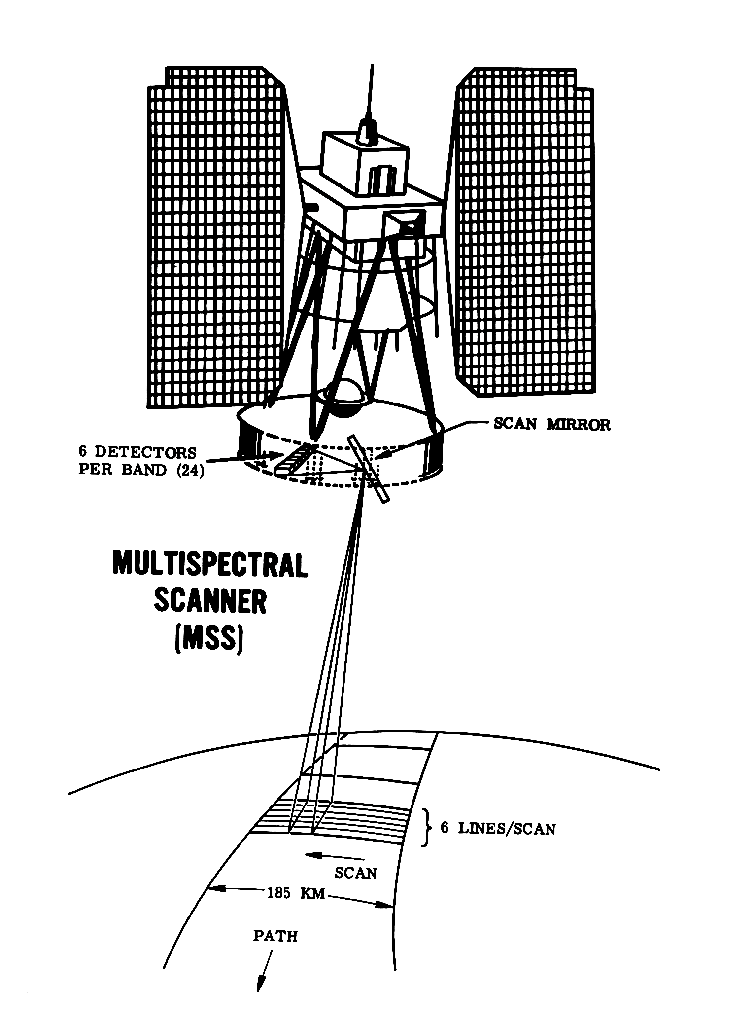
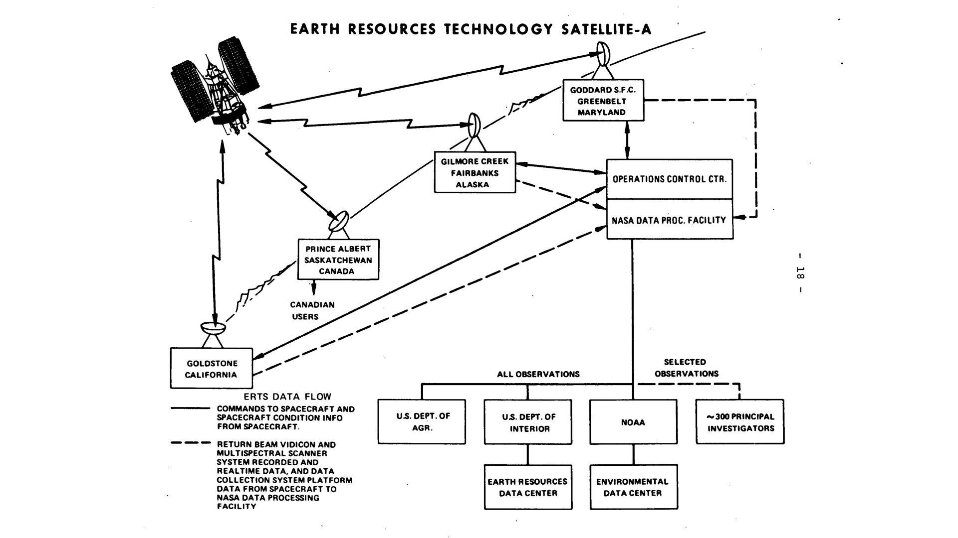
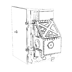
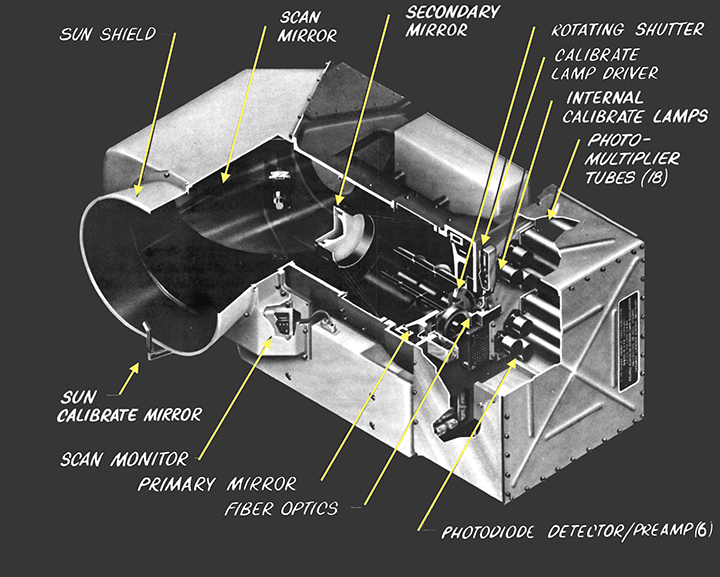
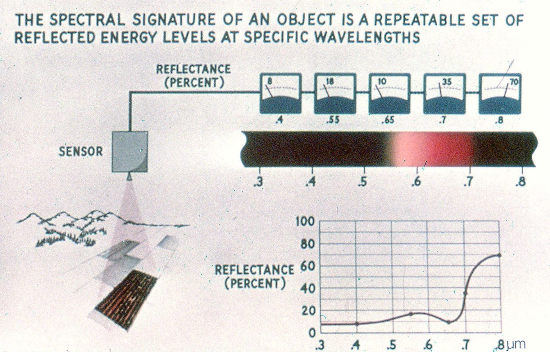
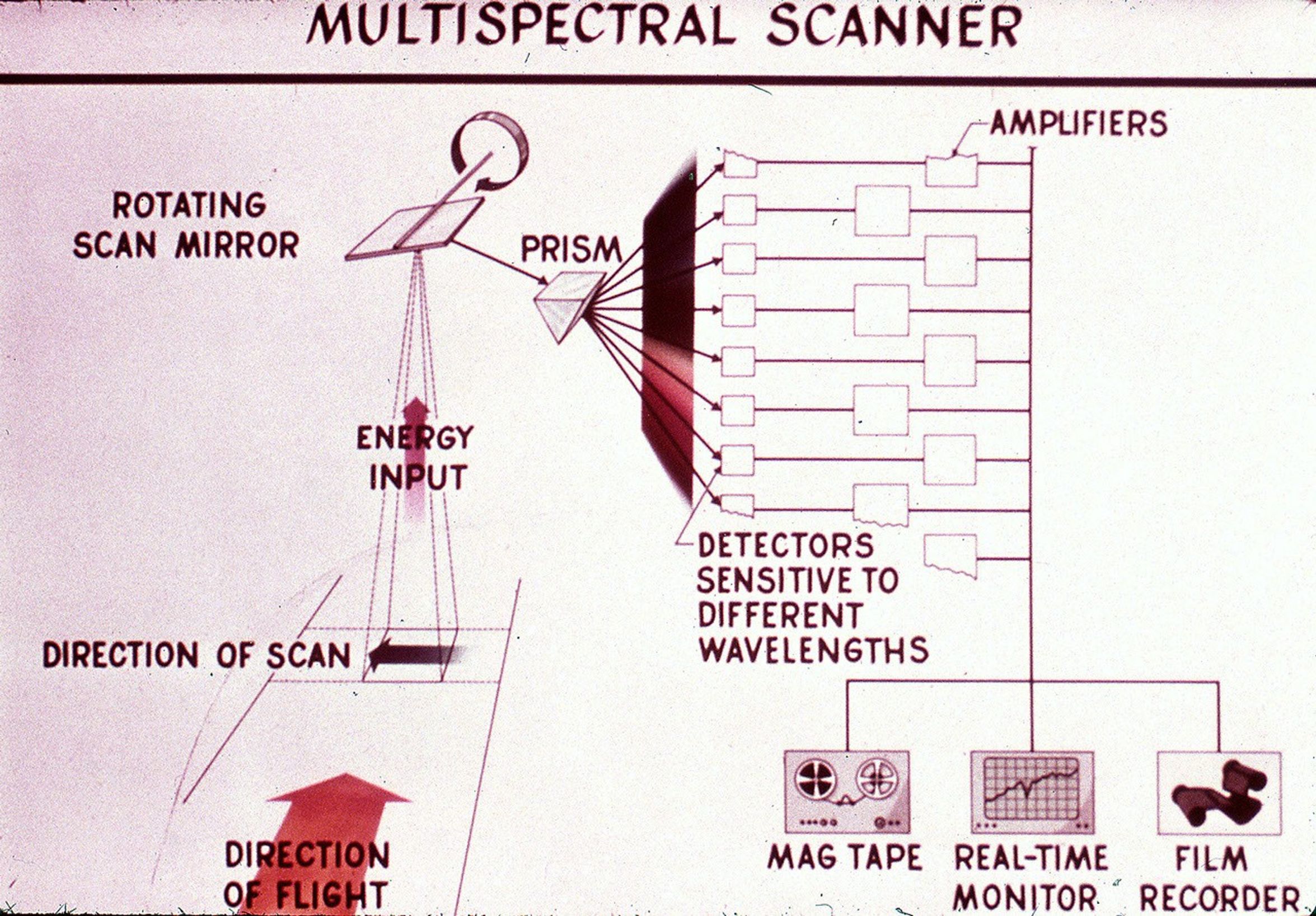
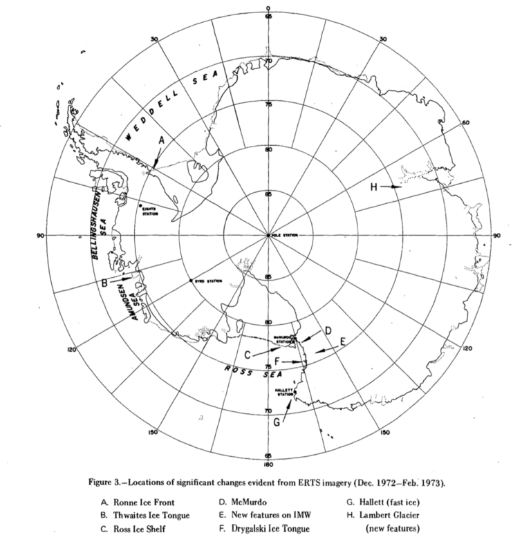
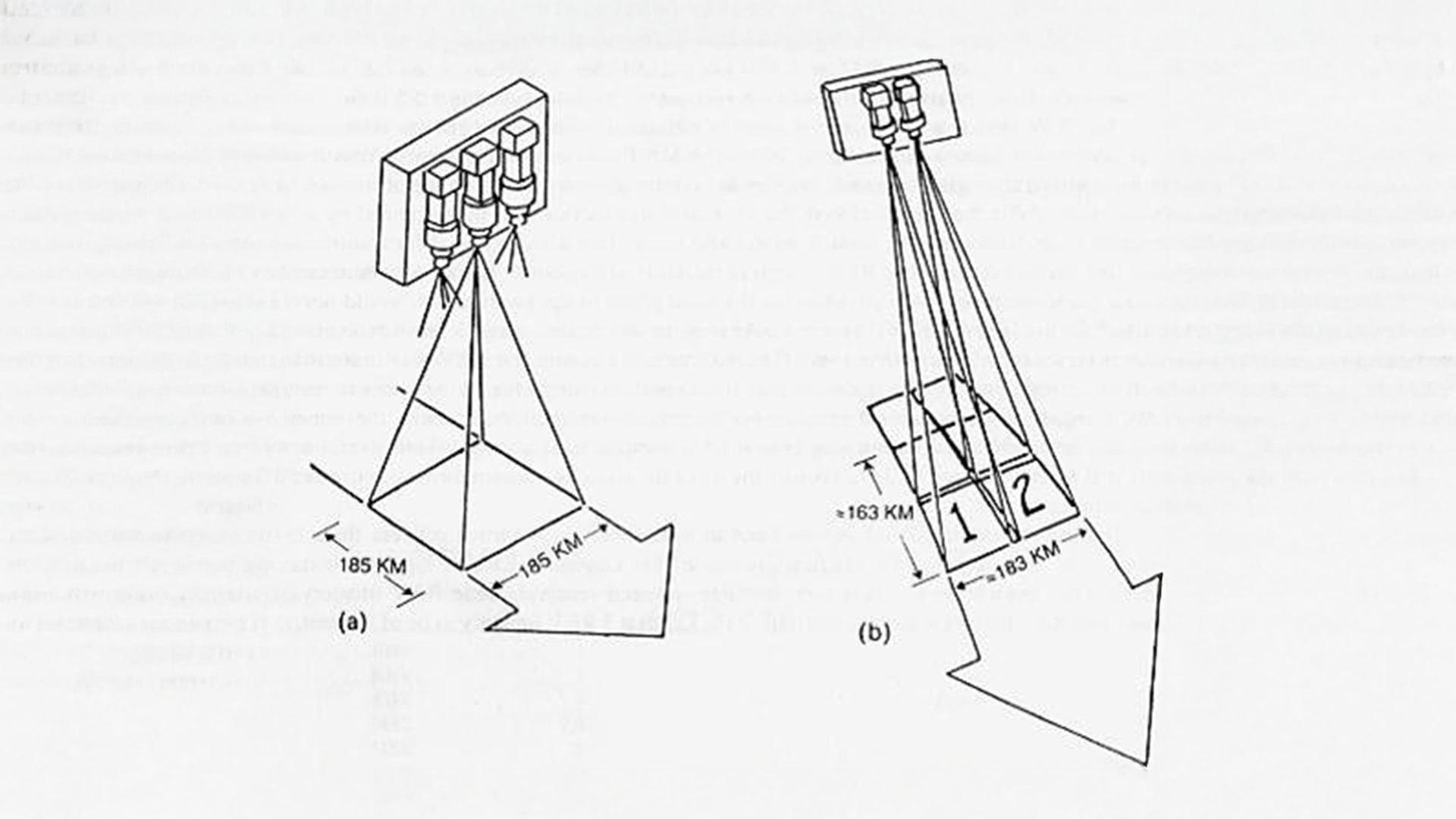
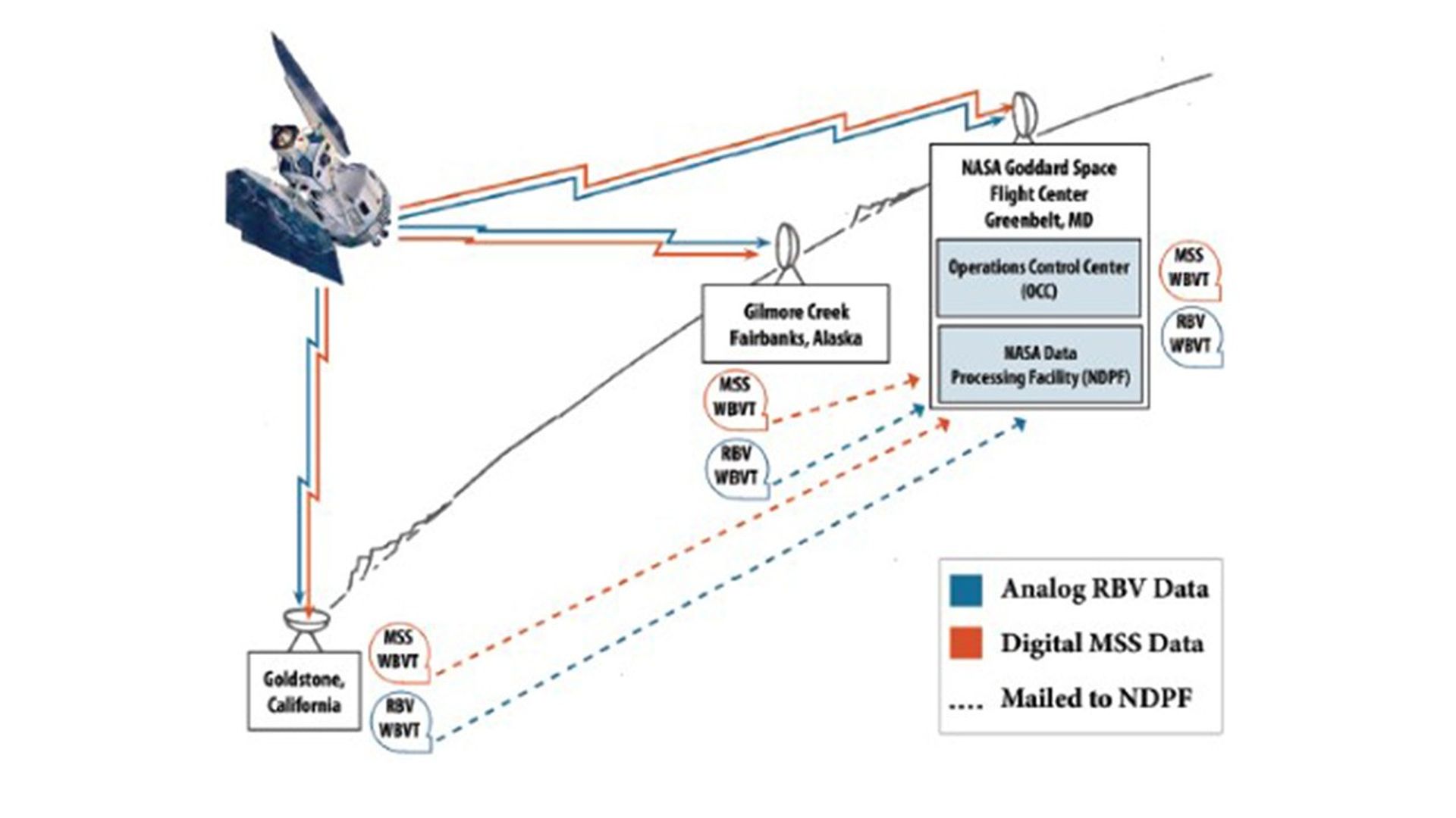
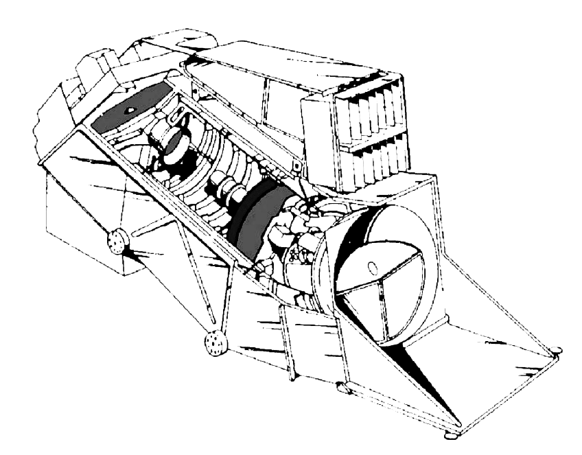
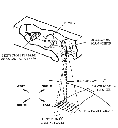
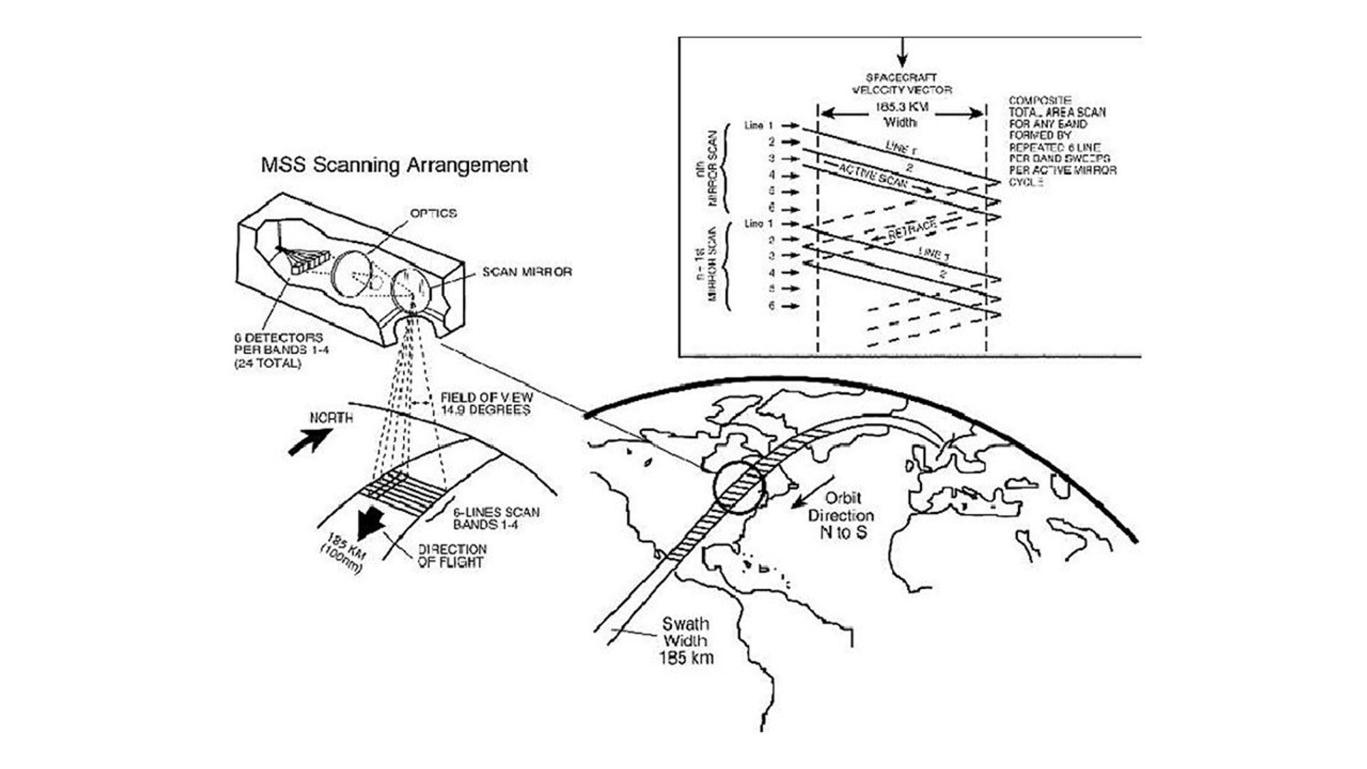
Landsat Diagrams and Technical IllustrationsThis gallery includes Landsat technical illustrations, diagrams, sensor schematics, and orbital visualizations.Line art illustration of the Landsat 8/9 satellite spacecraft.Side-view wireframe illustration of Landsat 9, launched in 2021 as the latest in NASA's Earth observation satellite series. The diagram...Detailed line art diagram of the Landsat 7 satellite showing labeled components including the ETM+ (Enhanced Thematic Mapper Plus) instrument,...Technical line drawing of the Landsat 6 satellite with labeled components including the Enhanced Thematic Mapper (ETM), imaging aperture, cooler...Technical diagram showing the key components of the Landsat 4-5 satellite.Technical line drawing of a the Landsat 4-5 satellite with labeled components including a high gain antenna on a pole...Technical line drawing of the Landsat 1 satellite (originally called ERTS-1) with labeled components including solar paddles, sensory ring, return...Detailed schematic of the Landsat satellite platform showing key subsystems and instruments. The illustration identifies critical components including dual solar...ERTS/Landsat multispectral scanner system data acquisition.Diagram illustrating how ERTS-A (Landsat 1) transmitted data to ground stations on Earth via satellite communication links.Line art illustration of the Thermal Infrared Sensor (TIRS) instrument on Landsat 8/9.Technical diagram showing the internal components of the Multispectral Scanner System (MSS) used on Landsat satellites. The exploded view illustration...Diagram of the four-band MSS, the photomultiplier tubes and silicon photodiodes are tucked in the rear of the sensor.A diagram showing a line scanning multispectral sensor.Point multispectral radiometer methodology (top), and a line scanning multispectral sensor (bottom).This schematic appears in The Landsat Tutorial Workbook: Basics of Satellite Remote Sensing, written by Dr. Nicholas Short and published...Ground track map displaying satellite orbit paths across Earth, with Goldstone and NTTF (NASA Tracking and Telemetry Facility) ground stations...Polar projection of Antarctica highlighting eight significant ice changes (labeled A-H) observed from ERTS satellite imagery during December 1972-February 1973....This schematic appears in the ERTS Reference Manual that was prepared by General Electric prior to the Landsat 1 (ERTS-1)...A typical day of image scheduling by the OCC. The solid lines are scenes recorded to the wideband video tape...Schematic view of coaligned RBVs taking imagery of a target region.Return beam vidicon (RBV) and multispectral scanner system (MSS) data downlinks. All data were recorded to wideband video tape (WBVT);...Artist rendering of the Enhanced Thematic Mapper Plus (ETM+) instrument with cutaway view showing internal optical components and systems. This...Technical line drawing of the Operational Land Imager (OLI) instrument showing its structural framework, optical components, and mounting system.Technical diagram of the Multispectral Scanner System (MSS) scanning instrument showing internal components including filters, an oscillating scan mirror, and...This illustration demonstrates the systematic Earth observation coverage pattern of a polar-orbiting satellite. The diagram shows how consecutive orbital passes...Enlarged view of MSS scanning geometry and image projection.Schematic diagram illustrating the geometry of a sun-synchronous orbit for the morning descending node of Landsat. This schematic appears in...To continually map the Earth’s surface using Landsat data, an entirely new projection had to be created. This new projection...Sun-synchronous polar orbit illustration showing key satellite parameters: 705 km nominal altitude, 98.2° inclination, 98.9-minute orbital period, and 9:45 A.M....Like all of the Landsat satellites, Landsat-6 would have been in a sunscreen orbit had its launch been successful. The...Satellite imaging geometry showing the relationship between orbital path and data collection. The illustration depicts a scanning sensor capturing 16...Multispectral Scanner (MSS) imaging concept showing the relationship between satellite position and ground coverage pattern. The diagram illustrates how the...Landsat TDRSS (Tracking and Data Relay Satellite System) communication architecture showing the three-satellite constellation (TDRS-East, TDRS-West, TDRS-Spare) and their coverage...This schematic diagram depicts the behavior of a perfectly diffuse, or Lambertian, surface. This diagram appears in the The Landsat...Diagram showing satellite imagery grid systems with WRS (Worldwide Reference System) grid boundaries. On the left is a vertical strip...Diagram illustrating the Space Oblique Mercator projection used for satellite imagery. A globe with latitude/longitude grid is shown inside a...This schematic appears in the handbook that accompanied the1983 Landsat Short Course lecture on “TM Data Processing and Correction” that...Landsat satellite viewing geometry diagram illustrating the relationship between satellite position, Earth's WGS84 ellipsoid reference frame, and the ground footprint...Graphic comparing the spectral bands of Landsat 1, 2, 3, and Landsat D along the electromagnetic spectrum.


![This schematic appears in The Landsat Tutorial Workbook: Basics of Satellite Remote Sensing, written by Dr. Nicholas Short and published by the NASA Scientific and Technical Information Branch in 1982. Dr. Short writes, “The Landsat-1 spacecraft was launched on July 23, 1972, and positioned in the orbit shown in [this figure]. Landsat-2 was launched on June 22, 1975, and Landsat-3 was launched on March 5, 1978. “These satellites [had] a nominal altitude of 917 km (570 miles); 99° orbital inclination, which makes them nearly polar; and a sun-synchronous orbit, which means that the orbit plane precesses about the Earth at the same angular rate that the Earth moves about the Sun. This feature enables the spacecraft to cross the Equator at the same local time (about 9:30 to 10:00 a.m.) on the sunlit side of the Earth.”](https://assets.science.nasa.gov/dynamicimage/assets/science/missions/landsat/landsat-1-3-mission-pages/T044623.png?w=600&h=431&fit=clip&crop=faces%2Cfocalpoint)
![This schematic appears in the ERTS Reference Manual that was prepared by General Electric prior to the Landsat 1 (ERTS-1) launch in 1972. The schematic shows the Landsat 1 flight profile, from liftoff (0) to spacecraft separation (10). The manual tells us, “an all-inertial guidance system, consisting of an inertial sensor package and guidance computer, controls the vehicle and sequence of operations from liftoff to spacecraft separation. The flight profile is presented in [this figure] .”](https://assets.science.nasa.gov/dynamicimage/assets/science/missions/landsat/2020/07/launch.jpg?w=1152&h=1152&fit=clip&crop=faces%2Cfocalpoint)


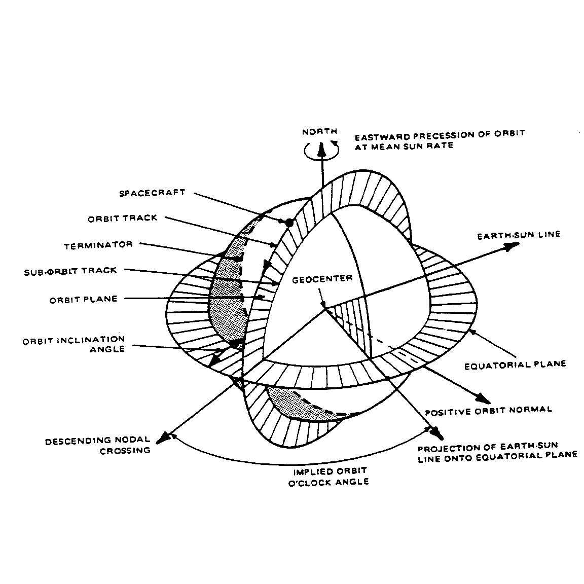
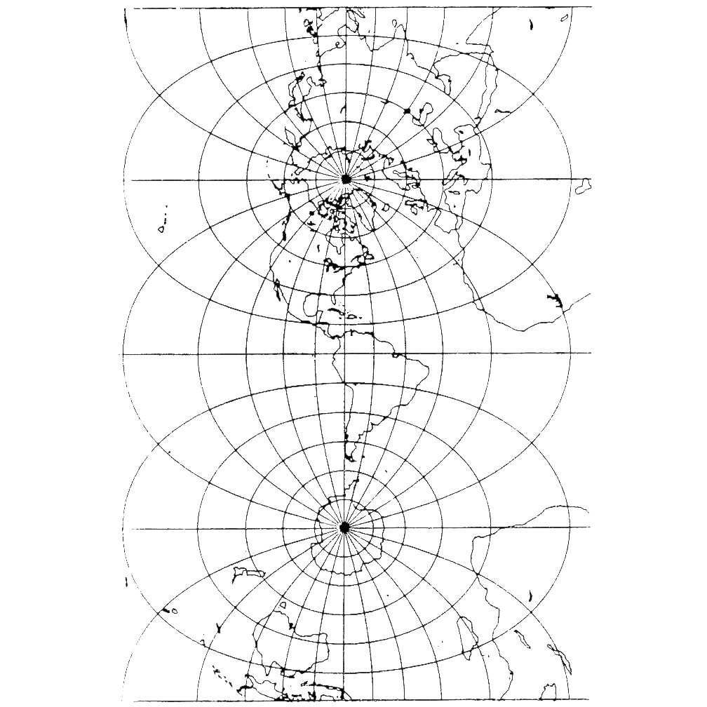
![Like all of the Landsat satellites, Landsat-6 would have been in a sunscreen orbit had its launch been successful. The L6 Handbook tells us, “Establishment of the sun-synchronous orbit provides for minimal variation of solar illuminations at the spacecraft and at the observed Earth scene. This occurs because of the near constancy of the geometry between the orbit plane and the sun vector. By achieving the correct combinations of altitude and orbit inclination, the orbit will precess about the geographic North Pole in the same direction (west to east) and at the same annual rate as the apparent Sun’s motion relative to the Earth. The geometry of the orbit-Earth-Sun relationship by season is shown in [this figure]. This figure also indicates how ground scene illumination is affected by changes in season. Such seasonal variations also have an impact on illumination at the spacecraft.”](https://assets.science.nasa.gov/dynamicimage/assets/science/missions/landsat/landsat-1-3-mission-pages/seasons-1024x1024.png?w=1024&h=1024&fit=clip&crop=faces%2Cfocalpoint)