


![Request for Information – Potential [Placeholder for Prize]](https://assets.science.nasa.gov/dynamicimage/assets/science/psd/solar/2023/09/s/solarsystem_0.jpg?w=1024)


Description
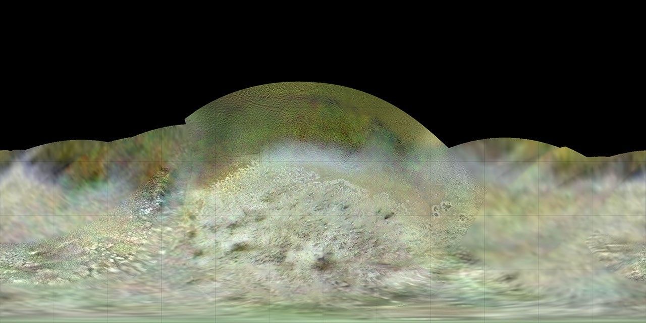
The Voyager 2 spacecraft flew by Triton, a moon of Neptune, in the summer of 1989. Dr. Paul Schenk, a scientist at the Lunar and Planetary Institute in Houston, used Voyager data to construct the best-ever global color map of Triton. This map has a resolution of 1,970 feet (600 meters) per pixel. The colors have been enhanced to bring out contrast but are a close approximation to Triton's natural colors. Voyager's "eyes" saw in colors slightly different from human eyes, and this map was produced using orange, green and blue filter images.
The Voyager mission is managed by NASA's Jet Propulsion Laboratory, in Pasadena, California, for NASA's Science Mission Directorate (SMD) at NASA Headquarters in Washington. Caltech manages JPL for NASA.


