


Description
Map Projected Browse Image
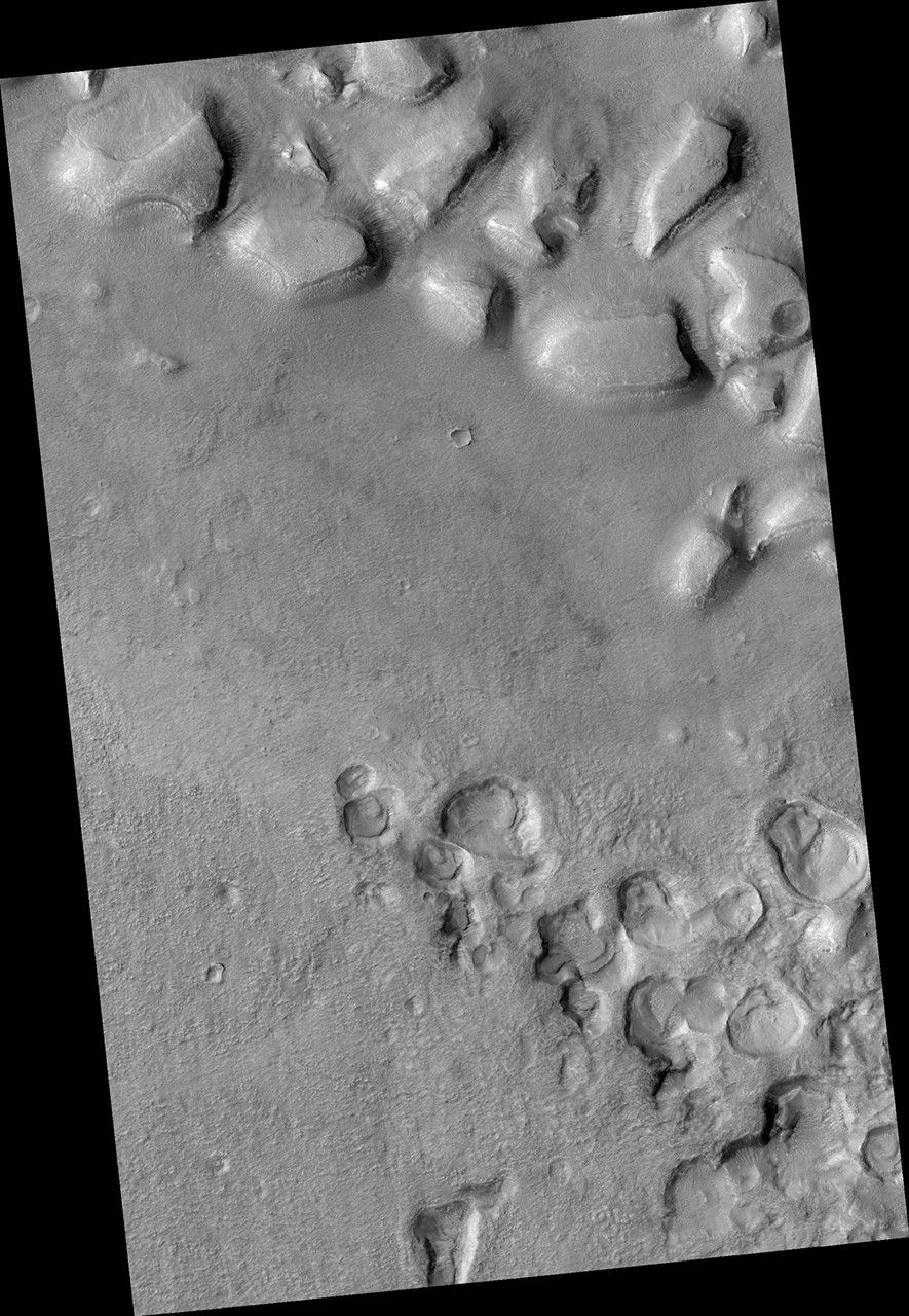
Click on the image for larger version
What's up and what's down? This image covers mesas, or high-standing plateaus, to the north and pits, or low-standing, depressions to the south. If it looks the other way around, then you are not seeing the topography correctly.
Remember that the Sun is coming from the left (west) at MRO's imaging time of about 3 p.m. What formed these mesas and pits is a question that is not so easy to answer.
The University of Arizona, Tucson, operates HiRISE, which was built by Ball Aerospace & Technologies Corp., Boulder, Colo. NASA's Jet Propulsion Laboratory, a division of the California Institute of Technology in Pasadena, manages the Mars Reconnaissance Orbiter Project for NASA's Science Mission Directorate, Washington.


