


Today was a Friday so we put together a three day plan to cover the weekend activities, or in Mars-speak, sols 1688 - 1690. We've been getting some really interesting data down from our investigation of a large sand drift (megaripple), so we packed in many more observations to assess the full variability of the sandy materials before driving away and continuing our climb up Mt. Sharp.
Over the weekend, we are planning to take APXS and MAHLI observations that focus on the materials inside the area of sand that was scuffed by the wheel ("Little Notch"), and also some bright undisturbed materials ("Cold Ledge"). We will also take MAHLI only observations of different undisturbed portions of the megaripple at "Schoolhouse Ledge" and "Man of War Brook". In addition to contact science, we will take many Mastcam images, including a full 360-degree mosaic, a mosaic of our future drive target ("Buttermilk Brook"), a multispectral observation of some vein targets ("Eddie Brook"), and images of a handful of interesting nearby rocks ("Little Harbor Brook", "Bubble Brook", and "Marshall Brook.") We're rounding out remote sensing observations in the plan with ChemCam observations of "Stanley Brook", "Chasm Brook", and "Denning Brook", and a post-drive automated ChemCam AEGIS activity. The environmental theme group also included a dust devil survey, measurements of dust in the atmosphere, and horizon movies.
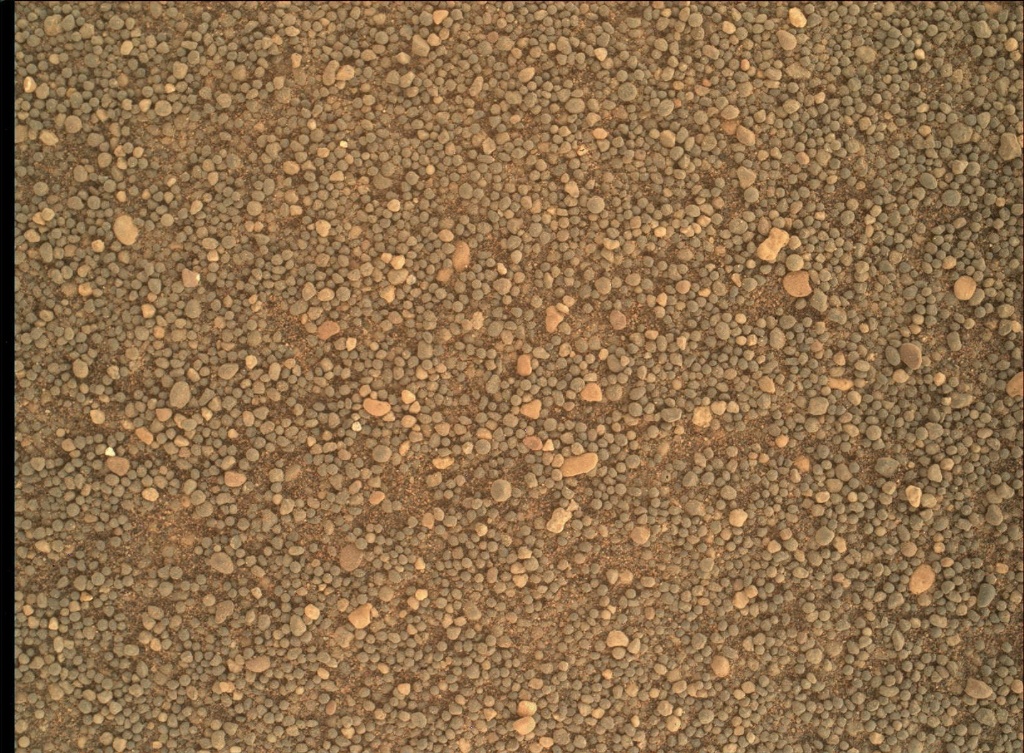
<!-- wp:image {"background": {"contentType": "image", "id": 357154, "url": "https://science.nasa.gov/wp-content/uploads/2024/03/1687MH0007000010603742E01_DXXX-br2.jpg", "alt": "", "caption": "NASA's Mars rover Curiosity acquired this image using its Mars Hand Lens Imager (MAHLI), located on the turret at the end of the rover's robotic arm, on May 5, 2017, Sol 1687 of the Mars Science Laboratory Mission, at 12:52:15 UTC.", "credits": "NASA/JPL-Caltech/MSSS", "zoom": 0, "fit": "fit", "parallax": "no", "focalPoint": {"x": ".50", "y": ".50"}}, "image_align": "inline", "migrated": true} -->
For tactical planning today, I was again staffed as a Surface Properties Scientist (SPS), so I worked closely with the rover planners (RPs) to help plan the drive to an interesting location ~20 meters away. We can see in the Mastcam images that there are some rocks that have colors and textures different from the typical outcrops we've been seeing during the majority of our ascent, so the science team is eager to drive over and check out this area up close. I look forward to seeing our new location Monday morning when the data come down.
MAHLI Image of sand: https://mars.nasa.gov/msl/multimedia/raw/?rawid=1687MH0007000010603742E01_DXXX&s=1687
Mastcam image of sand scuff: https://mars.nasa.gov/msl/multimedia/raw/?rawid=1686ML0087720020700897E01_DXXX&s=1686
Written by Abigail Fraeman, Planetary Geologist at NASA's Jet Propulsion Laboratory