We’re continuing to make steady progress, with successful
drives interspersed with plenty of good science. In the Sol 1516 plan, we
started off with a Mastcam mosaic of "West Mesa" to study the stratigraphy,
followed by a big 5x5 point ChemCam analysis on the nodular target "Ship
Island" which brings ChemCam to more than 400,000 laser shots! ChemCam also
analyzed the target "Stave Island" and Mastcam documented both targets as well
as the auto-targeted location from Sol 1514. Mastcam rounded out the science
block with a small mosaic of some interesting dark rocks. After that, Curiosity
drove, and ChemCam did another auto-targeted observation. Sol 1517 was pretty
simple, with a Mastcam image of the rover deck, Navcam atmospheric monitoring,
and a twilight MARDI image.
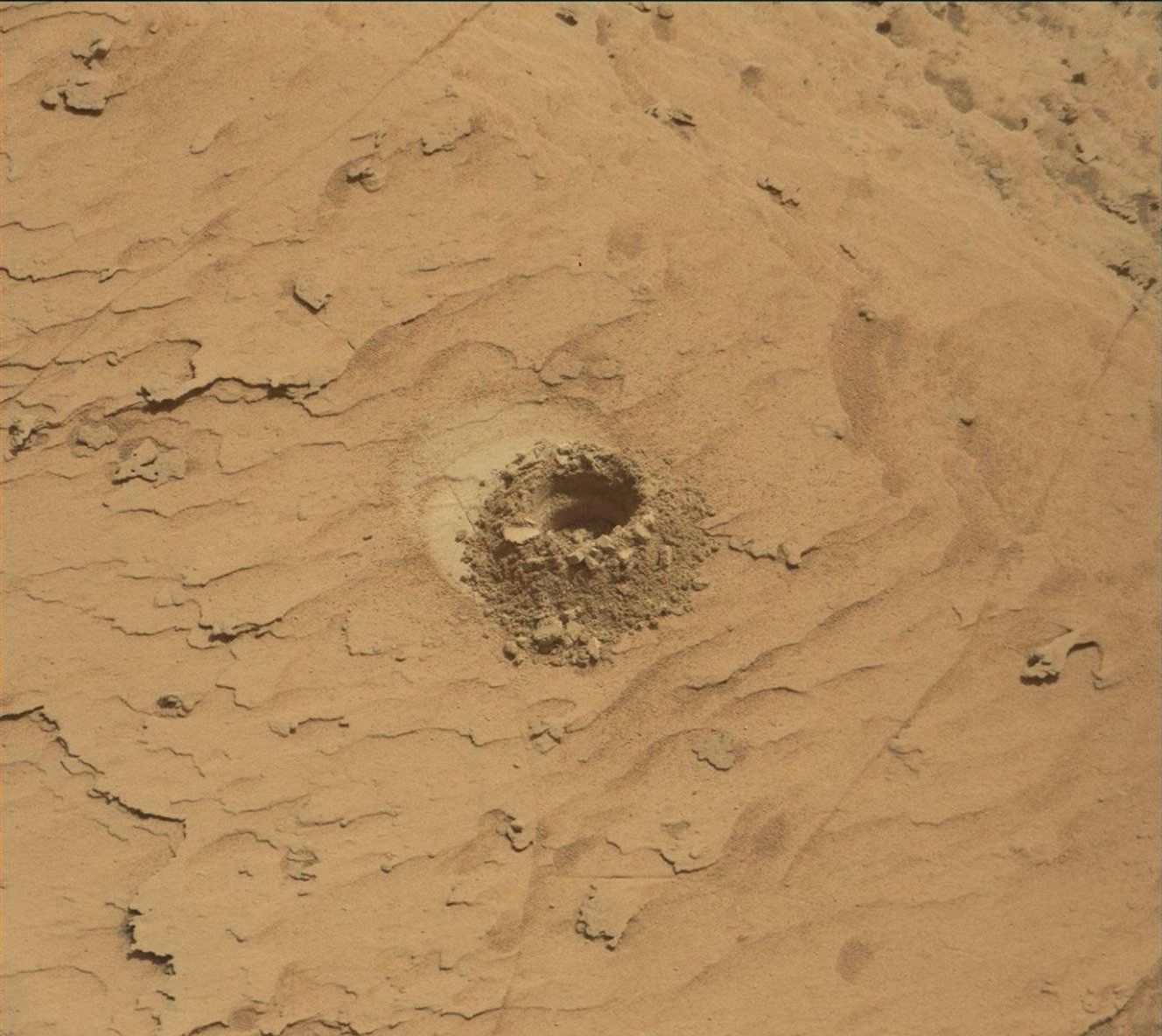
The Sol 1516 drive brought us to a sandy location, so the
Sol 1518 plan takes advantage of that location to study the sand. The plan
starts out with Mastcam observations to monitor the amount of dust in the
atmosphere, followed by ChemCam observations of "Folly Island", "Burnt
Porcupine", "Hadley Point", and "Old Whale Ledge". Mastcam will document all of
those targets, plus the AEGIS target from Sol 1516. Mastcam also has an
observation to extend the mosaic of the workspace. With the remote sensing
done, MAHLI will image "Folly Island" and the sandy targets "Sheep Porcupine"
and "Bald Porcupine". APXS will also measure Sheep Porcupine and Bald
Porcupine. Late in the day, Mastcam will repeat the observations of atmospheric
dust.
On Sol 1519, we have a short drive with the usual post-drive
imaging, and ChemCam will do another automated observation. Sol 1520 is an
untargeted Sol, so we are focusing on imaging distant targets. Mastcam has a
mosaic of the upcoming "Hematite Ridge", ChemCam has a long-distance RMI of Mt.
Sharp, and NavCam will look to the northern horizon to measure the dust in the
atmosphere. by Ryan Anderson -Ryan is a planetary scientist at the USGS Astrogeology Science Center and a member of the ChemCam team on MSL. Dates of planned rover activities described in these reports are subject to change due to a variety of factors related to the martian environment, communication relays and rover status
Written by Ryan Anderson, Planetary Geologist at USGS Astrogeology Science Center