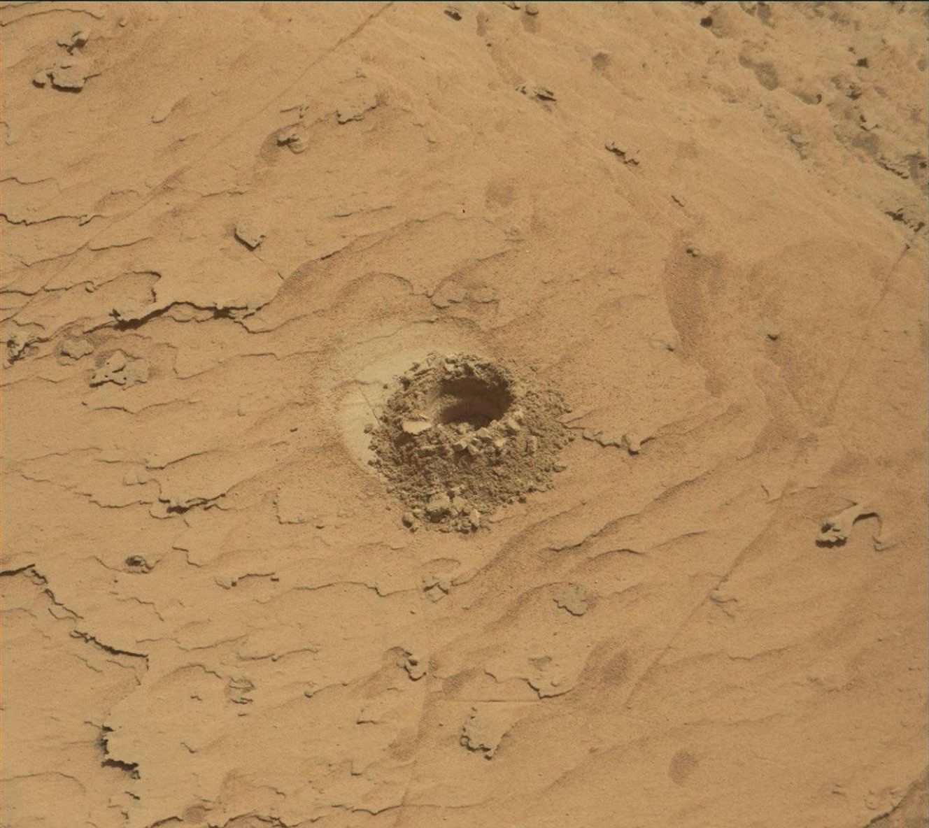
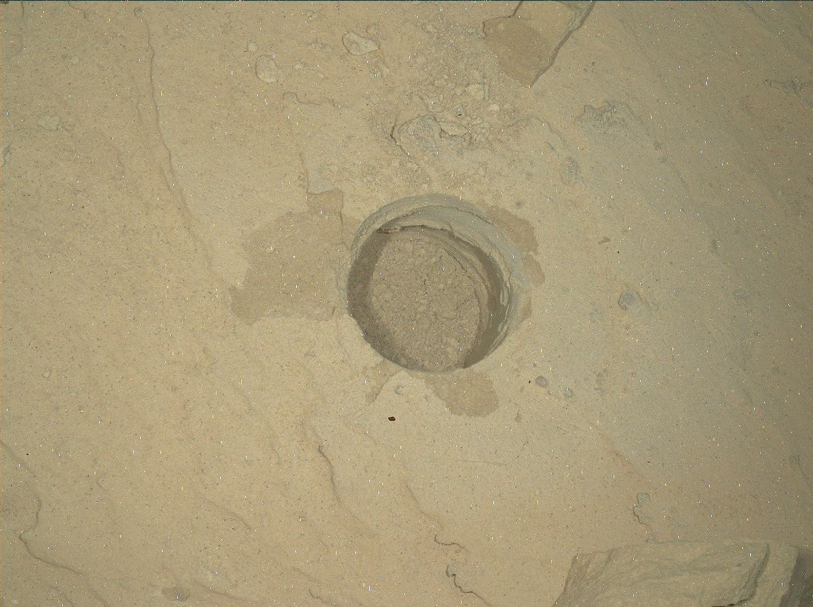
Our discussions during the start of planning this morning centred around: 1) Where to drive in order to maximize the view out of the front window to make planning the next drive easier, as well as trying to place Curiosity in a position where we will be able to image an interesting feature that from orbit, appears as though it may be a landslide that originated from the edge of the pediment cliff to the north; and 2) Which of the features in our immediate workspace to analyze with ChemCam? Bedrock, diagenetic features, pebbles or veins? The rover planner engineers managed to plan a drive that satisfied both mobility goals, and after much deliberation, the science team decided to use ChemCam to investigate the chemistry of the bedrock and a pebble in the workspace, all in one observation (“Outer_Golden_Pot”). The LIBS raster will transition from bedrock onto a dark grey pebble.
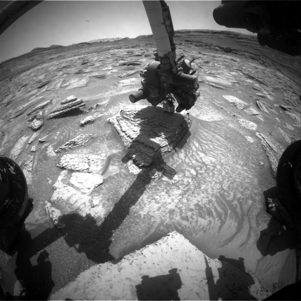
I had noticed some blocks with interesting dark-coloured coatings in our drive direction imaging last Friday, and once such block ended up just off to the right of the rover today. Although we will not get chemistry on this block (“Dunkeld”), Mastcam will image the block, and lighter-coloured veins and fractured rock around it to get a higher-resolution look. Mastcam will also capture the ChemCam target in more detail, as well as mosaics of the possible landslide feature (“Munlochy”), the pediment cliff off to the right (north) of the rover, and a 15 x 8 frame, 360° mosaic.
The environmental science group planned a suite of activities including three large Navcam dust devil surveys, a Navcam dust devil movie, and Navcam deck monitoring. The standard REMS, DAN passive and RAD activities are also included. A SAM Electrical Baseline Test (EBT) designed to monitor SAM’s electrical functions will execute during the overnight of the first sol of this plan.
As the APXS Payload Uplink/Downlink Lead today, it was a quiet planning day for me, with no contact science. However, I did analyze the data downlinked from our weekend observations looking at the typical bedrock chemistry (“Heather Island”) and helped identify the “Dunkeld” target. It is always a thrill to see the new view after a drive, and today did not disappoint.
Written by Lucy Thompson, Planetary Geologist at University of New Brunswick