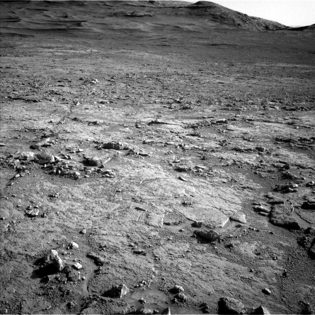
Today in tactical planning I was staffed as Surface Properties Scientist, which means I get to put my geology field experience hat on and work with the rover drivers to assess the terrain we’ll cross in our upcoming drive.
Today in tactical planning I was staffed as Surface Properties Scientist, which means I get to put my geology field experience hat on and work with the rover drivers to assess the terrain we’ll cross in our upcoming drive. We’ll crest onto a plateau in today’s drive, but before we do, we have to finish climbing a small but steep slope. The topography today actually reminds me a little bit of our ascent onto Vera Rubin ridge several years ago, were we similarly crested a steep slope onto a local flat expanse.
Curiosity starts the plan parked at an impressive 17˚ pitch (front up) and 17˚ roll (left up) for a total 24˚ tilt. You can get a bit of a sense of the rover’s non-horizontal position by looking at its orientation with respect to the ground in the above Navcam mosaic. Even though this slope is getting close to the limit of what Curiosity can traverse, we don’t think we’ll have any problems unstowing the arm or driving the rest of the way to the top because of the terrain we’re on – nice smooth bedrock with only a thin sand cover is almost the Martian equivalent of a paved road.
Outside of the drive, Curiosity will continue documenting the geology and environment around us. In today’s plan, we will collect ChemCam LIBS observations of a vein target named “Lago Esmeralda” and bedrock target named “Lago de Rei,” as well as some long distance RMI mosaics of a part of the “Bolivar” mound. We’ll also grab some more Mastcam images of Bolivar, as well as several significant outcrops around the rover. MAHLI and APXS will also participate in the science action, with observations of a DRTed bedrock target named “Parepona” and vein target named “Cabadiscana,” and we’ll also be using MAHLI to image our wheels at the start of today’s drive. Finally, several Mastcam and Navcam observations designed to monitor our environment will round out the plan.
Written by Abigail Fraeman, Planetary Geologist at NASA's Jet Propulsion Laboratory




.jpg?w=1024)
