Odds & Ends: Gulf Oil Spill
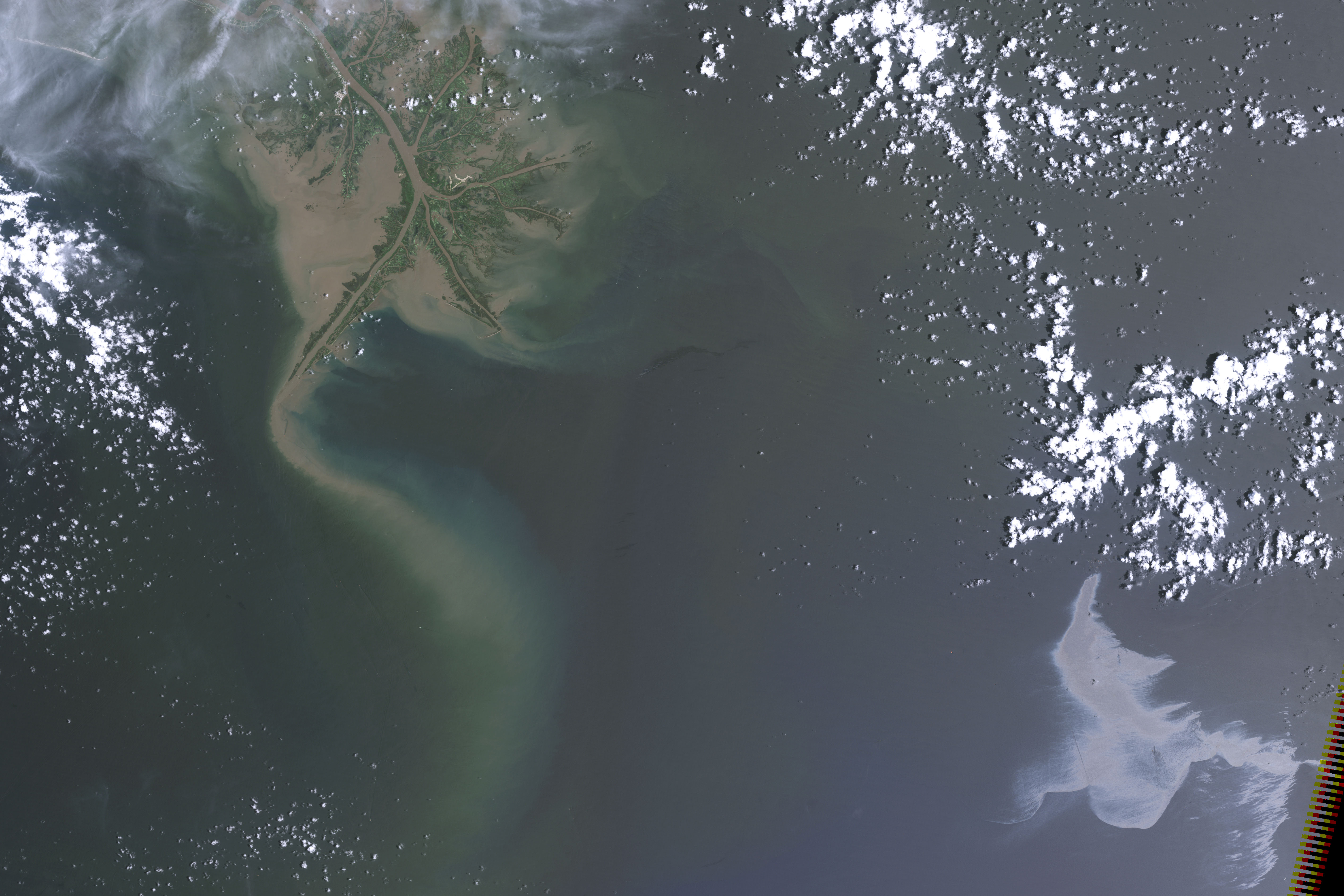
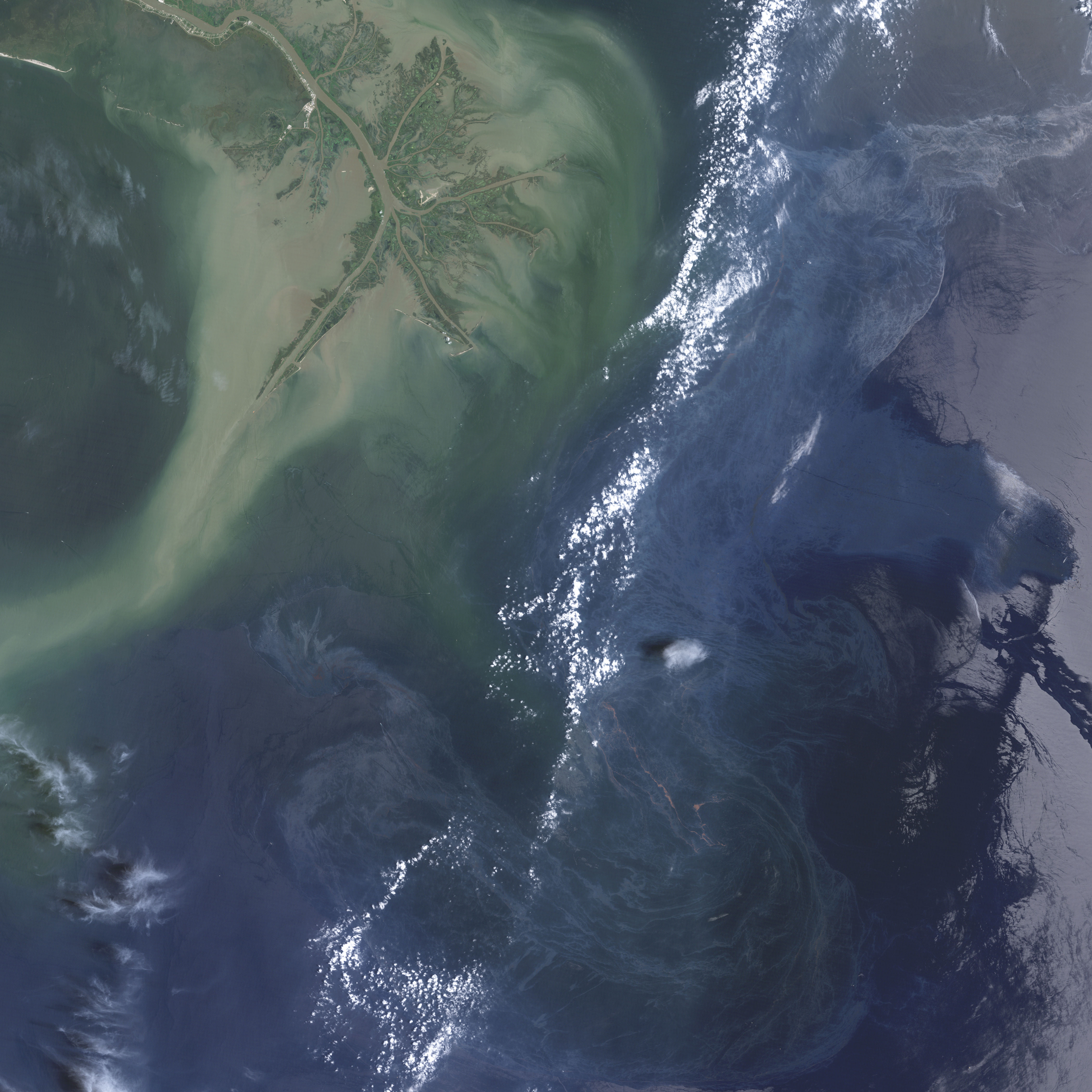
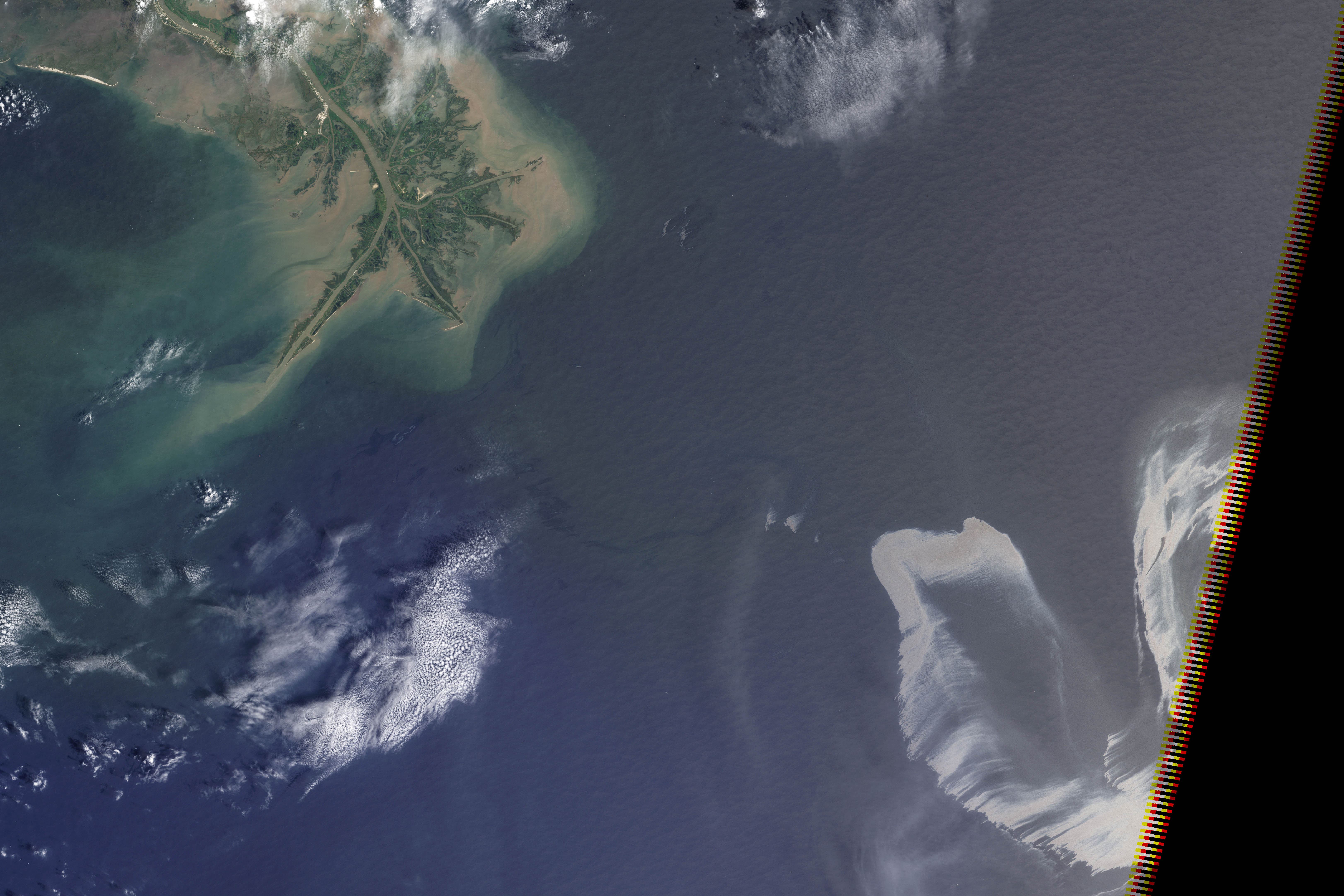
We sort through a lot of imagery at the Earth Observatory, and not all of it makes it onto the site. A picture might be cloudy, we might not be able to tell a good story about it, it’s not quite relevant, the quality might not be good enough, or—as in this case—we might find something after it’s no longer newsworthy. These three satellite images show oil slicks on the Gulf of Mexico after the Deepwater Horizon drilling rig explosion. All are from Landsat-5 in May and July. I found them earlier this month while looking for image ideas. (Click for large images.)