


Keeping track of changing landscapes
When you look at a parcel of Earth’s surface at a moment in time, it can be hard to grasp the story behind the image. It’s a snapshot, a fleeting glimpse. Does it always look like that? Am I seeing this place on a normal day, an abnormal day, an everyday? Where’s the motion, the action, the dynamics?
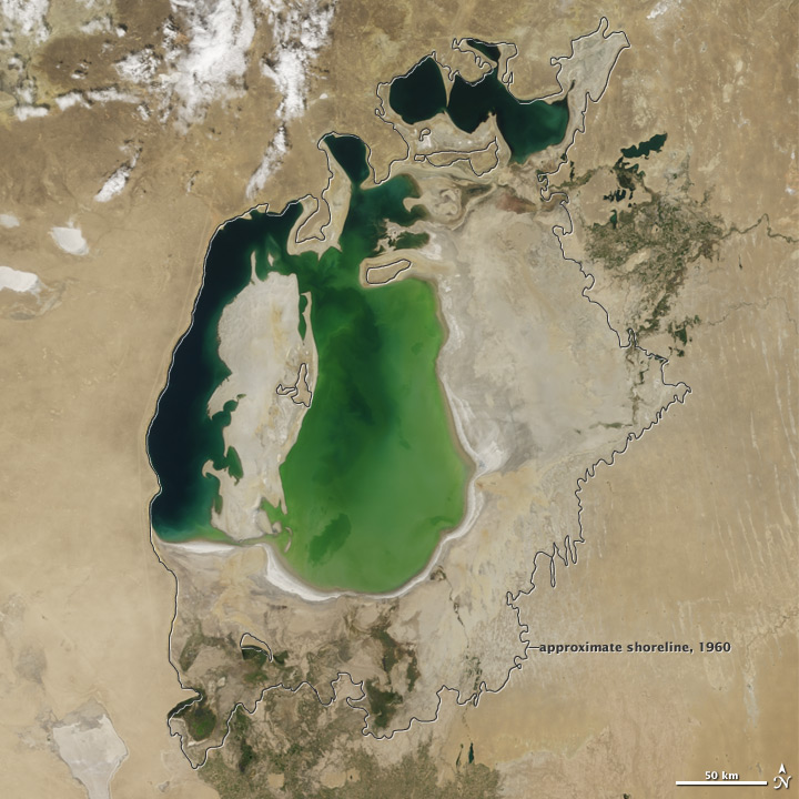
For instance, take a look at this collection of lakes amidst the barren, salt-crusted landscape of central Asia.
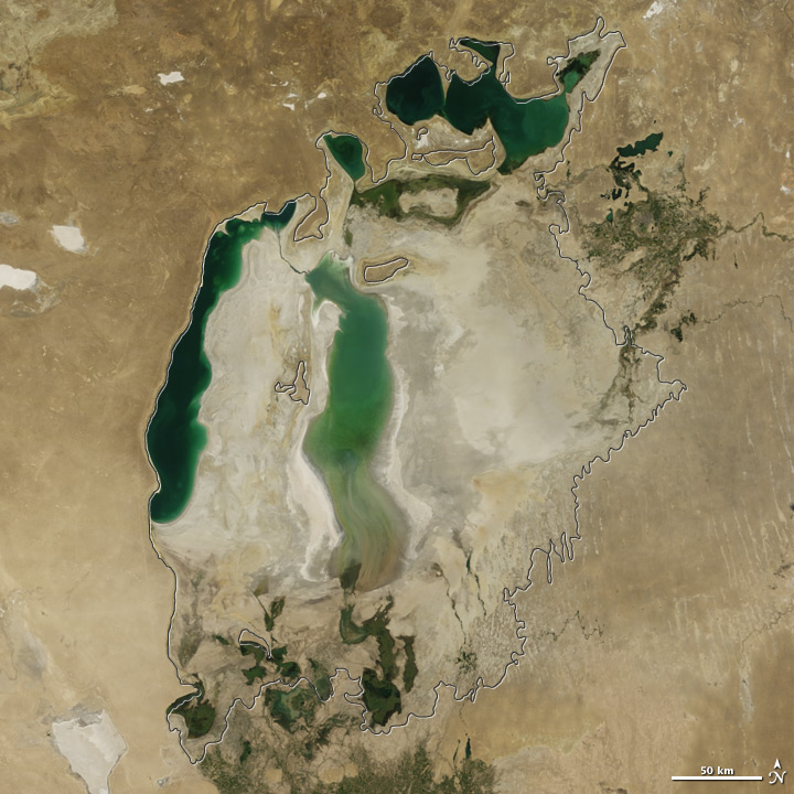
The size of these freshwater lakes is compelling…tens to hundreds of kilometers long…oases of green and blue amidst the tans of the desert. These “inland seas” are impressive. That is, until you look at that same region a decade earlier (below)…or forty years earlier.
Through the lens of time, the planet comes to life. The color of the landscape changes, waters rise and fall, ice advances and retreats. The planet has vital signs. Earth Observatory’s World of Change series offers some visual vital signs for 23 different landscapes and locales on Earth, with images updated across seasons to decades, depending on the length of the satellite record.
Our newest updates include 2012 images for the Aral Sea (sampled above) and for the Hobet Mine, a mountaintop coal-mining operation in West Virginia.
What do you think we should show in future installments of World of Change? (Keep in mind that it has to be something we can see or measure via satellite.)