Egypt’s Greening Desert
In early March 2017, we featured the top image as our monthly satellite puzzler and as an Image of the Day. But sometimes we learn even more about an image after we publish, as people write to us with a local or personal connection to the place. That was the case here.
Local knowledge is especially important when it comes to agriculture. Ragab Hafiez, a hydrogeologist and geologist working for DASCO, studies Egypt’s Western Desert. He gave us permission to re-publish some of his photographs showing the ground-based view of East Owinat, one of Egypt’s land reclamation projects aimed at making some desert areas suitable for agriculture. He also took the time to answer some questions about the satellite image that inspired the puzzler.
Q: What features visible in these images strike you as interesting?
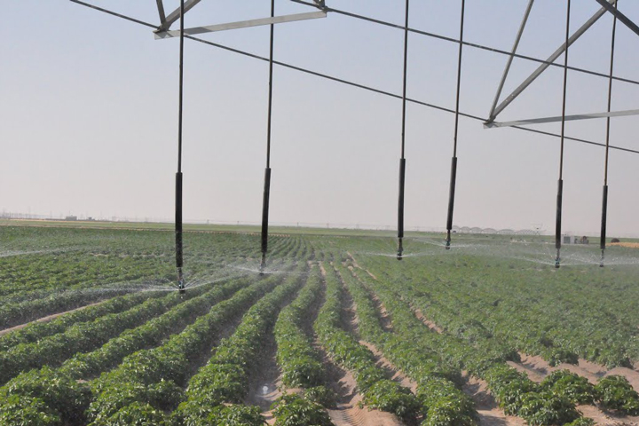
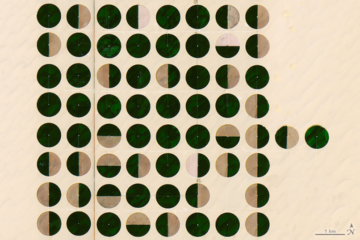
A: The features visible in these images are the irrigated crops mainly clustered in a center-pivot irrigation systems; the diameter of the pivots range from 700 to 820 meters. The total irrigated area at the beginning of this year was about 79,000 hectares.
Q: Is there anything not visible that is worth noting?
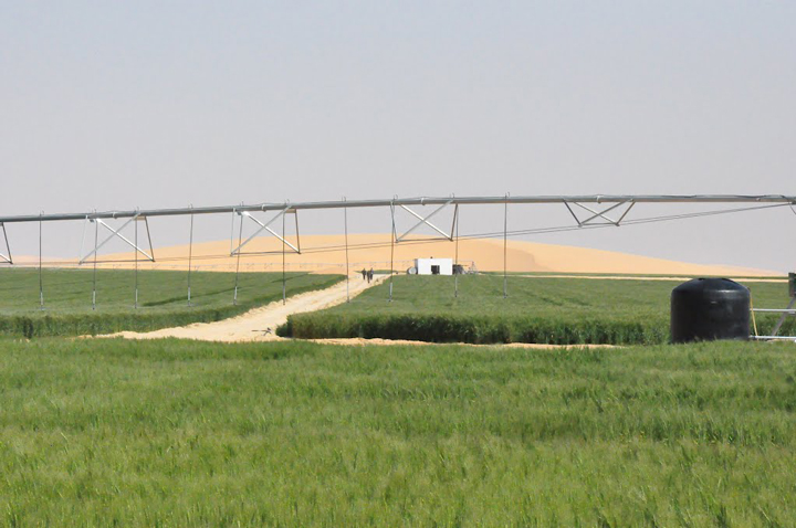
A: East Owinat is an interesting area located at the far south of Egypt. It’s an arid to hyper-arid area, the rainfall is nil, and fossil groundwater is the only source of water in the area.
The area is covered with a thin sheet of loose sand, followed by the thick sandstone rock bed. The sandstone beds belong to the Nubian sandstone formation deposited through the Lower Cretaceous and Jurassic periods.
The water wells in the area are usually drilled to depths of 200 to 350 meters (650 to 1150 feet) below the ground surface. The water level ranged from 30 to 60 meters (100 to 200 feet) below ground.
Q: Do you happen to know what crops are planted here, and the reason for the various green/brown patters?
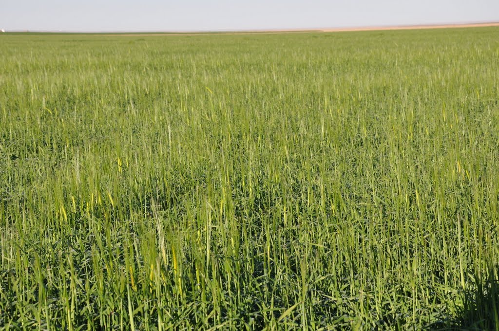
A: The crops cultivated in the winter season are wheat, barley, potatoes, and alfalfa. Virgin soil, fresh water (salinity less than 700 parts per million), mild weather, and long daily sunlight hours are all factors that combine to produce high-quality and prolific crops.
The green areas are currently cultivated, while the brown areas are left without cultivation this season.