


Data from NASA’s ICESat-2 Goes Beyond the Surface
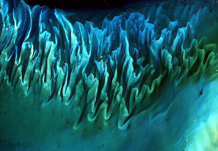
Researchers have developed a new way to measure near-shore bathymetry using satellite observations alone. Soon after NASA’s ICESat-2 satellite launched into orbit in 2018 on a mission to measure the heights of Earth’s ice, forests, and land cover, scientists examined the data and found something unexpected. As the laser instrument aboard the Ice, Cloud, land, Elevation Satellite 2 sent light pulses into certain coastal waters, the light reached beyond the surface, reflecting off the seafloor and lakebeds below.
These profiles of the underwater topography, or bathymetry, provide insights into hard-to-access areas. Shallow waters can contain crucial habitat as well as pose navigational challenges. Now, university scientists working with the ICESat-2 mission have developed a data product that allows researchers, hazard mappers, and others interested in coastal regions to easily find and use these bathymetric measurements.
To generate this data product, called ATL24, the team developed algorithms and used machine learning to identify the water surface as well as the coastal seafloor below.
If the waters are too rough, or too murky, the green laser light from the satellite’s instrument cannot penetrate the surface. But when the right conditions align, ICESat-2 can measure the seafloor down as far as 130 feet (40 meters) beneath the waves.
~Kate Ramsayer