Suggested Searches

ICESat-2 (Ice, Cloud, and Land Elevation Satellite 2)

Viewing Posts from March 2025

View All Posts

    ICESat-2’s Laser Fires 2 Trillionth Shot, Spots Clouds

    A data visualization with a bright blue background and dots, representing height measurements taken by ICESat-2. A vertical green line marks the satellite's 2 trillionth laser pulse. An inset map of Antarctica shows a green line from the interior of the continent, through a spot labeled Vanderford Glacier, and out into the southern ocean, locating data shown on the larger plot.

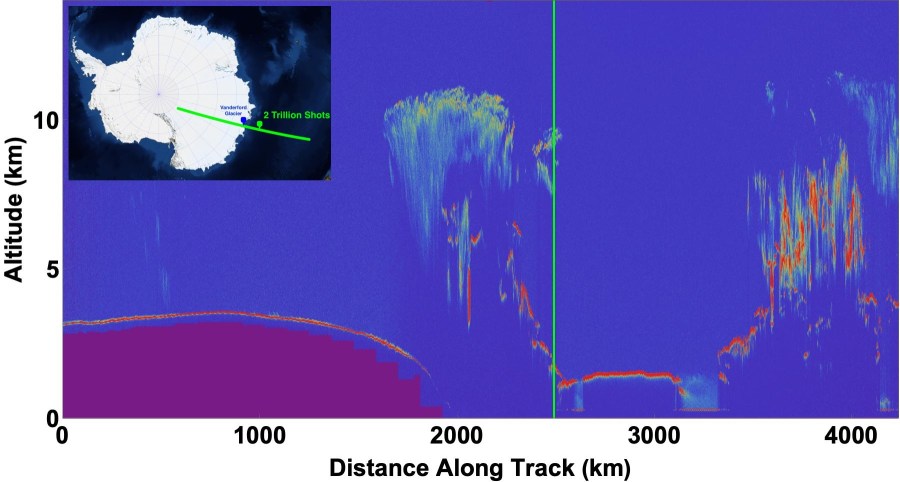
    Happy 2,000,000,000,000th, ICESat-2! NASA’s Earth-observing laser in orbit passed a milestone on March 9 at 12:51 p.m. EDT — 16:51:00.268 UTC, to be precise — as its laser instrument fired for the 2 trillionth time and measured clouds off the coast of East Antarctica. ICESat-2’s instrument, the Advanced Topographic Laser Altimeter System (ATLAS), uses rapid …

    Read Full Post