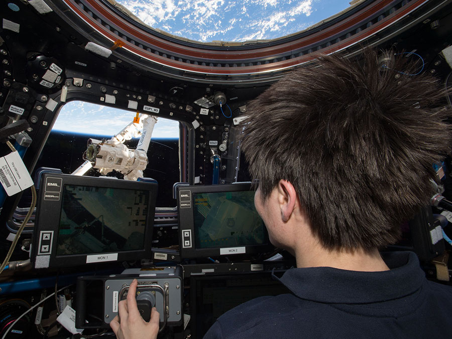
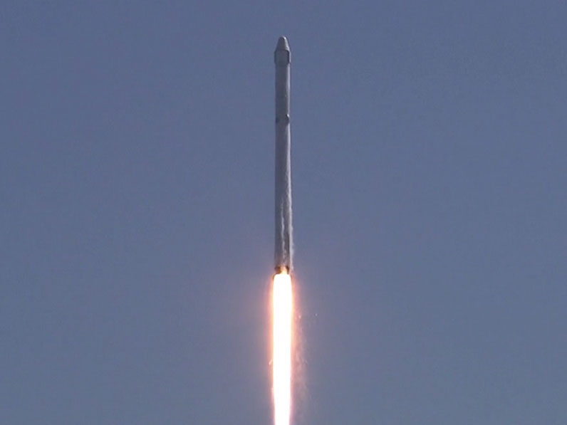
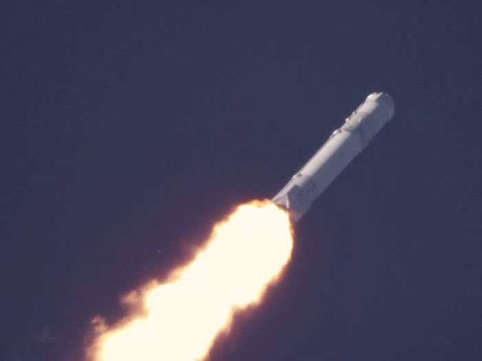
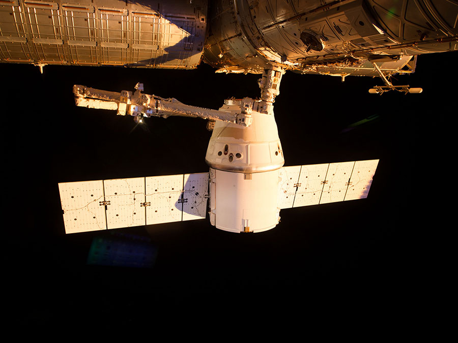
Suggested Searches

Blogs

    Moonlit Clouds Obscure Indian Blackout

    Earlier this week, as India endured the worst blackout in its history, many readers and members of the media asked us to show the vast country without lights. Just a few weeks ago, Earth Observatory showed the world what the Mid-Atlantic United States looked like before and after a massive storm-induced blackout. (We also showed […]

    Read Full Post

    Siberia 2012: The Thirsty Kochechum

    Kochechum River   64°42’31’’M      100° 54’ 14’’ E 10:19 p.m.  Siberia   10:19 a.m. EDT 79°F   High    48°F Low      Sunny Dr. Ranson reports: We have finally just landed on a camping spot, after a long day on the Kochechum. We spent about hours on the river today.   Last night’s camp was about 100 miles upriver – a […]

    Read Full Post

    Siberia 2012: After the Fire

    Embenchime River    65°16’35’’N    101°9’21’’E 11:00 p.m.  Siberia      11:00 a.m. EDT 78° F  High    49°F  Low       Sunny Dr. Ranson reports: We hopped out of our tents early this morning, broke camp, grabbed a quick breakfast and headed into the forest to make our measurements.  We were in the woods by 8:30 this morning, and didn’t return […]

    Read Full Post

    Twelve Years of Fires

    Besides acquiring photo-like images of the surface of Earth, the Moderate Resolution Imaging Spectroradiometer (MODIS) on NASA’s Terra and Aqua satellites can detect the anomalously high temperatures associated with actively burning fires. Using this “hotspot” data, John Nelson of IDV Solutions made a map of major fires in the contiguous 48 United States from 2001 […]

    Read Full Post

    Siberia 2012: Smoke and Rising Waters

    Embenchime River    66.34 N   100.63 E   11:30 p.m. Siberia, 11:30 a.m. EDT 78°F High   52°F Low      Partially cloudy Dr. Ranson reports: I am tired tonight.  Actually, I think everyone is tired, because it was a very long and intense day. The day started early.  Really early.  As in, today’s work started late last night. As […]

    Read Full Post

    Tall Crops

    Sab Kim Jet Propulsion Laboratory Updates on the vegetation conditions are provided here, monitored by the crop structure team. There were localized thunderstorms on July 15th, which gave 8 mm rainfall according to the local weather data. I happened to be in the field(!) and believe the campaign fields received much more. Some fields outside […]

    Read Full Post

    Siberia 2012: Laundry Day

    Embenchime River    66.57 N  99.28 E 79°F High  45°F Low 10:15 p.m. Siberia   10:15 a.m. EDT Dr. Ranson reports: Tonight, I’m calling in from my tent.  I’m not going to bed – I’ve turned it into an office, because it makes it easier to work on the computer and the data terminal if I’m shaded […]

    Read Full Post

    Siberia 2012: Reading the Signs

    Embenchime River 9:35 p.m. Siberia  9:35 a.m. EST 74°F High  46°F  Low           Sunny Dr. Ranson reports: Today we chugged down the river.  We’re heading towards the junction of the Embenchime and the Kochechum Rivers.  Just before we get there, we have a series of plots we really want to measure. That confluence is still a […]

    Read Full Post

    Answer to July Puzzler: Dudinka, USSR

    Congratulations to Yiannis Raftopoulos for being the first to correctly identify that our second satellite puzzler was a view of Dudinka, a port city along the Yenisei River in northern Siberia. Raftopoulos submitted his answer just 15 hours and 51 minutes after we posted the image—not quite as fast as Alexandre Manthieu was at solving our […]

    Read Full Post

    Siberia 2012: We are all Connected

    Embenchime River 9:30 p.m. Siberia,  9:30 a.m. EDT 65°F High   54°F low       Rain Dr.  Ranson reports: We’re at the end of another long journey on the Embenchime.  We’ve covered 38 kilometers in a straight line – with the twists and turns, of the river, multiply that by about 1 ½ – so it’s more like […]

    Read Full Post