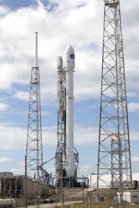
Suggested Searches

Blogs

    Our Traveling Roadshow

    May 16, 2011 Each day we traveled to a new site in the area around Swiss Camp and set up a new GPS station on the ice sheet. We looked a bit like an Arctic version of the Beverly Hillbillies with Tom puttering the snowmobile out of camp pulling a big red sled piled up […]

    Read Full Post

    What Is ROGUE and What Has It Done For Me Lately?

    May 16, 2011 On the way up to Greenland a few weeks ago, we discussed very briefly the science that has brought us here to Greenland this spring. Now that we have some pictures of our work, let’s discuss it in a bit more detail.  As you already know, Matt and I were traveling about […]

    Read Full Post

    Pieces of Comet Halley Strike the Moon!

    Three meteoroids were seen hitting the moon last week — all of them possible pieces of Comet Halley! The Eta Aquariid — the meteor shower caused from Comet Halley, see post below — radiant was positioned so that almost the entire visible part of the moon was exposed to it. On the evenings of May 9-11, members of …

    Read Full Post

    Second Time’s the Charm

    May 15, 2011 With a 50-50 chance of good weather, Matt and I headed out to Swiss Camp on Wednesday, May 4. We were lucky to get a break in the clouds and the wind that allowed the plane to land and drop us off safely with Koni and company. The weather continued to deteriorate over the […]

    Read Full Post

    Odds and Ends: Morgan City, Louisiana, 1973

    While poking around looking for imagery of the 1973 flooding on the Mississippi, I discovered some fascinating, very high resolution aerial photography. Images of Morgan City—a community near the mouth of the Atchafalaya River that was damaged by flooding in 1973, and will likely be hit by rising water in the next few weeks. Both […]

    Read Full Post

    Map of the Ancient Mississippi

    Historic flooding along the Mississippi River gives me an excuse to show another of my favorite maps, from Geological Investigation of the Alluvial Valley of the Lower Mississippi River. Each color represents an old channel, dating back 1,000 years or so. Those that correspond to historical records are dated, while older channels are ordered according […]

    Read Full Post

    One of my Favorite Maps: the 1906 San Francisco Earthquake

    Since I was (slightly) critical of the New York Times graphics department yesterday, I’ll show a Times map that is one of my favorite visualizations today: a map of shaking intensity and slip during the 1906 San Francisco Earthquake. Aside from being elegant, it’s data-rich without being cluttered, and multivariate. It shows shaking intensity (in […]

    Read Full Post

    A Hierarchy of Perception

    Last week, Jessica Ball of the American Geophysical Union’s Magma Cum Laude blog pointed out this map of natural hazards in the U.S., published by the New York Times: The map has many of the design virtues common in graphics from the Times (clean, focused on the data, clearly labeled, small multiples), but when I […]

    Read Full Post

    2011 ISRSE Wrap-up

    I recently had the opportunity to attend & give a presentation at the 2011 International Symposium on Remote Sensing of the Environment in lovely Sydney, Australia. (OK, not so recently—the conference ended on the April 15th. I blame jetlag.) Just over 60 people turned up for the talk, which was mostly about our visualization of […]

    Read Full Post

    It’s Raining Comet Halley!

    We at the Meteoroid Environment Office are hoping that you have clear skies on May 5/6 when we have the opportunity to see pieces of Comet Halley whiz through Earth’s atmosphere!Image of an Eta Aquarid meteor, taken the night of May 3, 2011. (NASA/MSFC)Comet Halley (NASA)Depending on your age, you may remember 25 years ago …

    Read Full Post