From the Archives: NASA’s Goddard Instrument Field Team at Long Valley Caldera
Editor’s note: This blog entry is adapted from NASA social media content originally published September 12-15, 2023.
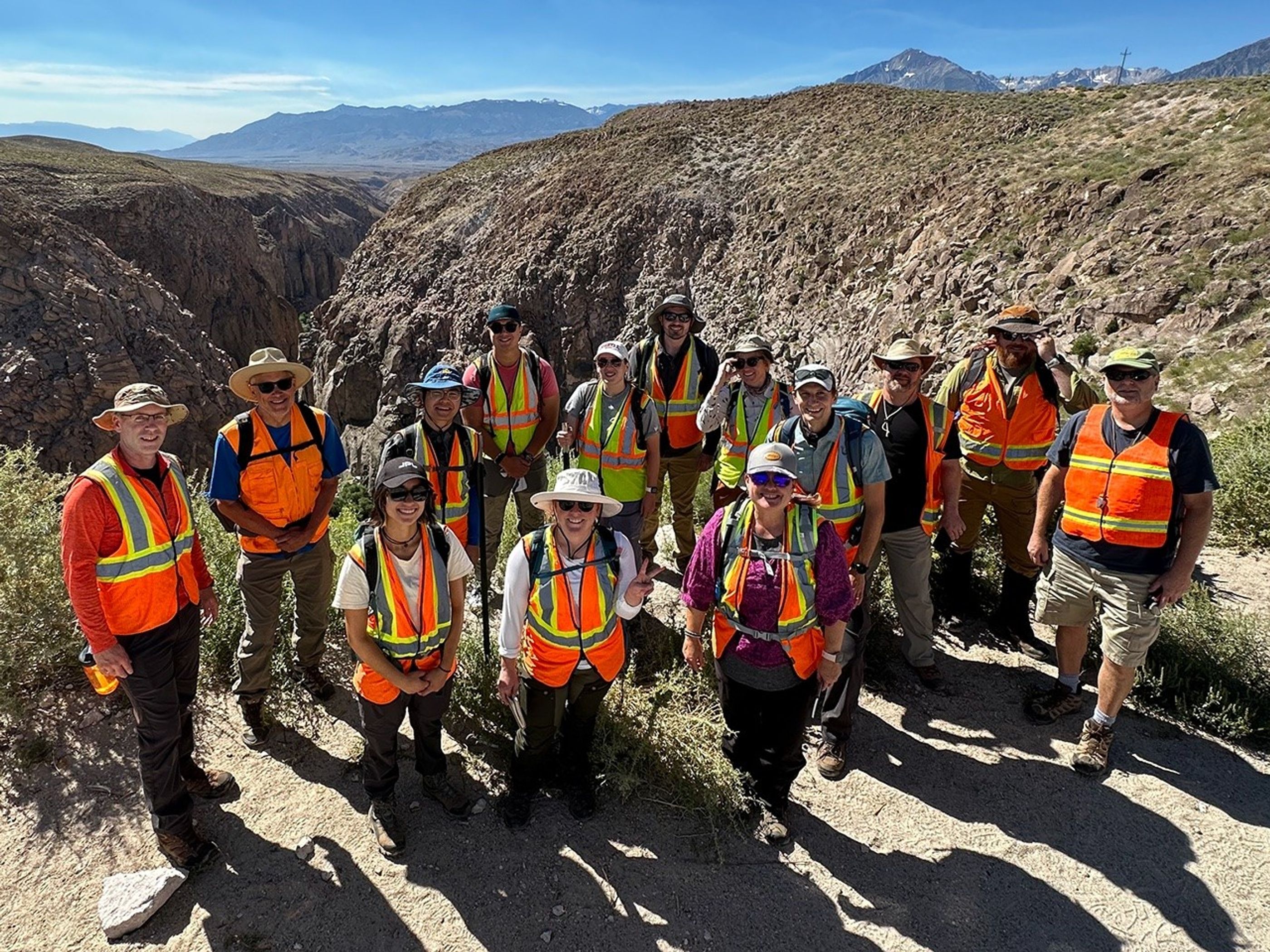
Hello from NASA’s Goddard Instrument Field Team (GIFT for short)! In September 2023, we spent several days as guest researchers at California’s Long Valley Caldera and the Bishop Tuff, east of the Sierra Nevada mountain range, studying the remains of an ancient supervolcano.
Long, long ago – think 760,000 years! – a column of ash, gas, and rocky debris blasted high into the sky above what is now central California. When the eruption column collapsed, hot debris flow and ashfall blanketed many square miles of Earth’s surface. The ground we’re standing on is what’s left of that ancient eruption.
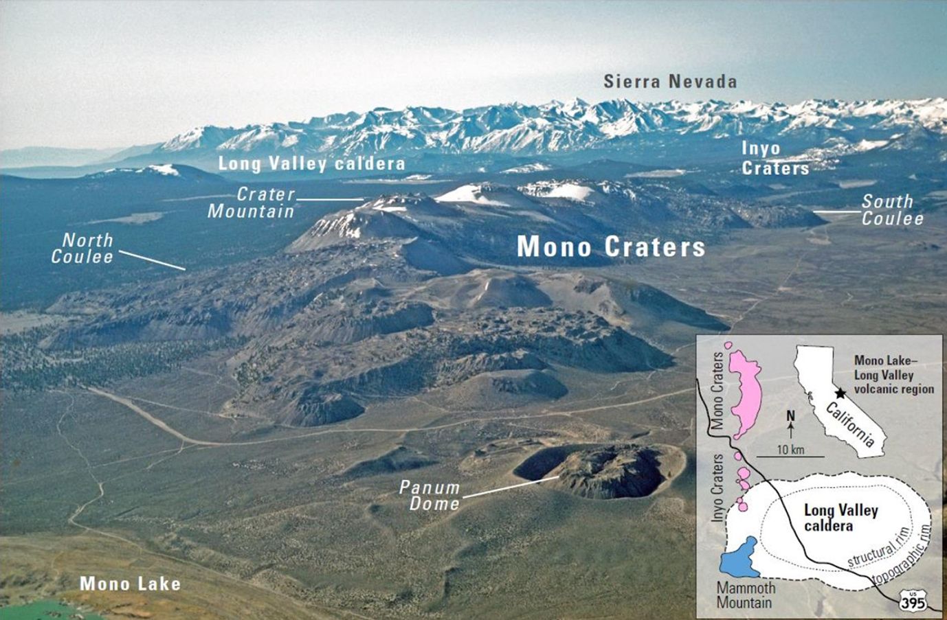
Our task: learn how this caldera, or large volcanic crater, fits into the bigger story of past and present volcanic activity in our solar system. Earth isn’t the only place with an explosive history. Venus and Mars both show evidence of very large volcanoes, our own Moon has a volcanic past, and Jupiter’s moon Io is extremely volcanically active today. The Long Valley Caldera region has characteristics in common with large-scale volcanic terrains on Mars, and members of our team are working to learn how Arabia Terra’s super eruptions may have changed the Martian environment. If you want to understand volcanoes on other worlds (and we do), it helps to start close to home.
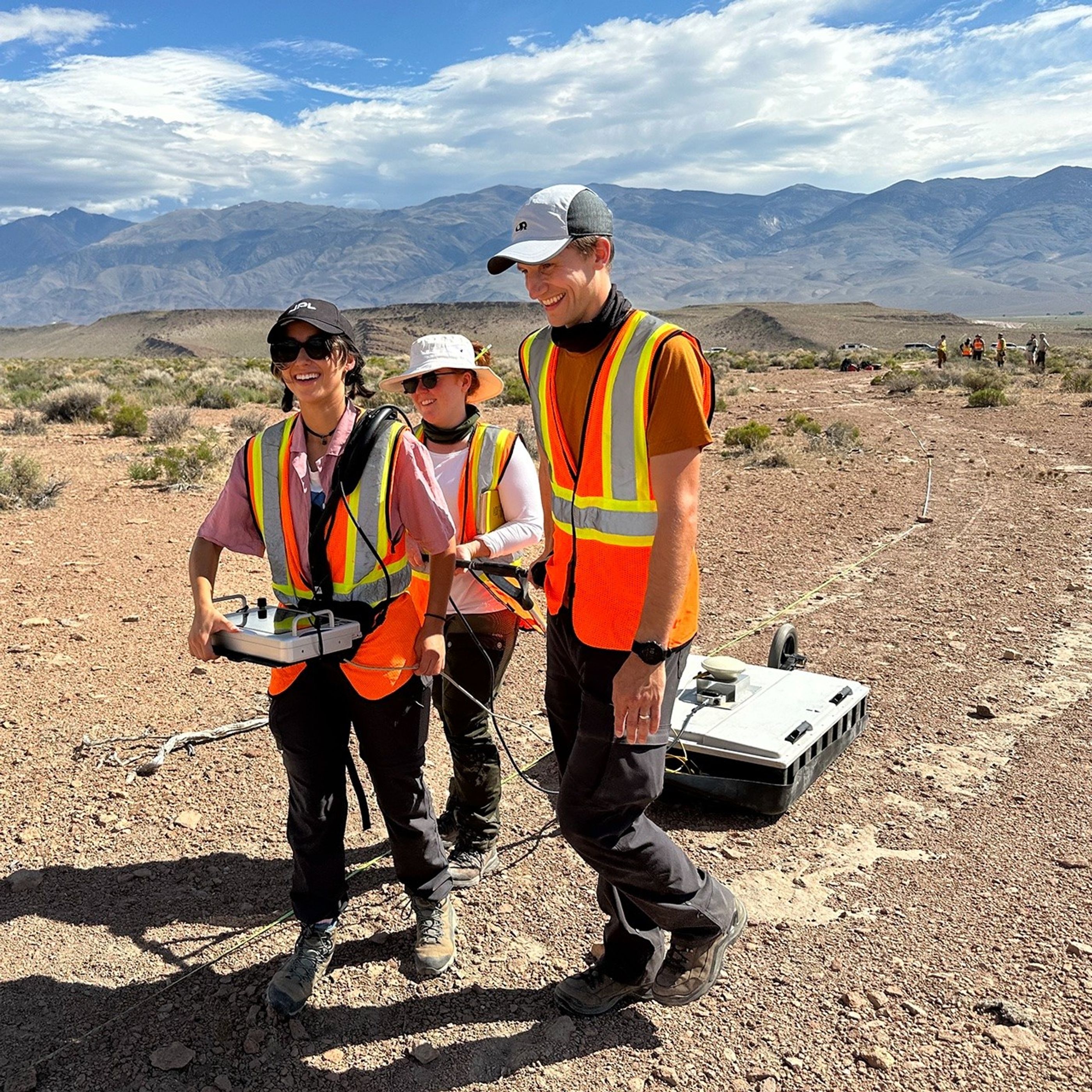
The Ground-Penetrating Radar or GPR Team (nickname: Team GRIT) carefully moves a radar antenna over the surface of the Volcanic Tableland to find out what’s underneath. We use a range of GPR antennae to reveal layers and features hidden underground. Larger antennae have a longer range, but they return lower-resolution data. Smaller antennae deliver higher-resolution images from closer to the surface.
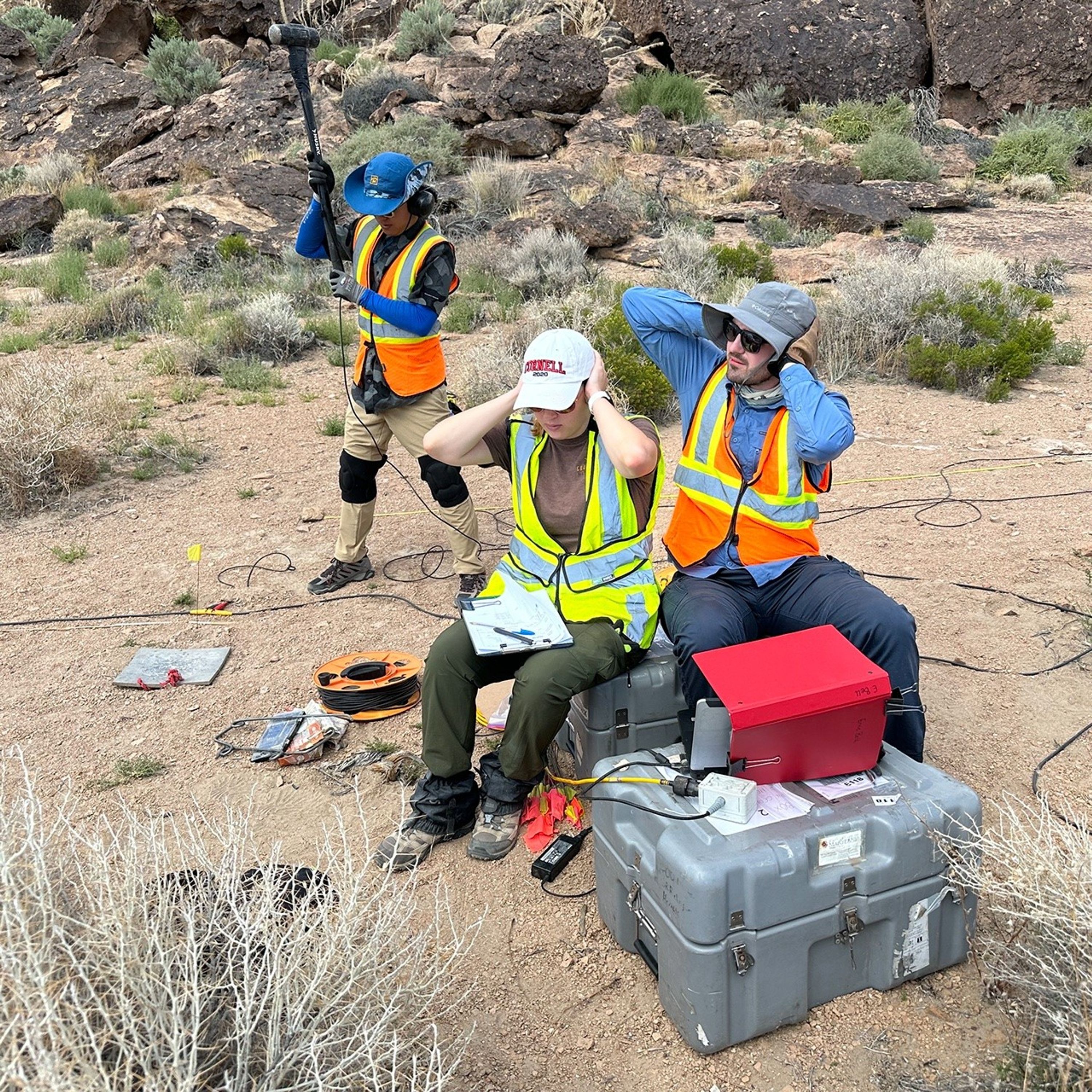
“Team Seismic” strikes a metal plate with a hammer to generate tiny tremors and monitors the results in real time. We set up a long line of seismic activity detectors, called geophones, to measure the vibrations from each hammer strike. This helps us understand how the subsurface of the landscape is structured. The geophones are sensitive enough to measure footsteps, so everyone nearby pauses briefly during each test.
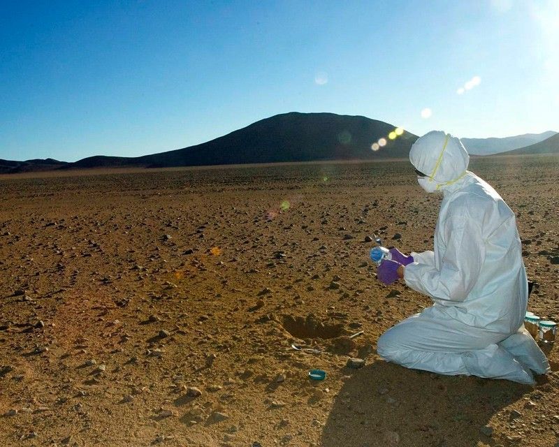
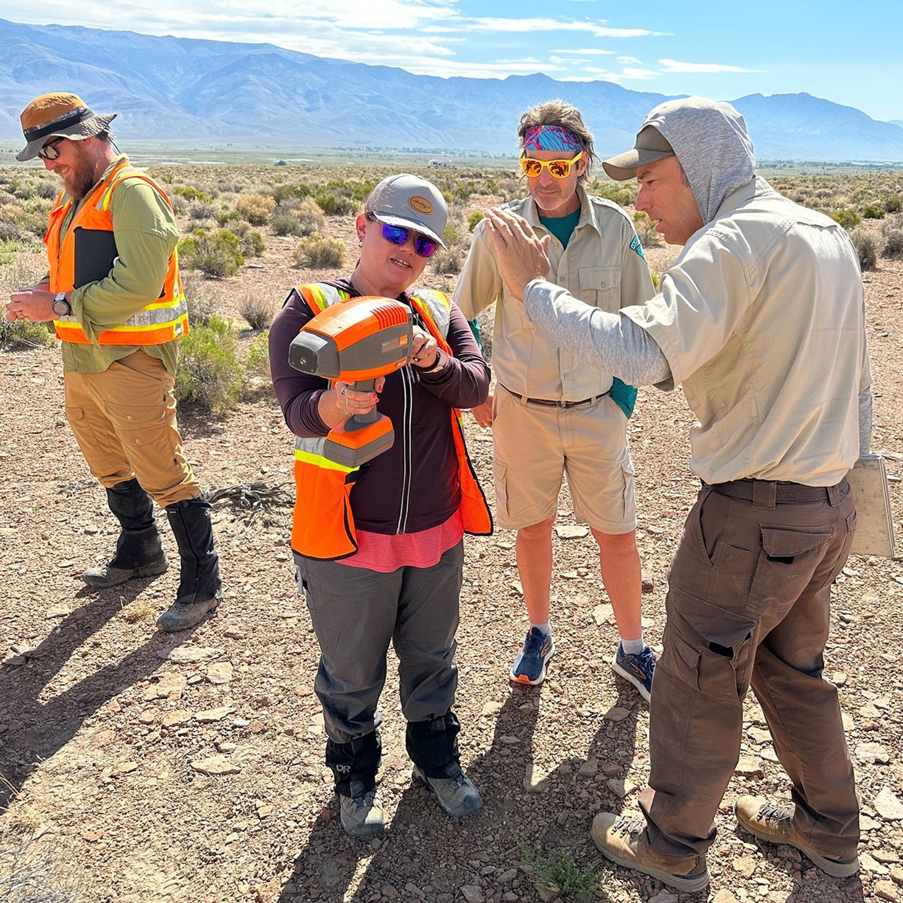
A hand-held spectrometer gives scientists on-the-spot information about the minerals each rock is made of. Mineral info, together with subsurface data from the Ground-Penetrating Radar and Seismic teams, helps us interpret Long Valley Caldera’s geologic history.
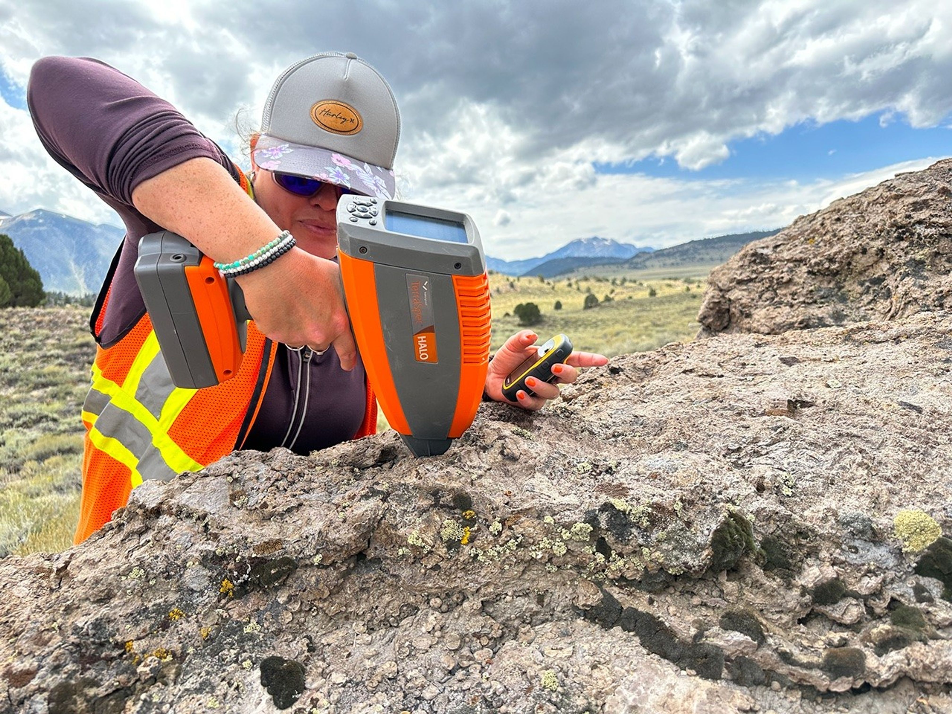
We’ve worked closely with the Bureau of Land Management (BLM) to operate in permitted areas and minimize the impact of our fieldwork on the environment. Below, BLM team members take a look at the data readout on our hand-held field spectrometer.
Meanwhile, “Team SHOVELS” studies the desert left behind by Mono Lake’s shrinking shoreline. The lake is evaporating; we trek across its dried outer reaches to sample the sediment where the water used to be.
Mono Lake has no natural outlets, so as it dries and shrinks, the water that’s left behind gets saltier and saltier. Gale Crater, where NASA’s Curiosity rover landed on Mars, may once have been a closed, salty, evaporating lake, too. Fieldwork helps us understand both places better.
Aerial footage of the site is brought to you by the Uncrewed Aerial Vehicle or UAV team (field nickname: Team GLIDE). This group captures overhead views of the landscape and uses the data to create context videos & topographic maps for our teammates on the ground.
Aerial and orbital views are critical tools for scientists studying Earth & beyond. From UAV data in the field to satellite images of our changing planet to maps of other worlds, a detailed, big-picture perspective can change everything.
Thanks for joining us! Keep learning about similar environments on different worlds, also called planetary analogs, at the link below.
About Planetary Analogs
Our planet isn't the only place with volcanoes, impact craters, quakes, and erosion. Studying extreme environments on Earth helps us to understand other worlds better, too.
Learn More