


NASA, Partners Nearing International Ocean Tracking Mission Launch
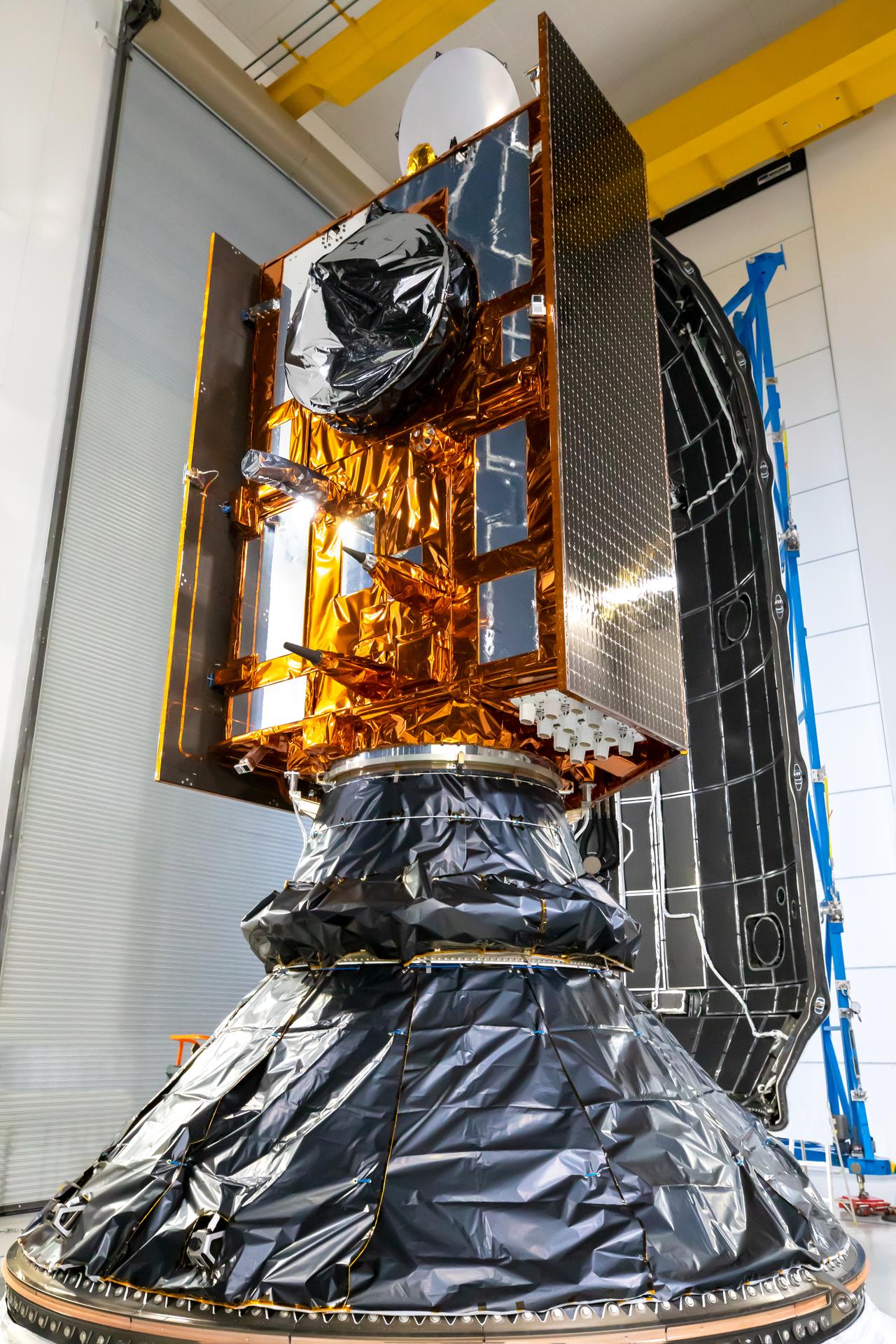
Technicians are continuing launch preparations for Sentinel-6B, a satellite jointly developed by NASA and ESA (European Space Agency), that will measure sea level for nearly the entire globe, as well as atmospheric temperature and humidity ocean measurements. The team has completed nearly all their prelaunch milestones, including testing solar arrays, fueling the spacecraft, and encapsulating the satellite inside the payload fairing as liftoff draws near.
Launch is targeted for 12:21 a.m. EST Monday, Nov. 17 (9:21 p.m. PST Sunday, Nov. 16), on a SpaceX Falcon 9 rocket from Space Launch Complex 4 East at Vandenberg Space Force Base in California.
On Nov. 10, NASA and its mission partners conducted a Flight Readiness Review to provide updates on the status of Sentinel-6B and certify its readiness to initiate final launch preparations.
Following encapsulation, technicians transported the payload fairing to the SpaceX hangar where technicians joined it with the rocket’s second stage.
NASA and its partners will conduct a Launch Readiness Review on Saturday, Nov. 15, to determine whether Sentinel-6B is “go” for launch.
Sentinel-6B will measure sea level for about 90% of the Earth’s oceans, down to roughly an inch. This data is key to helping improve public safety, city planning, and protecting commercial and defense interests. The satellite will eventually take over for its twin, Sentinel-6 Michael Freilich, becoming the official reference satellite for global sea level rise measurements. The pair make up the Copernicus Sentinel-6/Jason-CS (Continuity of Service) mission. They continue a data record that started with the TOPEX/Poseidon satellite in the early 1990s and was followed by the Jason series of satellites. The Jason-1 and Jason-2, satellites, have been decommissioned, while Jason-3 and Sentinel-6 Michael Freilich remain active. Every satellite extends our view of Earth’s changing seas.
Learn more about the mission at:
https://science.nasa.gov/mission/sentinel-6b/