Visible Infrared Imaging Radiometer Suite (VIIRS)
Filters

Dry, warm, and windy conditions across the U.S. Great Plains led to extreme fire activity in March 2026.

The powerful storm lashed the northern edge of the continent with damaging winds and drenching rain as it made landfall…

A series of nighttime satellite images revealed how moonlight reaching Earth varied throughout a total lunar eclipse.

Plants exposed to artificial lighting burst into bloom earlier and flower longer than plants exposed exclusively to natural sunlight. A…

A vivid display of the aurora lit up skies over the Denmark Strait and eastern Canada during a minor geomagnetic…

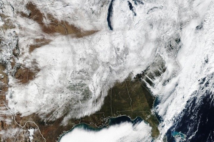
Satellites observed a frozen landscape across much of the country after a massive winter storm.

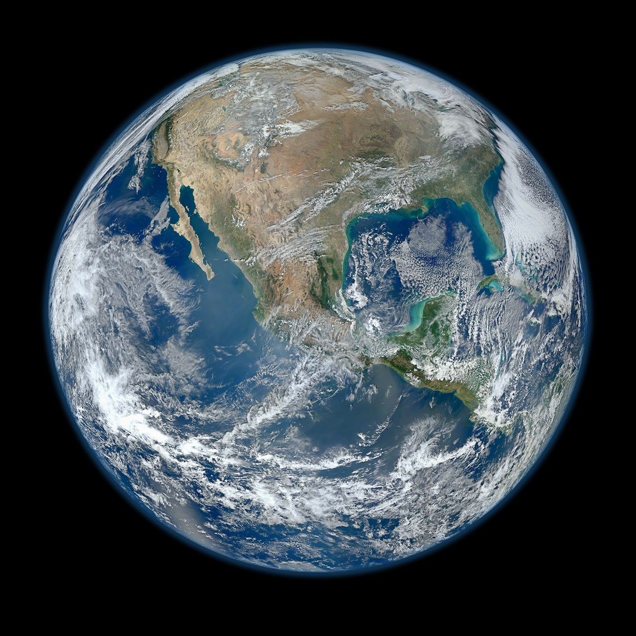
This Jan. 30, 2012 image of Earth was created from photographs taken by the Visible/Infrared Imager Radiometer Suite (VIIRS) instrument…

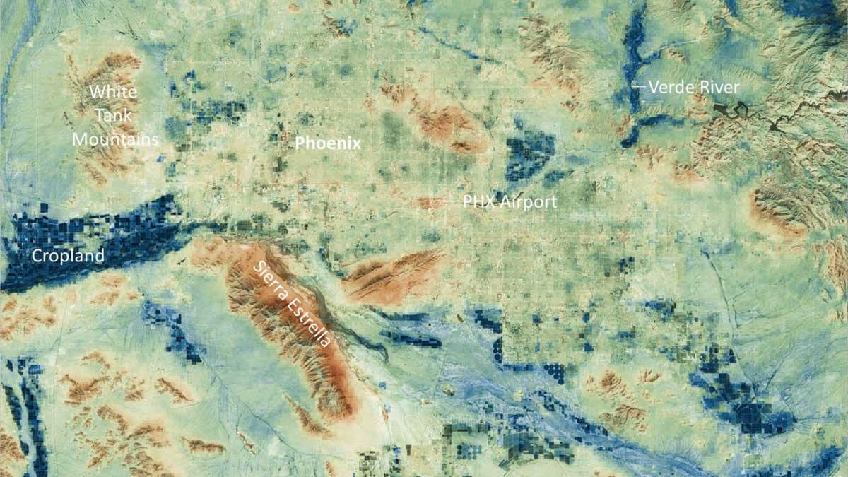
Amid a record heat wave in July, the Phoenix area saw surfaces such as roads and buildings stay hot long…

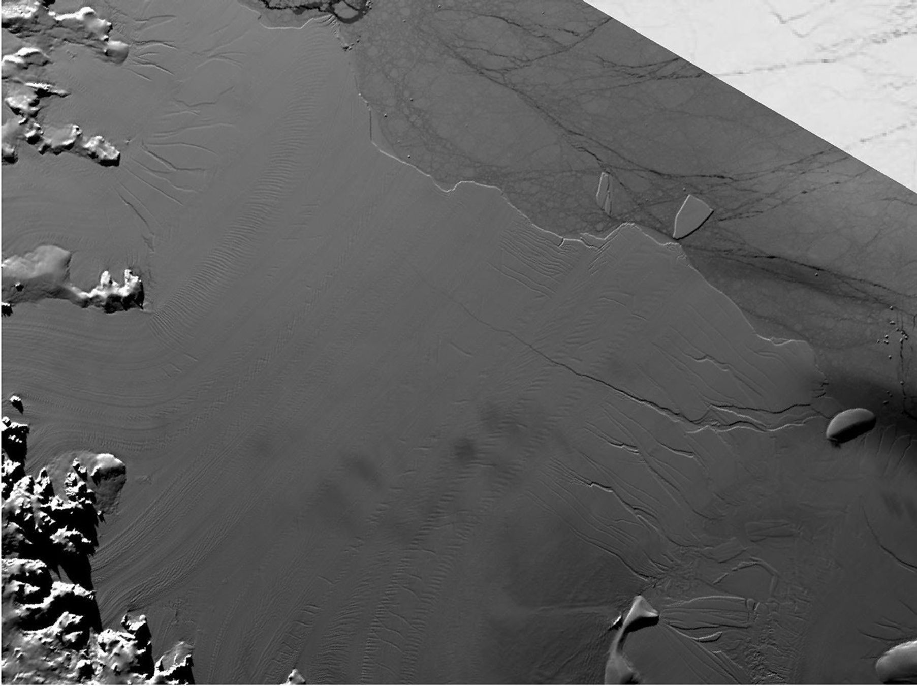
This still from an animation shows the Larsen C Ice Shelf in West Antarctica calved one of the largest icebergs…