Oceanography
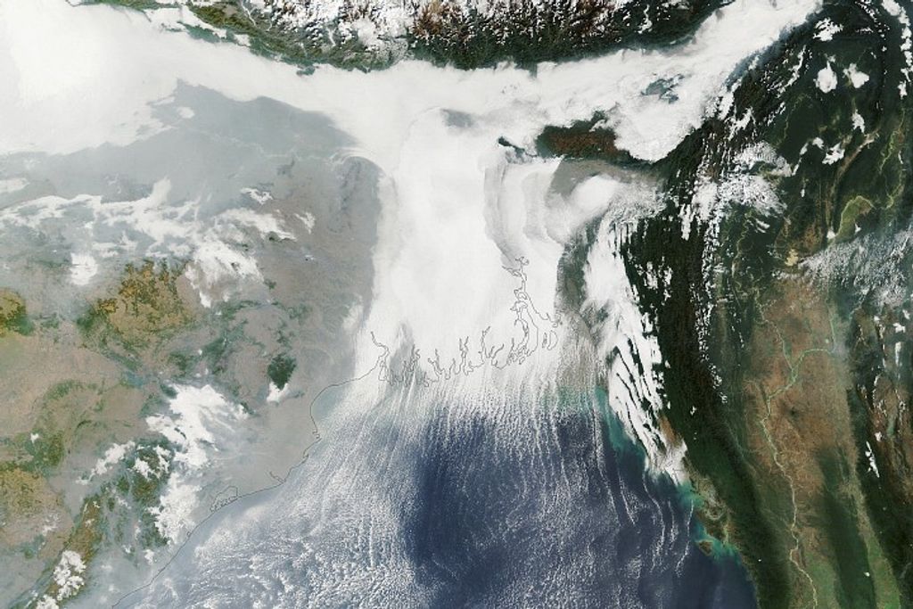
Looking at our Earth from space, it is obvious that we live on a water planet. Ocean covers over 70% of the Earth's surface and contains about 97% of the Earth's surface water. Life in the oceans can be found from the surface to the extreme environments at the bottom of the deepest submarine trench. It is not surprising that the oceans represent over 99% of the living space on Earth...we are indeed living on what is truly an ocean planet.
Why does NASA study the ocean?
Part of NASA's mission is to develop an understanding of the total Earth system and the effects of natural and human-induced changes on the global environment. Our oceans play a major role in influencing changes in the world's climate and weather. Collecting and analyzing long-term ocean data from satellites is a relatively new field of exploration. The analysis of remotely-sensed ocean data makes it possible to understand the ocean in new and exciting ways.
Prior to satellite data, most of what we have learned about the oceans had come from infrequent measurements collected from ships, buoys, and drifters. Ship-based oceanographers are limited to sampling the ocean in a relatively small area with often a great deal of difficulty. Data from ships, buoys, and drifters are not sufficient to characterize the conditions of the spatially diverse of the ocean.
The advent of ocean-observing satellites has launched a new era of marine discovery. Remotely sensed satellite data and modeling techniques enable the global mapping of seasonal changes in ocean surface topography, currents, waves, winds, phytoplankton content, sea-ice extent, rainfall, sunlight reaching the sea, and sea surface temperature. Studying these patterns at a global scale help forecast and mitigate the disastrous effects of floods and drought. Images generated by ocean observing satellite missions tell us volumes about the most fundamental climate changes. During the last decade, forecasting models have benefited from satellite data as they have improved the ability to predict events such as El Niño and other global and regional climate cycles. These models will become more sophisticated as scientists and forecasters further develop the ability to simulate certain ocean phenomena and thus better predict when they will occur.
Using remote sensing data and computer models, scientists can now investigate how the oceans affect the evolution of weather, hurricanes, and climate. Oceans control the Earth's weather as they heat and cool, humidify and dry the air and control wind speed and direction. And the weather determines not just what you'll wear to work in the week ahead--but also whether the wheat crop in Nebraska will get enough rain to mature, whether the snow pack in the Sierras will be thick enough to water southern California, whether the hurricane season in the Atlantic will be mellow or brutal, whether eastern Pacific fisheries will be decimated by El Niño. Long-term weather patterns influence water supply, food supply, trade shipments, and property values. They can even foster the growth of civilizations, or kill them off. You can't escape the weather, or even change it--but being able to predict its caprice makes its impact manageable. And only by understanding the dynamics of the oceans can we begin to do this.
NASA has been observing the oceans from space for more than 20 years. NASA launched Seasat, the first civilian oceanographic satellite, on June 28, 1978. The satellite carried five complementary sensors designed to monitor the oceans from space. These sensors included:
- a radar altimeter to measure spacecraft height above the ocean surface
- a microwave scatterometer to measure wind speed and direction
- a scanning multichannel microwave radiometer to measure sea surface temperature
- a visible and infrared radiometer to identify cloud, land and water features
- a synthetic aperture radar to monitor the global surface wave field and polar sea ice conditions
Although a massive short-circuit in its power system ended all data-taking operations after only 105 days, the Seasat instruments provided as much oceanographic data as had been acquired by ships in the previous 100 years! The variables that Seasat measured in its short lifetime are some of the most important for understanding the ocean and its role in climate.
Another satellite, Tiros-N, was also launched in 1978. It carried the first AVHRR sensor which produced the first really useful maps of sea-surface temperature, and the Coastal Zone Color Scanner, that produced the first maps of chlorophyll and primary productivity in the ocean.
Today there are several ocean-observing satellite missions and an extensive scientific research community studying these data. Each mission provides its own unique contribution to our knowledge of the ocean, however our understanding is rapidly evolving such that we are coming to more fully understand the role that each parameter plays in the constantly changing conditions and cycles of the ocean and thus on climate and weather.

